

Feb 10: Snow Approaching
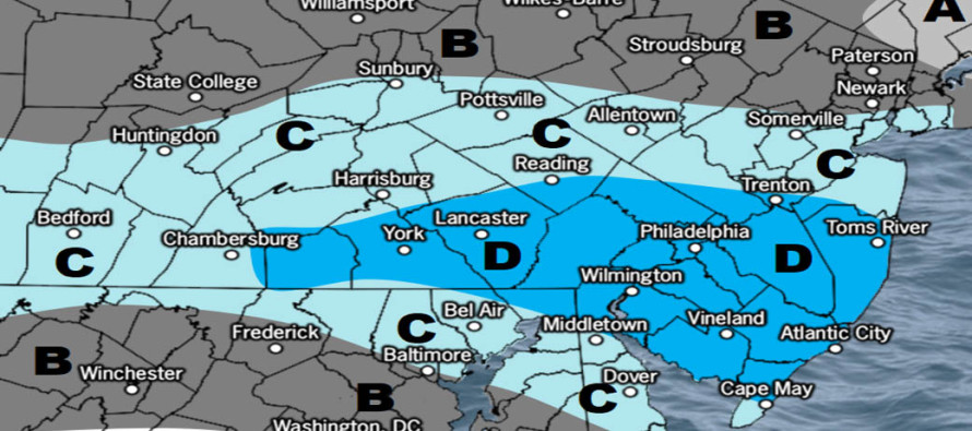

Click here to view full resolution map!
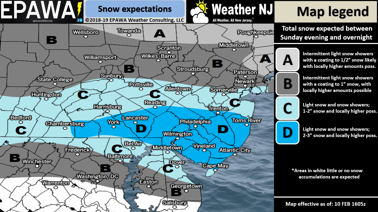
Discussion: Our first system is approaching from the W. High pressure is sliding E out to sea from Delmarva and the back-side return flow will feed our precipitation shield with moisture and warmth. But the warmth will not arrive in time to spoil this first system from dropping wintry accumulations across our region. While lighter snowfall can extend even into NNJ/CNJ I still expect SNJ to jackpot from this first system. If anyone is going to see a brief period of mixing it would be Cape May County and possibly extreme southern portions of Cumberland/Atlantic Counties. Otherwise it looks like Ocean, Burlington, Camden, Gloucester, Salem and northern portions of Cumberland/Atlantic Counties will jackpot system one with snow accumulations. We have a general 2-3″ across the jackpot zone D but with the caveat “locally higher possible.” We’ll have to see how cold the snowfall is overnight tonight and how that impacts snow ratios. Also you can never rule out mesoscale banding from strong frontogenesis.
As far as timing goes for system one expect snow to arrive from the W between 10pm and midnight tonight. 10pm for WNJ and midnight for ENJ. Snowfall should then persist until about 6am tomorrow morning before cutting off from N to S. Therefore Ocean and Burlington Counties might end between 6-8am tomorrow. However SNJ areas further S might see an additional few hours of snowfall before precip ends from N to S. And then there’s not much time before system two moves in.
System two will be treated with a separate article later today. This allows the latest model guidance and live observations possible to be considered. What’s interesting though is the trend of precipitation starting earlier during Monday PM hours. The 3k NAM and Euro have snow re-starting across CNJ/SNJ around 5-8pm tomorrow night. If that verifies then the system one jackpot areas could see an additional few inches before the inevitable changeover to rain Tuesday morning. There is no escaping the Tuesday morning changeover to rain for CNJ/SNJ. 500mb heights are N of 540dam and 700mb/850mb flow will be SW. The surface might hang onto cold longer but the upper levels will surely warm enough to prevent all snow for most of NJ. Only NWNJ has the chance to stay completely wintry and likely in the form of ice not snow. We’ll cover that on the system two article later this evening. Just wanted to point out that more accumulating snowfall is possible Monday evening after ending Monday morning…before the Tuesday morning changeover.
In English: Snow should move into CNJ and SNJ tonight (Sunday) between about 10pm and midnight. It should wrap up between mid-to-late tomorrow (Monday) morning. The above snow map indicates how much snow should fall in that period. We should then see a break in precipitation between tomorrow morning and late-afternoon. By tomorrow evening we could be snowing again as system two moves in. We might snow a few more inches from tomorrow evening through Tuesday morning before most areas change to ice and/or rain. Another article will release later today covering the second system. Radar observation posts will begin when snow moves in late-tonight. Download the new free Weather NJ mobile app on Apple and/or Android. It’s the easiest way to never miss Weather NJ content. Have a great rest of your Sunday and please be safe! JC
Jonathan Carr (JC) is the founder and sole operator of Weather NJ, New Jersey’s largest independent weather reporting agency. Since 2010, Jonathan has provided weather safety discussion and forecasting services for New Jersey and surrounding areas through the web and social media. Originally branded as Severe NJ Weather (before 2014), Weather NJ is proud to bring you accurate and responsible forecast discussion ahead of high-stakes weather scenarios that impact this great garden state of ours. All Weather. All New Jersey.™ Be safe! JC


LOCAL FORECAST | INTERACTIVE RADAR | LATEST NJ WEATHER ALERTS | WEDDING FORECAST| PRIVACY POLICY
© Copyright 2026 Weather NJ LLC. All Rights Reserved.
Some information that can be found on our website is provided by a private weather station and is not an officially recognized station for weather reporting. Though we always strive to achieve accurate reporting for our own use, it is important that you do NOT depend on the data provided here for any purpose.
