

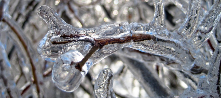
Feb 11: Ice Storm(s) Detected
Discussion: The South Jersey Express is through. Looks like it left 1-3 across CNJ and some parts of NNJ and 3-6 across SNJ. It fell overnight and fluffy out of the colder air aloft but compacted into a wetter accumulation today via daylight and above freezing temps, especially for S areas. The second batch of precipitation from this long wave will likely miss to the S. Only a small chance of flurries/snow showers for the Cape May tip overnight tonight.
Tonight through Saturday morning then looks cold for all of NJ. Entire/most of NJ might not rise above freezing on Friday. Tonight and tomorrow night overnight lows are expected to drop into single-digits in the NNJ elevations and at least into the teens for mostly everyone else. Maybe immediate coastal areas of ECNJ/SENJ hang near-20. This will establish a very cold surface especially for areas away from the SENJ/ECNJ ocean leading into the event. A coastal disturbance is then expected to track from OBX northward towards the Jersey coast before turning out to the E. The track eventually favors a snow rain line pushing all the way into NWNJ at the warmest point of the storm. The precipitation arrives on most guidance by Saturday afternoon/evening and tapers off, in general, by late Sunday morning. Some guidance is keeping scattered precipitation around through Sunday into Monday morning.
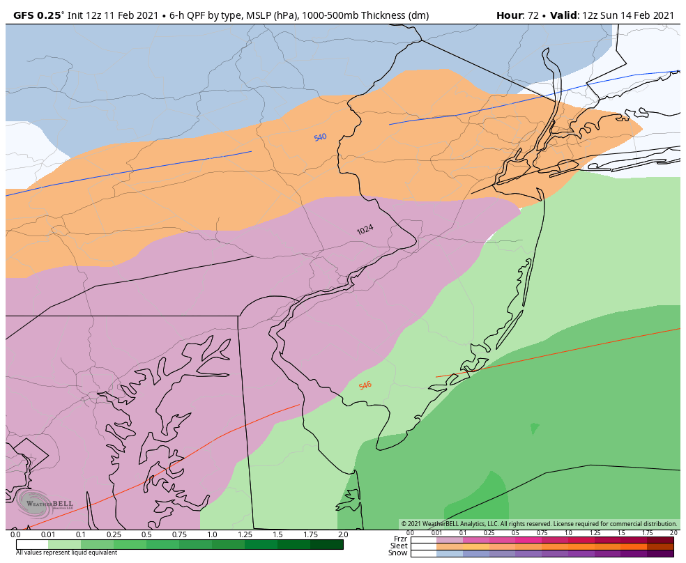
The bigger concern for Saturday night and Sunday is ice either in the form of sleet or freezing rain. The coastal disturbance will be shoving warmth and moisture in at the low-mid levels. The surface however will remain below freezing, for interior NJ, from the cold days leading up. At 700mb and up we’re very cold. Remember, the tropospheric polar vortex daughter vort/lobe is directly battling the warmer SE US ridge on a boundary running just over or to the S of NJ. A very tight thermal gradient and therefore opportunity for warmth to slide NW in at different levels—and cold to slide SE at other levels to balance. This is an ice storm recipe for much of NJ IMO. Therefore, I’m starting to lean towards a solution that is snowy (~2-4″) for extreme NWNJ, sleet NE of 95/NJTP corridor, freezing rain along and just to the SE of 95/NJTP corridor, and then mostly rain for SENJ (after a brief possible wintry mix to start). A higher population impact SWNJ/CNJ/NENJ ice storm though so travel will likely be very dangerous. Here’s a model slide that represents the general idea seen almost unanimously by today’s data. Blue is snow. Orange is sleet, Pink is freezing rain (most dangerous), and green is plain rain:
The next wintry signal of interest is for next Tuesday which unfortunately is also currently modeled very icy for much of New Jersey with only NWNJ having a chance for snow. A similar temp profile but possibly heavier precipitation. I don’t like either of these next two systems. I never have. I’d rather have cold rain than ice. The next signal after that is around Feb 19th and that could be the one that breaks us out of the wintry dip we entered around Jan 31. It’s currently modeled too warm for snow but we’ll have to watch for any trends SE in low track. With that said, only NWNJ has a chance for snow with these next two systems and it might only be light-to-significant. You’ll likely see ice accumulation maps from us soon.
In English: Expect a cold and dry period between tonight and Saturday morning. Bitter cold lows overnight (tonight and Friday night) and highs just short of freezing Friday afternoon for most of NJ. A storm should then move in and deliver maybe 2-4 inches of snow to NWNJ, rain to SENJ and likely an ice storm for everyone between from Saturday afternoon/evening through Sunday morning. We should then see a break before another likely ice storm hits again on Tuesday. These kinds of systems aren’t fun for anyone and can lead to power outages and travel-related loss of life. Please take them seriously. Not sure how much more snow we’ll see in NJ for the near future unless these ice storms trend SE for a colder NJ solution (not likely). The next signal after the two ice storms is Feb 18-20 but currently modeled warm. The last third of February is very uncertain whether or not the colder Arctic air, that has been sitting over N/C US and N Plains, will propagate eastward over the Mid-Atlantic/NE US or get pulled back up to the W of us—leaving us in a warmer air mass. I guess we’ll see.
Either way we have about 4 weeks left where it commonly snows for much of NJ. Late-March and even early-April snow is always possible (see 2014 and 2018) but becomes rarer by the day beyond the ides of March. We will now start to deal with sun angle as we get further in February where it will have to snow either overnight or hard during the day to stick. Extreme SNJ likely already saw this in the last few daytime snow events, not so much the overnight event last night. I’ll check back in tomorrow to see how the two immediate ice storm signals look. Have a great rest of your Thursday. Stay warm and be safe! JC
Our premium services go even further above and beyond at the hyper-local level. Get your merch on at the KABOOM shop in time for the holidays.
Jonathan Carr (JC) is the founder and sole operator of Weather NJ, New Jersey’s largest independent weather reporting agency. Since 2010, Jonathan has provided weather safety discussion and forecasting services for New Jersey and surrounding areas through the web and social media. Originally branded as Severe NJ Weather (before 2014), Weather NJ is proud to bring you accurate and responsible forecast discussion ahead of high-stakes weather scenarios that impact this great garden state of ours. All Weather. All New Jersey.™ Be safe! JC


LOCAL FORECAST | INTERACTIVE RADAR | LATEST NJ WEATHER ALERTS | WEDDING FORECAST| PRIVACY POLICY
© Copyright 2026 Weather NJ LLC. All Rights Reserved.
Some information that can be found on our website is provided by a private weather station and is not an officially recognized station for weather reporting. Though we always strive to achieve accurate reporting for our own use, it is important that you do NOT depend on the data provided here for any purpose.

 Detected)