

Feb 11: What to Expect for Thursday-Friday
A weak clipper system is currently moving in from the W/NW. It will transfer to the coast and intensify as it pulls away but probably too late for any substantial impact to New Jersey. All I’m going to leave on the table is anything from a coating to an inch statewide. If someone gets 2 inches, consider yourself luckier than the next person(s) who win the PowerBall Lottery.
Scattered snow showers seem like the most probable scenario with maybe…and I mean “maybe” a few snow squalls worst case scenario. Here’s the latest GFS showing 850mb pressure, temperature and precipitation for the time period of interest (Thursday afternoon through Friday morning):
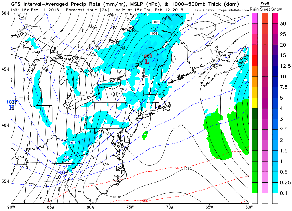
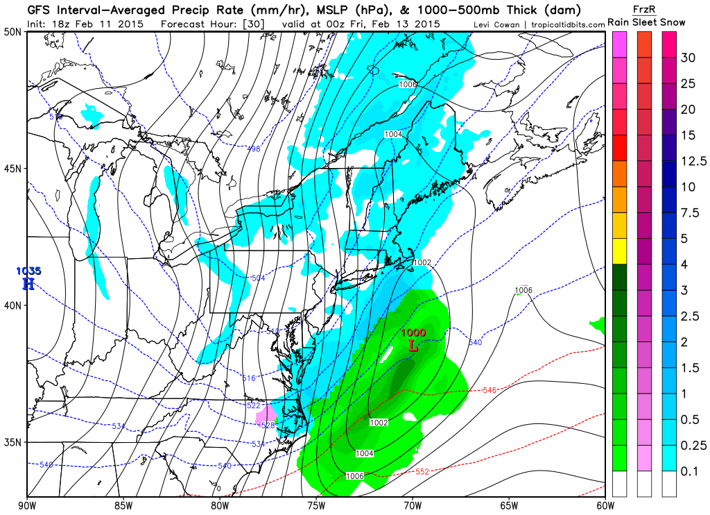
In English: Weak snow showers are possible tomorrow afternoon through Friday morning. Anything from a coating to an inch of snow is possible with NNJ favored over SNJ. Let’s see what overnight and tomorrow’s guidance says about Saturday night into Sunday. Anything from just another round of snow showers to a significant snowfall is still possible so we have to narrow down the uncertainties more. I’ll have a nice article out tomorrow evening that covers all guidance and my updated thoughts. Thanks for your patience during this train wreck of a winter for the snow lover (or heaven for the snow hater). Be safe! JC
Jonathan Carr (JC) is the founder and sole operator of Weather NJ, New Jersey’s largest independent weather reporting agency. Since 2010, Jonathan has provided weather safety discussion and forecasting services for New Jersey and surrounding areas through the web and social media. Originally branded as Severe NJ Weather (before 2014), Weather NJ is proud to bring you accurate and responsible forecast discussion ahead of high-stakes weather scenarios that impact this great garden state of ours. All Weather. All New Jersey.™ Be safe! JC


LOCAL FORECAST | INTERACTIVE RADAR | LATEST NJ WEATHER ALERTS | WEDDING FORECAST| PRIVACY POLICY
© Copyright 2026 Weather NJ LLC. All Rights Reserved.
Some information that can be found on our website is provided by a private weather station and is not an officially recognized station for weather reporting. Though we always strive to achieve accurate reporting for our own use, it is important that you do NOT depend on the data provided here for any purpose.
