

Feb 12: Storm Update

Discussion: Our second system is disrupting NJ travel quite a bit today for NNJ and parts of CNJ. Most of SNJ has changed over to rain and will not go back until this event concludes late tonight/early tomorrow. The notable trends so far have been slight tardiness. The snow was late to fill into CNJ/NNJ overnight. A stream of constant light snow trained across extreme SNJ most of yesterday but the snow only worked into Burlington and Ocean Counties late last night and further into CNJ/NNJ this morning. Why did the snow take so long to spread NE? Dry air from high pressure located well to the N/NE of NJ. High pressure features sinking dry air which required saturation time before precipitation can occur. The moisture was colliding with this dry air over CNJ/NNJ overnight and that’s why you didn’t wake to at least light accumulations. That’s why snow accumulations are ending fairly low. We were pretty conservative with our snow maps leading into this event but many areas will still see less than their expected ranges especially in CNJ and SNJ. Eventually (obviously) the moisture was able to saturate and overcome the dry air. That’s when the precipitation broke out for the northern 2/3 of NJ this morning. We had snow late to end for SNJ yesterday, late to start for CNJ/NNJ today. This leads me to believe a later period of icing for NNJ and parts of CNJ this evening. With the high involved it makes sense. We were aggressive with our ice maps and language for NNJ/CNJ with this system and with good reason.
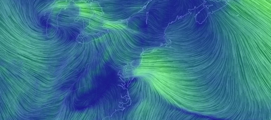
The high is feeding NJ with much colder air. This is holding the 925mb layer and below to much colder temps. Even where it’s raining in SNJ the surface temperatures are mostly in the 30s. The surface is currently near or below freezing for most of NJ N of I-195. Sussex County temperatures are currently in the teens. Here’s the high and it’s cold influence on the region from 925mb and down to the surface (surface line of freezing illustrated):
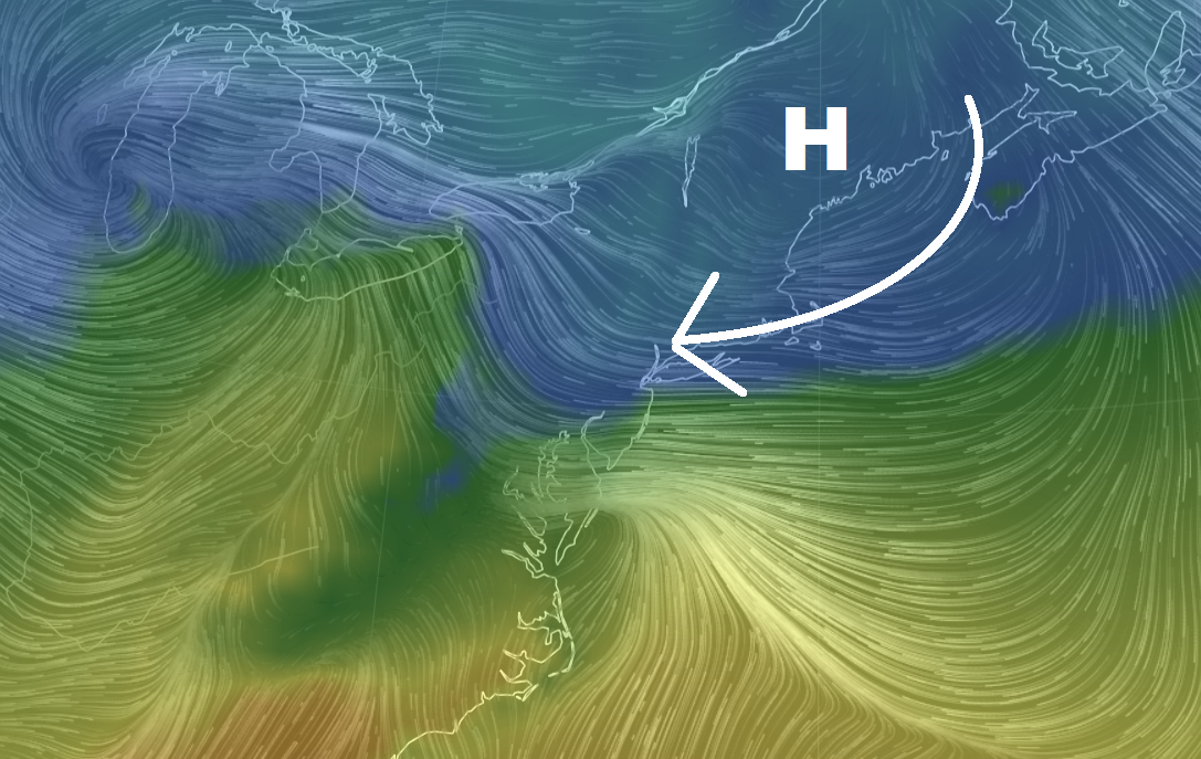
Ok so it’s cold at the surface. We got that. The reason why most areas are not seeing snow is because of the low-mid level warming. The high has control of the surface layers but the 850mb and 700mb lows have control of their layers above the surface but below precipitation creation. The 850mb and 700mb lows are near the Great Lakes which means warm SW/S flow over New Jersey at said layers. This creates warm (above-freezing) low-mid layers in the atmosphere over NJ. The precipitation therefore falls through this layer in liquid form before freezing either before it hits the surface (sleet) or after (freezing rain).
That is why we have the ice storm across NNJ/CNJ right now (rain for SNJ). Because the high has put up so much of a fight so far, I expect it to hold the surface layers colder later into this evening. It might be 8pm before the plain rain line makes it’s way to I-80 (when it is no longer freezing at the surface). Extreme NNJ counties like Sussex, N Warren, N Morris, NW Passaic, etc. might never warm enough at the surface and just stay ice until precipitation ends. This should make NNJ and parts of CNJ very dangerous to travel in especially during the PM rush hour. I expect precipitation to wrap up either late tonight or very early tomorrow morning for all areas.
In English: The rain line has made it up to about I-195. Areas S of this should likely remain plain rain. Areas N of I-195 are facing less than ideal conditions. Only extreme NNJ is still seeing all snow. Most of NNJ/CNJ is dealing with prolonged sleet and/or freezing rain. I expect these conditions to continue through the rest of this afternoon into this evening. One positive sign I see is that precipitation should become a little more broken up between now and finish time. The rain line should continue advancing but very slowly. Extreme NNJ could finish as ice before the precipitation runs out. I can’t stress enough how dangerous it will be traveling in northern areas of concern this evening. I imagine power outages are likely overnight especially when winds pick up after midnight near the front. Winds and frozen tree branches/powerlines/etc. Looking forward there are a few winter storm signals showing. Some as early as this weekend. Some early next week. Looks like a parade of wintry disturbance potential to start the second half of February. I’ll have an article out later tonight that covers the rest of this week and more detail about the near-future winter storm signals. Download the new free Weather NJ mobile app on Apple and/or Android. It’s the easiest way to never miss Weather NJ content. Have a great rest of your Tuesday and please be safe! JC
Jonathan Carr (JC) is the founder and sole operator of Weather NJ, New Jersey’s largest independent weather reporting agency. Since 2010, Jonathan has provided weather safety discussion and forecasting services for New Jersey and surrounding areas through the web and social media. Originally branded as Severe NJ Weather (before 2014), Weather NJ is proud to bring you accurate and responsible forecast discussion ahead of high-stakes weather scenarios that impact this great garden state of ours. All Weather. All New Jersey.™ Be safe! JC


LOCAL FORECAST | INTERACTIVE RADAR | LATEST NJ WEATHER ALERTS | WEDDING FORECAST| PRIVACY POLICY
© Copyright 2026 Weather NJ LLC. All Rights Reserved.
Some information that can be found on our website is provided by a private weather station and is not an officially recognized station for weather reporting. Though we always strive to achieve accurate reporting for our own use, it is important that you do NOT depend on the data provided here for any purpose.
