

Feb 15: Monday Morning Observations
After some “here and there” light snowfall overnight, heavier rates are now pushing further into SNJ. The principals of this system remain as called. Front end snow (mostly light accumulations) eventually changing to all rain with a possible period of ice between (moreso along and NW of the I-corridor/NJTP than for points SE).
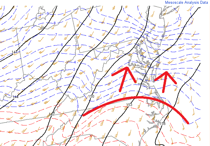
I’d say by late-afternoon hours, the snow/ice/rain line should be moving from S to N through New Jersey. The Cape May area will see the transition first while the NWNJ elevations will see it last. The mid-levels will represent the “top of the bow” in regards to warming first. The surface will warm above freezing afterwards. Here is the current location of the line of freezing at 850mb. Blue = snowfall. Red = rainfall. This line will be moving north through this afternoon eventually changing snow to rain. But remember, the surface/ground line of freezing will follow northward at a slower rate than the mid-levels (hence the concern for freezing rain):
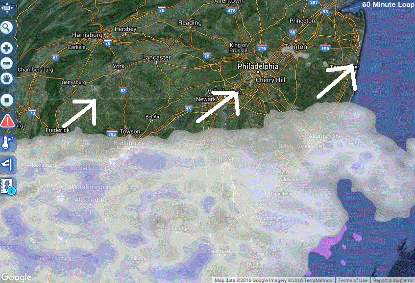
By sunset, most of NJ should be all rain. However, we’ve yet to see how strong the CAD (Cold-Air Damming) mechanism will be. I believe the icing will be worst between the I-95 corridor/NJTP and the base of the Appalachian Mountains due to such CAD (worse for points NW in that zone than along 95/NJTP. This will have to be now-casted later today. For now, here’s the latest radar showing snowfall already in to SNJ:
Here’s the latest ultra short-range model (the HRRR) showing a snapshot of what 3-4PM might look like today. Blue = snowfall. Pink = ice (sleet/freezing rain). Green = rain:
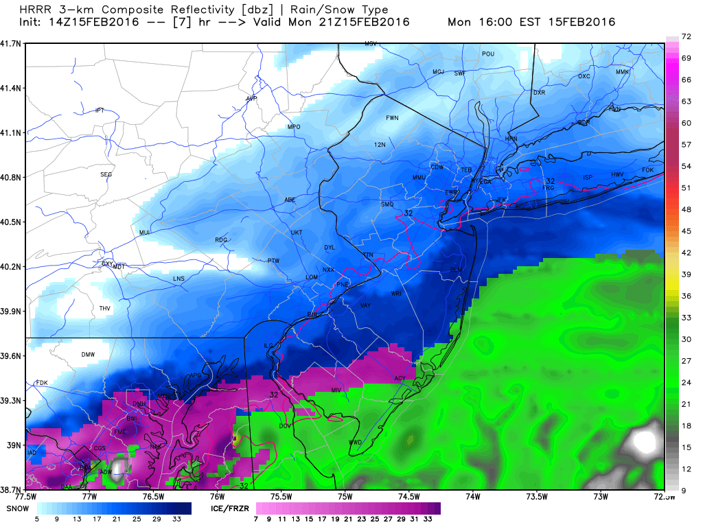
As you can see, New Jersey is in for a disruptive period during the icy transition. In my opinion, I think the front end snow is looking slightly more robust but should still fall within the parameters of my snow map posted last night—which had C-2 for extreme SENJ, 4-6 for extreme NWNJ and 2-4 for most of the state between.

In English: Snow is pushing into SNJ and will spread northward through the rest of the state through afternoon hours. Snow will change to rain from south to north. For areas raining while the surface remains at or below 32F, freezing rain is possible. By sunset we should be mostly all rain but front-end wintry disruption will have been made already. Areas NW of I-95/NJTP should hang onto a colder surface the longest hence the greater ice threat. I’ll make another observation post late-afternoon. In the meantime, be safe! JC
Jonathan Carr (JC) is the founder and sole operator of Weather NJ, New Jersey’s largest independent weather reporting agency. Since 2010, Jonathan has provided weather safety discussion and forecasting services for New Jersey and surrounding areas through the web and social media. Originally branded as Severe NJ Weather (before 2014), Weather NJ is proud to bring you accurate and responsible forecast discussion ahead of high-stakes weather scenarios that impact this great garden state of ours. All Weather. All New Jersey.™ Be safe! JC


LOCAL FORECAST | INTERACTIVE RADAR | LATEST NJ WEATHER ALERTS | WEDDING FORECAST| PRIVACY POLICY
© Copyright 2026 Weather NJ LLC. All Rights Reserved.
Some information that can be found on our website is provided by a private weather station and is not an officially recognized station for weather reporting. Though we always strive to achieve accurate reporting for our own use, it is important that you do NOT depend on the data provided here for any purpose.
