

Feb 15: Tuesday Snow Storm Detected!
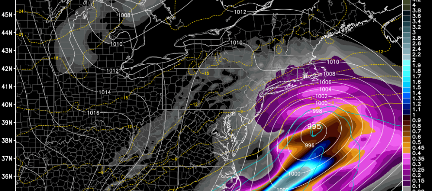
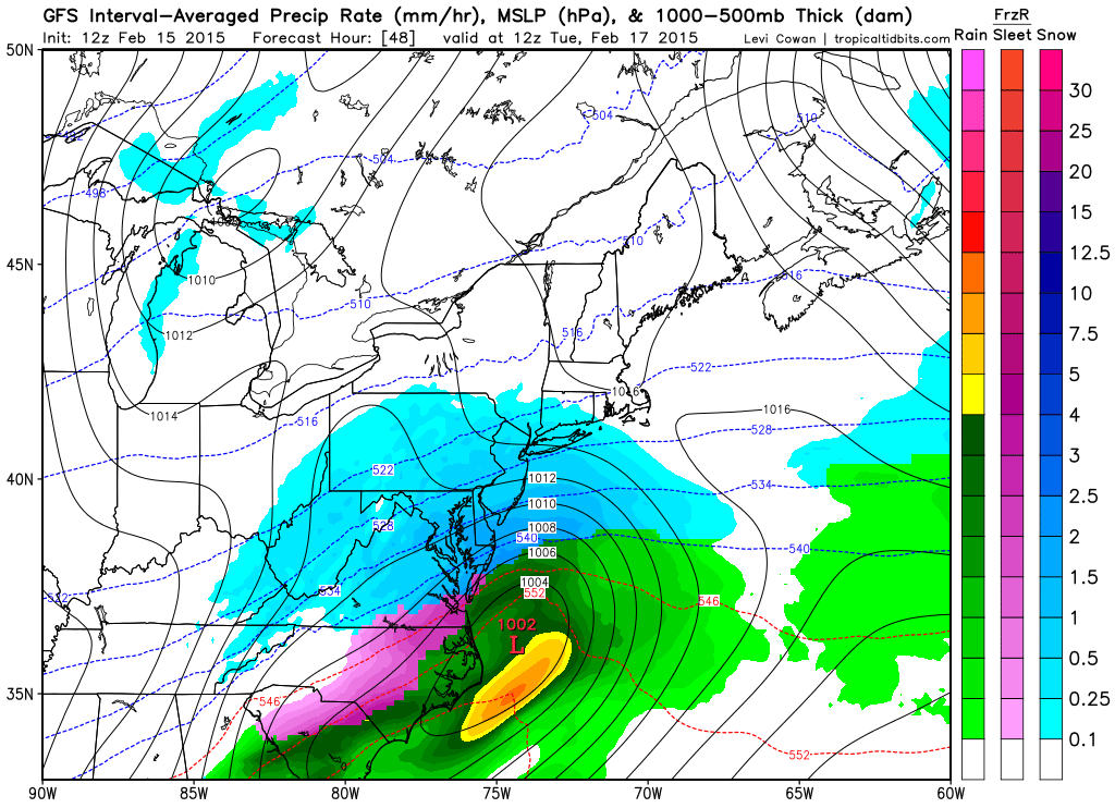
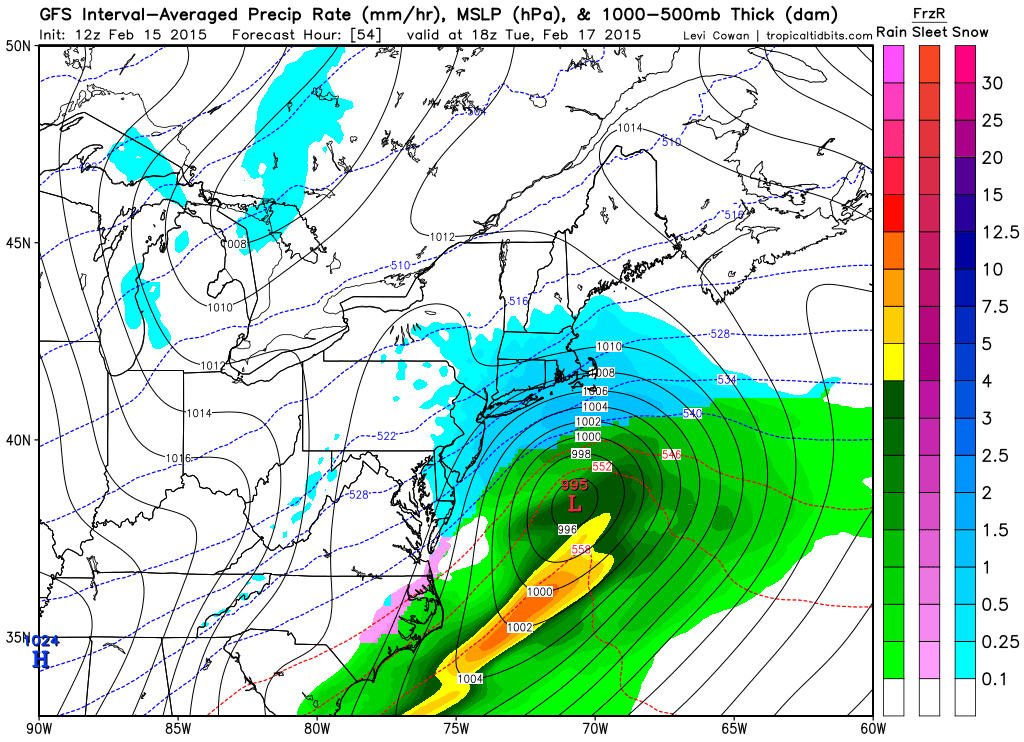
New Jersey will likely see another snow event this Tuesday. A low pressure disturbance, currently approaching W. Texas, will track across the SE US before ejecting into the Atlantic Ocean over OBX and passing over the benchmark. The system appears to be a quick mover but could easily dump significant snowfall over NJ. For now, it looks like a statewide 3-6 (maybe more) with coastal CNJ/SNJ in the jackpot. Timing looks like early Tuesday through Tuesday afternoon. Here’s the latest GFS guidance showing 850mb pressure, temps and precipitation:
1AM-7AM Tuesday AM:
7AM-1PM Tuesday:
No crazy upper-level dynamics, inverted troughs, etc. to worry about. Just a textbook progressive coastal low during peak mid-Atlantic US snow season. If blocking could slow it down it would be major but given how fast it will be moving, it should be held to a significant event.
In English: Expect snow to start as early as late Monday night but definitely by early Tuesday AM. It should snow until Tuesday afternoon with 3-6 inches of snowfall accumulation likely throughout the entire State. Perhaps snow ratios could produce slightly more than that…I’ll adjust up if needed, especially if the system trends slightly further north. As of right now, CNJ and SNJ are in the bulls eye for the highest snowfall amounts within that range. I’ll be tracking and have a map out tomorrow morning but you get the idea. Be safe! JC
Jonathan Carr (JC) is the founder and sole operator of Weather NJ, New Jersey’s largest independent weather reporting agency. Since 2010, Jonathan has provided weather safety discussion and forecasting services for New Jersey and surrounding areas through the web and social media. Originally branded as Severe NJ Weather (before 2014), Weather NJ is proud to bring you accurate and responsible forecast discussion ahead of high-stakes weather scenarios that impact this great garden state of ours. All Weather. All New Jersey.™ Be safe! JC


LOCAL FORECAST | INTERACTIVE RADAR | LATEST NJ WEATHER ALERTS | WEDDING FORECAST| PRIVACY POLICY
© Copyright 2026 Weather NJ LLC. All Rights Reserved.
Some information that can be found on our website is provided by a private weather station and is not an officially recognized station for weather reporting. Though we always strive to achieve accurate reporting for our own use, it is important that you do NOT depend on the data provided here for any purpose.
