

Feb 2: Monitoring Thursday and Beyond
Road crews have been doing an excellent job given the amount of icing that occurred yesterday and overnight. There are still areas of ice, mostly north of I-195, but now that the sun has been up for a few hours conditions should improve. Let’s talk about Thursday…
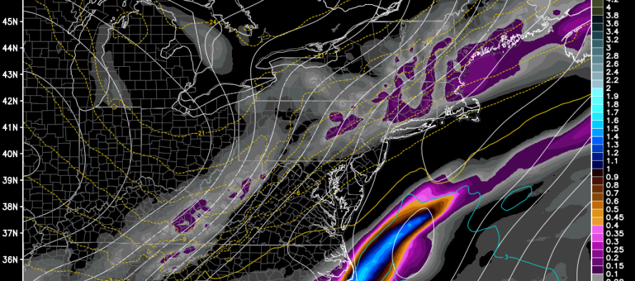
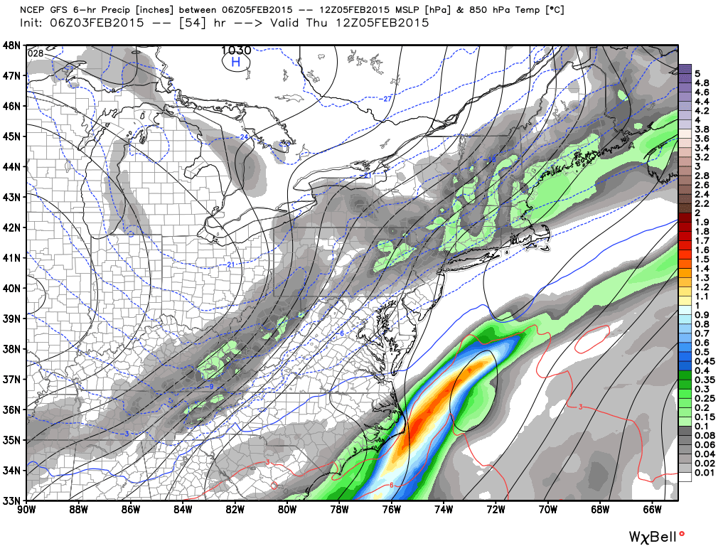
Northern and southern stream energy will be meeting up over the mid-Atlantic but most model guidance is indicating that will be too late to produce a significant snowfall for New Jersey. Light precipitation in the form of snow showers and squalls appear possible but far from a wrapped up low pressure center hurling precipitation off the ocean into Arctic air. The model image below is from the latest GFS (850mb temps, pressure and precip). As you can see, the northern stream brings just light wintry precipitation while the northern stream remains too far to the SE. These energies will eventually phase for a stronger coastal New England impact but give the progressive nature of the overall setup, it spells minor impact for New Jersey. Most other guidance is on board with the late phase too.
The next system I’m paying close attention to is the Sunday-Monday system as decent high-latitude NW Atlantic blocking should be in place to slow down the low. We’re still a ways out so I’ll be monitoring/analyzing guidance for you until about Friday when I’ll make my first call on it. Until then, the emotional roller coaster for the snow lover/hater continues…
In English: Snow showers and squalls could lay down statewide trace-to-minor snow accumulations late Wednesday night into Thursday morning. I’ll be tracking and updating on Sunday-Monday as we approach. Be safe! JC
Model images used with permission from WeatherBell Analytics.

Jonathan Carr (JC) is the founder and sole operator of Weather NJ, New Jersey’s largest independent weather reporting agency. Since 2010, Jonathan has provided weather safety discussion and forecasting services for New Jersey and surrounding areas through the web and social media. Originally branded as Severe NJ Weather (before 2014), Weather NJ is proud to bring you accurate and responsible forecast discussion ahead of high-stakes weather scenarios that impact this great garden state of ours. All Weather. All New Jersey.™ Be safe! JC


LOCAL FORECAST | INTERACTIVE RADAR | LATEST NJ WEATHER ALERTS | WEDDING FORECAST| PRIVACY POLICY
© Copyright 2026 Weather NJ LLC. All Rights Reserved.
Some information that can be found on our website is provided by a private weather station and is not an officially recognized station for weather reporting. Though we always strive to achieve accurate reporting for our own use, it is important that you do NOT depend on the data provided here for any purpose.
