

Feb 23: Thunderstorms Detected!
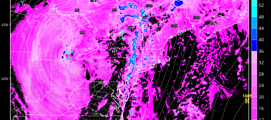
The system that brought snow, rain and wind to New Jersey today is on it’s way out to sea. The more powerful low will now track through the Ohio Valley, over the E Great Lakes and into Canada while rapidly intensifying. The associated warm front of the Mid-Atlantic cyclone should push through from the south tomorrow morning. New Jersey will then stay in the warm sector tomorrow into tomorrow evening. During this time, on and off rainfall is expected with a few isolated downpours and rumbles. Tomorrow night, the cold front will push through our region and bring the more severe threat of thunderstorms. Here’s the latest high-resolution NAM simulated precipitation for late tomorrow night:
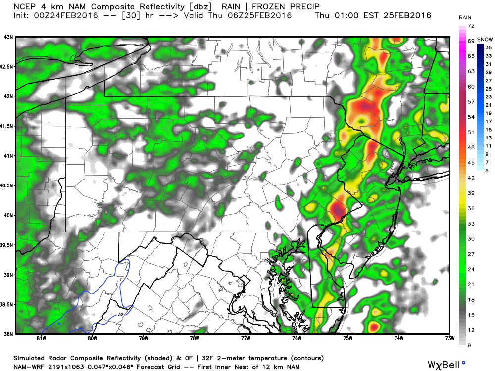
This shows strong convection moving through EPA and into NJ around midnight. Given that this is simulated precipitation, give or take a few hours. The main idea here is evening thunderstorms in EPA and overnight thunderstorms for NJ. I imagine the energy will weaken as it approaches the coast so WNJ seems more favorable for thunderstorm activity than ENJ. Also, SNJ in general has a better chance than NNJ. So what that boils down to is SEPA/SWNJ having a higher chance for severe thunderstorm criteria being met. Neighboring areas have a lesser chance for such.
With the strength of the low passing to our far W, there is going to be stiff southerly flow to begin with. Add convective dynamics and much higher wind gusts can be brought to the surface from aloft. The National Weather Service will trigger a severe thunderstorm warning if wind gusts exceed 58mph. I only see that possible surrounding the cold frontal passage period tomorrow night. Thursday should feature improving conditions despite gusty westerly winds.
In English: Expect on and off rainfall tomorrow morning through evening with warmer temperatures than today. Thunderstorms are then possible later tomorrow night and into the early AM hours of Thursday. Some could reach severe criteria for high wind gusts but most activity should at least be strong. We’ll have to watch how strong these storms are in EPA tomorrow evening. That should give us an idea what to expect a few hours later. Traditionally such energy weakens as it move to the coast but in this kind of a setup one should not let their guard down. Just to be clear, if you find yourself under one of these convective cells you should expect heavy downpours and gusty winds. Thursday could start out wet with lingering precipitation but we should dry out quickly once the sky clears, especially with gusty W winds. Have a great night and be safe! JC
Jonathan Carr (JC) is the founder and sole operator of Weather NJ, New Jersey’s largest independent weather reporting agency. Since 2010, Jonathan has provided weather safety discussion and forecasting services for New Jersey and surrounding areas through the web and social media. Originally branded as Severe NJ Weather (before 2014), Weather NJ is proud to bring you accurate and responsible forecast discussion ahead of high-stakes weather scenarios that impact this great garden state of ours. All Weather. All New Jersey.™ Be safe! JC


LOCAL FORECAST | INTERACTIVE RADAR | LATEST NJ WEATHER ALERTS | WEDDING FORECAST| PRIVACY POLICY
© Copyright 2026 Weather NJ LLC. All Rights Reserved.
Some information that can be found on our website is provided by a private weather station and is not an officially recognized station for weather reporting. Though we always strive to achieve accurate reporting for our own use, it is important that you do NOT depend on the data provided here for any purpose.
