

Feb 24: Watching Thursday Morning
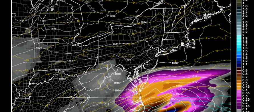
The storm that was modeled last week for this Wednesday-Thursday shifted southward over this past weekend. Over the last 24 hours it has trended slightly back northward and shifted potential impacts for SENJ closer to the 2AM-11AM Thursday morning period. We have a flat low track coming across the US from the west which will likely impact the lower eastern US with wintry weather before ejecting into the Atlantic Ocean near OBX.
As of right now, the track is just S of OBX but that’s after the overnight trend in guidance. Further northward trending is possible today and tomorrow so I’ll be paying attention to a few things: 1) Any level of W. US ridge amplification that shows up on live observations. This would result in a dip in the east which ultimately extends the time the low has to amplify. 2) Any further northerly track movement which obviously brings the storm further northward. 3) Any amplification of the low when it passes over OBX area (currently about 997-999mb)—closely related to #1. If none of these features happen, then the storm will miss to the south with only light snow showers possible for SENJ. If they all happen then it will be time to sound the alarms for at least SNJ and parts of CNJ.
Here’s the latest 12Z NAM (showing simulated precipitation type and intensity) to give you an idea of how close it’s currently modeled:
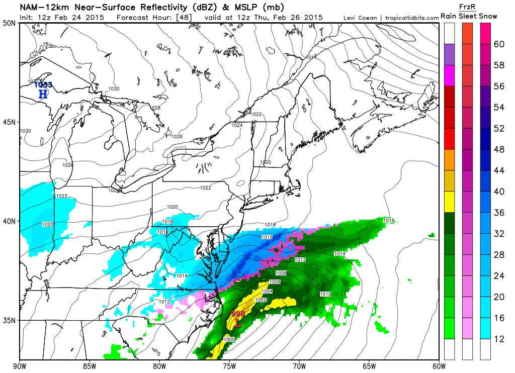
In English: As currently modeled verbatim, a weak wintry storm will be passing to the south of New Jersey with just enough precipitation to possibly reach into SENJ with some light snow showers Thursday morning (between early AM hours and noon). I’ll be watching this system for any northerly shift that would bring more snow into SNJ and possibly CNJ. Otherwise the solution shown above by the NAM is most likely. Be safe! JC
Jonathan Carr (JC) is the founder and sole operator of Weather NJ, New Jersey’s largest independent weather reporting agency. Since 2010, Jonathan has provided weather safety discussion and forecasting services for New Jersey and surrounding areas through the web and social media. Originally branded as Severe NJ Weather (before 2014), Weather NJ is proud to bring you accurate and responsible forecast discussion ahead of high-stakes weather scenarios that impact this great garden state of ours. All Weather. All New Jersey.™ Be safe! JC


LOCAL FORECAST | INTERACTIVE RADAR | LATEST NJ WEATHER ALERTS | WEDDING FORECAST| PRIVACY POLICY
© Copyright 2026 Weather NJ LLC. All Rights Reserved.
Some information that can be found on our website is provided by a private weather station and is not an officially recognized station for weather reporting. Though we always strive to achieve accurate reporting for our own use, it is important that you do NOT depend on the data provided here for any purpose.
