

Feb 3: Sunday Weather Impact Map
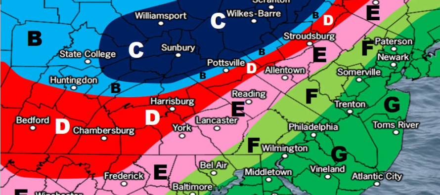
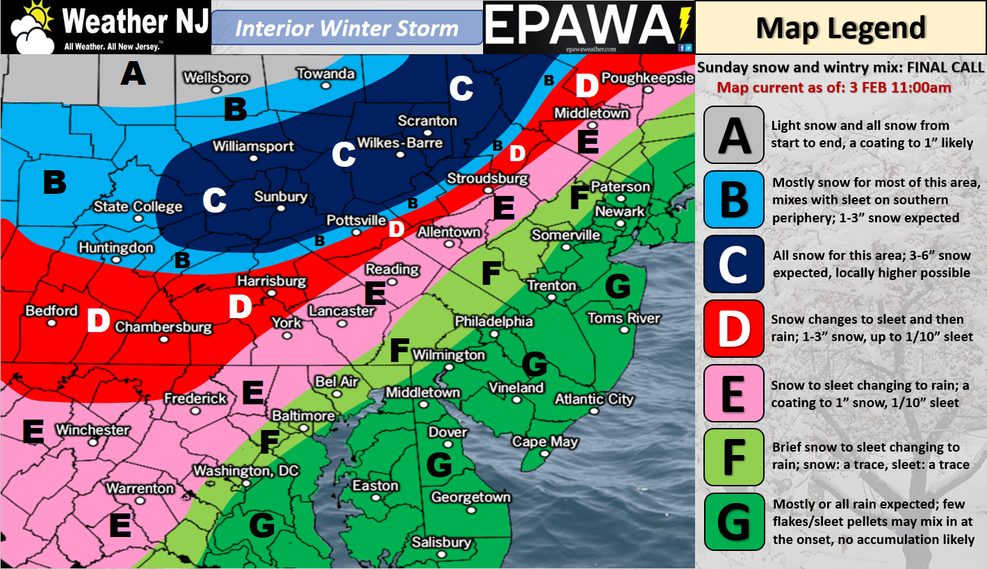
Click here to view full impact map!
Discussion: Low pressure will drive into the E Great Lakes before transferring to a weak coastal low just offshore of SENJ. Warm sector flow ahead of the low pressure should keep most of New Jersey at or above freezing at the important snow-making levels. NWNJ elevations are favored for wintry precipitation with chances rapidly diminishing as you head SE from there. Precipitation amounts should range from a half-inch or so for NNJ to 1.25″ for SNJ. General timing is from late-tomorrow morning through late tomorrow night (right through the Super Bowl).
In English: Most of New Jersey should expect rainfall late-tomorrow morning through tomorrow night. It could start out as snow along and NW of I-95. Heck there might even be a few snowflakes/sleet pellets just SE of I-95. The lower 2/3 of NJ (including NENJ) however should quickly go over to rain. NWNJ elevations could hold onto snow and/or sleet a bit longer before changing over. This is why NWNJ elevations are favored for the wintry-impact from this nuisance of a system (please see above map). We then clear out tomorrow night as temperatures drop to start the week. The detailed Monday-Friday Outlook and February Discussion will be released tomorrow. Have a great Saturday evening and please be safe! JC
For comprehensive and interactive hyper-local analysis that goes way above and beyond the detail of this public forecast, check out our premium services which include text notifications and forum access.
Jonathan Carr (JC) is the founder and sole operator of Weather NJ, New Jersey’s largest independent weather reporting agency. Since 2010, Jonathan has provided weather safety discussion and forecasting services for New Jersey and surrounding areas through the web and social media. Originally branded as Severe NJ Weather (before 2014), Weather NJ is proud to bring you accurate and responsible forecast discussion ahead of high-stakes weather scenarios that impact this great garden state of ours. All Weather. All New Jersey.™ Be safe! JC


LOCAL FORECAST | INTERACTIVE RADAR | LATEST NJ WEATHER ALERTS | WEDDING FORECAST| PRIVACY POLICY
© Copyright 2026 Weather NJ LLC. All Rights Reserved.
Some information that can be found on our website is provided by a private weather station and is not an officially recognized station for weather reporting. Though we always strive to achieve accurate reporting for our own use, it is important that you do NOT depend on the data provided here for any purpose.
