

Feb 4: Another Winter Storm Detected
Discussion: Real quick, we still expect a weak disturbance moving through Friday. It seems nuisance at this point with only trace/light accumulations for NWNJ elevations. Maybe non-accumulating snow as far SE as 95. It will be out of here by Friday night and set up a cold weekend behind it, ahead of the February 7-9 winter storm signal. As far as timing this signal is leaning more towards Sunday Feb 7 for impacts, maybe just into Monday Feb 8.
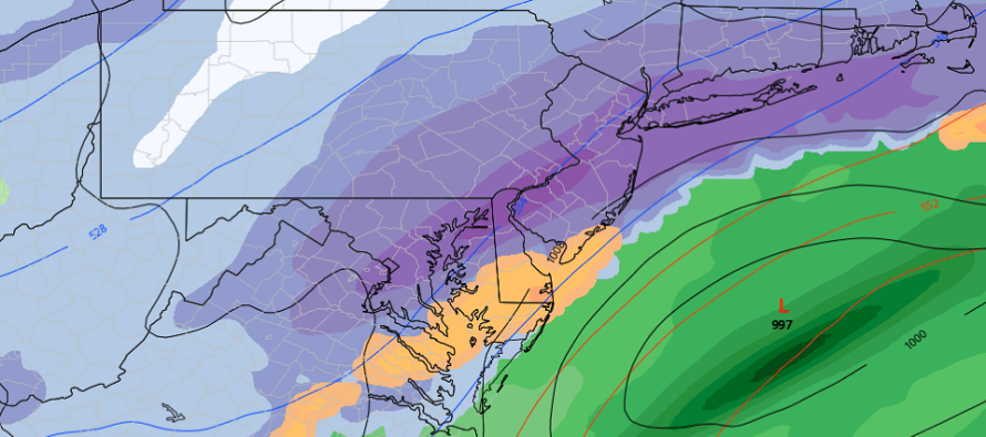
Most surface data today is showing a NJ winter storm hit for Sunday. I’m still not sold on a specific surface solution yet. I told you they would swing, and they should continue to do so in either direction until more of a consensus is reached. What matters most IMO is why the output is now snowy for NJ.
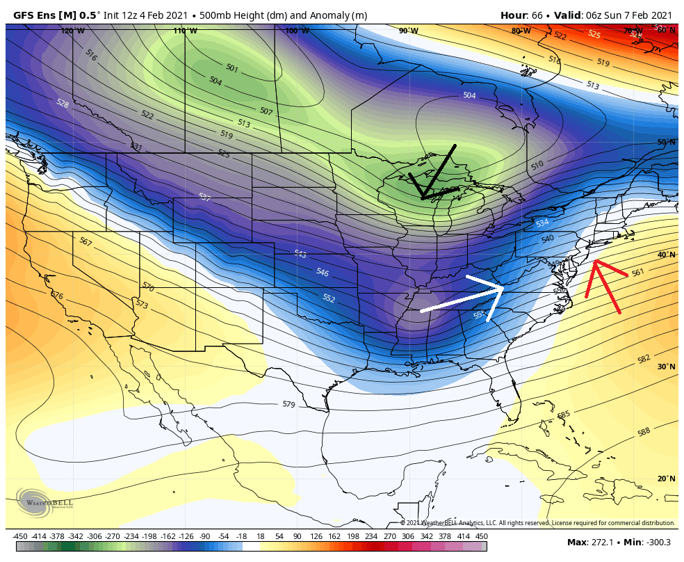
We’re not really dealing with a full 500mb phase between the N branch and S branch streams. If that starts to become evident then this would turn into another historic storm. Instead there will likely be interaction but not the full wrap-up of cyclonic vorticity.
Today, the guidance is showing the N branch energy holding back and digging a little more over the Great Lakes. This allows the S stream to catch up and turn the trough axis counter-clockwise to a near-neutral axis. Downstream physics are then applied to raise the geopotential heights along the E coast and allow the Southern energy to come up the coast more. The surface output responded by bringing the low’s precipitation shield over much of New Jersey. The black arrow is the N energy, white arrow the S energy, and red arrow the rising heights:
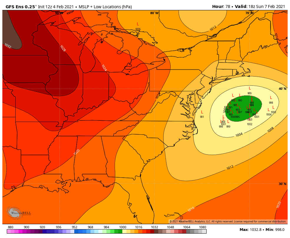
Some more practical guidance from this range would be the ensembles. The GFS ensemble mean is a fairly strong single for the event to occur. The Euro ensembles are similar. A tight cluster on the NW side of the existing mean, which indicates to me we’re possibly not finished trending:
On today’s model guidance, 925mb and above were all cold enough to support snowfall. The surface however was in the 33-34 range for the immediate SENJ coastal areas recently robbed. I’m sure this will jump around too but as modeled verbatim, there would be precipitation rate-dependent stickage issues SE of the Turnpike/95 corridor. Since it’s the S stream energy that will make this more of a storm, it could bring more baroclinic surface issues like the recent storm. Just something else I’m watching.
In English: Chances are increasing for another winter storm towards the end of the weekend. I don’t think it will feature historical components like the recent system, likely more of a significant to major event. Maybe a 6-12 for the jackpot axis kind of thing if it all works out. Today was a step closer to it happening. Tomorrow it will be time to start forecasting the surface impacts if the model guidance and observations keep the status quo for another 24 hours. See you tomorrow and have a great rest of your Thursday.
Our premium services go even further above and beyond at the hyper-local level. Get your merch on at the KABOOM shop.
Jonathan Carr (JC) is the founder and sole operator of Weather NJ, New Jersey’s largest independent weather reporting agency. Since 2010, Jonathan has provided weather safety discussion and forecasting services for New Jersey and surrounding areas through the web and social media. Originally branded as Severe NJ Weather (before 2014), Weather NJ is proud to bring you accurate and responsible forecast discussion ahead of high-stakes weather scenarios that impact this great garden state of ours. All Weather. All New Jersey.™ Be safe! JC


LOCAL FORECAST | INTERACTIVE RADAR | LATEST NJ WEATHER ALERTS | WEDDING FORECAST| PRIVACY POLICY
© Copyright 2026 Weather NJ LLC. All Rights Reserved.
Some information that can be found on our website is provided by a private weather station and is not an officially recognized station for weather reporting. Though we always strive to achieve accurate reporting for our own use, it is important that you do NOT depend on the data provided here for any purpose.
