

Feb 4: Winter Storm Detected!
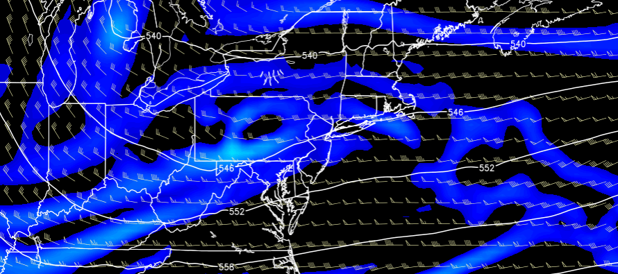
Model guidance is in agreement that an Arctic frontal boundary will push southward and stall somewhere over the SNJ area this Sunday-Tuesday. A weak area of low pressure will crawl along this boundary due to strong high pressure to the north. The low pressure system will bring in the required moisture and eventually make its way into the Atlantic Ocean—where it will back-fill more snow into New Jersey. This should result in on-and-off light-to-moderate snowfall for a prolonged period of time. Heavy bands of snow are possible within this entire event but that will have to be now-casted in a mesoscale environment.
Real quick…once tomorrow’s Arctic front is through, tomorrow night will likely be one of the coldest nights we’ve seen this winter so do what you have to do to prepare for that.
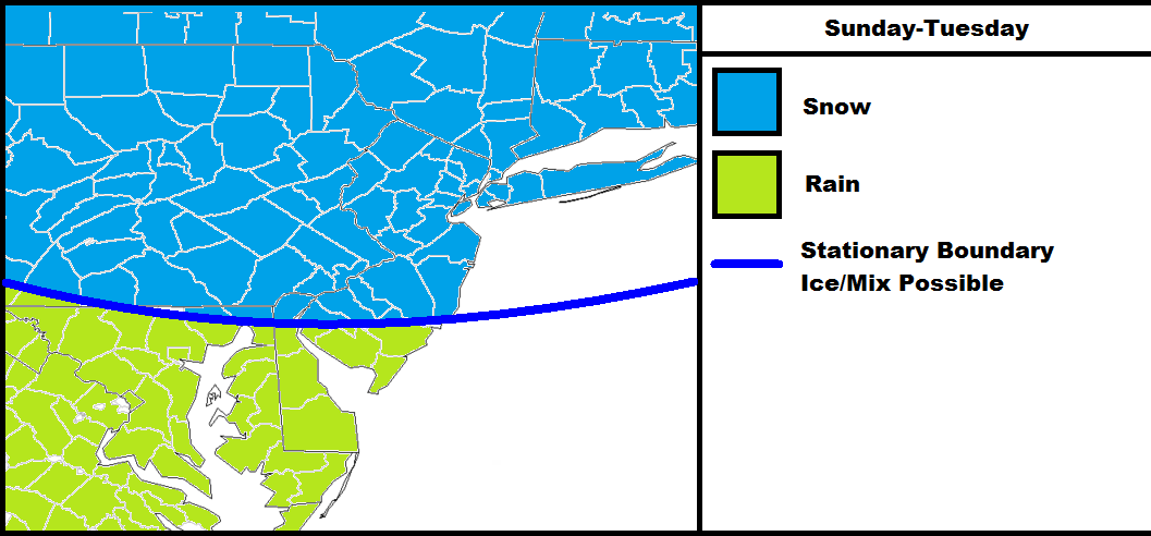
Right now the frontal boundary is expected to stall somewhere in SNJ. That means that for the first 2/3 of the storm, NNJ/CNJ could see snowfall while SNJ sees rainfall. For the final third of the storm, temperatures would crash for SNJ when energy transfers to the coast—still keeping minor-to-significant snow accumulations on the table when all is said and done. NNJ and CNJ are looking at more snowfall accumulations than SNJ. As we learned the other day, this Polar Vortex reinforced Arctic air mass means business and will only take so much warm air advection to the face before overpowering it. This next image is only to demonstrate the concept of where the snow/rain line will set up with respect to the frontal boundary. Since we’re still a few days out, this stationary boundary could end up being as far north as I-195 or as far south as the Atlantic City Expressway. Sleet and/or freezing rain would be possible just to the north and south of this stationary boundary but that will be a thin geographic area of icing:
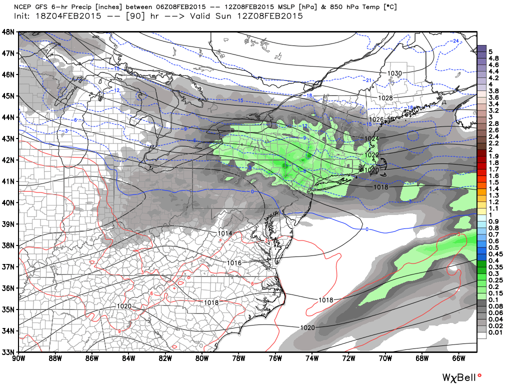
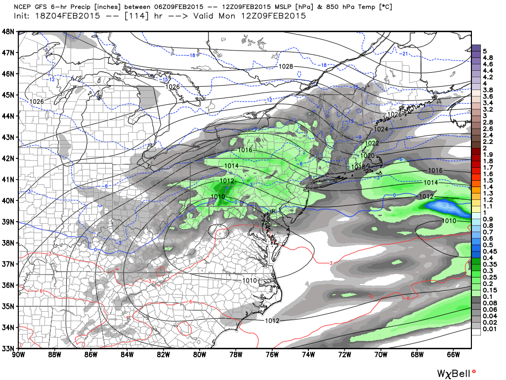
Now that we have an idea of the general setup and why it’s going to be such a long event, lets look at some supporting guidance. This is the latest GFS run showing 850mb pressure, temperature, and precipitation between 1AM and 7AM each morning:
Sunday Morning
Monday Morning:
Tuesday Morning
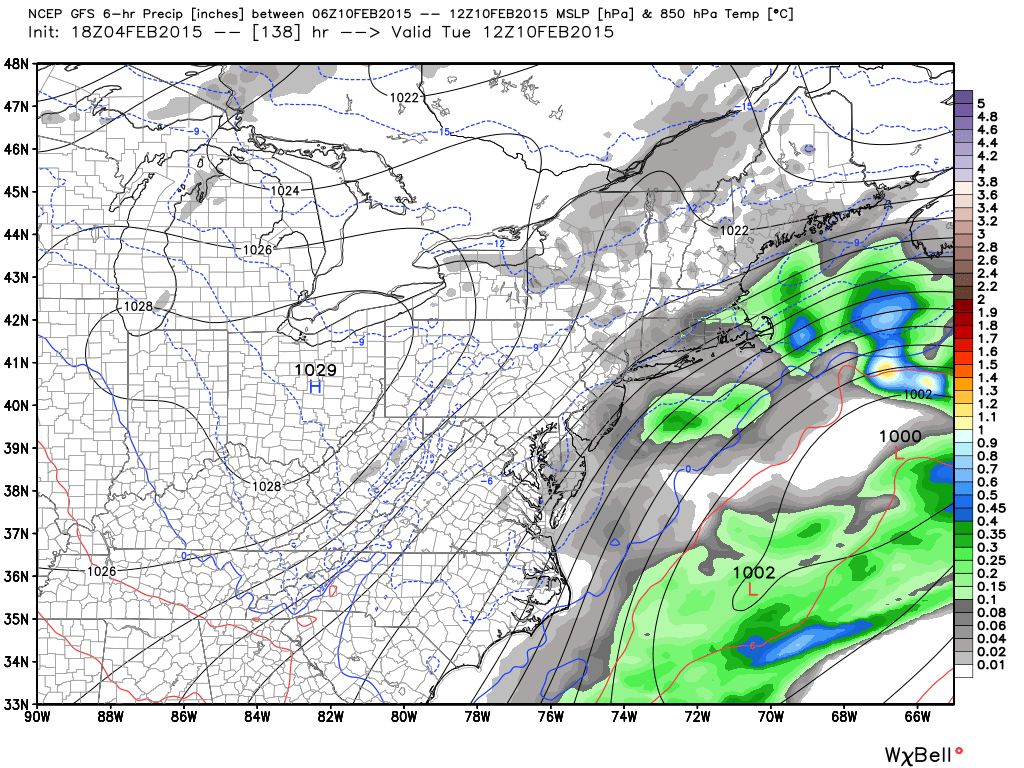
Notice that precipitation is moving in from the W/NW as early as Sunday morning and just pulling away from the coast on Tuesday morning. That’s the best timing estimate that can be given at this point. Again, weak low pressure crawling along a stationary Arctic boundary due to decent blocking. that’s where we’re at right now.
In English: NNJ/CNJ are looking at light-to-moderate snowfall from Sunday morning through Tuesday morning. SNJ is possibly looking at rain Sunday and Monday before changing over to snow Monday night into Tuesday. Guidance will likely wobble north and south with the boundary location over the next few days but I think everyone north of I-195 should see mostly snow throughout the entire event. It’s too early for accumulation totals. Those will be given on Friday with my first call map. I’ll post an update each night as we approach. Be safe! JC
Jonathan Carr (JC) is the founder and sole operator of Weather NJ, New Jersey’s largest independent weather reporting agency. Since 2010, Jonathan has provided weather safety discussion and forecasting services for New Jersey and surrounding areas through the web and social media. Originally branded as Severe NJ Weather (before 2014), Weather NJ is proud to bring you accurate and responsible forecast discussion ahead of high-stakes weather scenarios that impact this great garden state of ours. All Weather. All New Jersey.™ Be safe! JC


LOCAL FORECAST | INTERACTIVE RADAR | LATEST NJ WEATHER ALERTS | WEDDING FORECAST| PRIVACY POLICY
© Copyright 2026 Weather NJ LLC. All Rights Reserved.
Some information that can be found on our website is provided by a private weather station and is not an officially recognized station for weather reporting. Though we always strive to achieve accurate reporting for our own use, it is important that you do NOT depend on the data provided here for any purpose.
