

Feb 5: Winter Storm Update
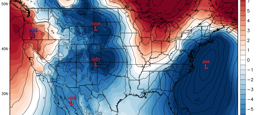
Model guidance has trended northward overnight and today. A low pressure track from Pittsburgh through SNJ was modeled by the GFS and Canadian. The Euro was south of both runs with low pressure moving from just south of Pittsburgh through southern Delmarva. This would put the rain/snow line anywhere between I-195 and I-80 for the peak precipitation of the storm (most of Monday). A front end thump of snow would be likely to start Sunday as far south as Philly<->Toms River before the snow/rain line marches northward. Everything would change back to wintry precipitation on the back end Tuesday morning for all of New Jersey. At this point temperatures will be crashing and turning any remaining precipitation into snow (ice possible during transition like last storm). So mostly snow for NNJ, snow to mix to rain to mix to snow for CNJ and light snow to mostly rain ending as light snow for SNJ—if taking current model guidance and general synoptics into consideration.
By tomorrow afternoon, the models will have much more data to work with re: simulation. That’s when the energy responsible for this winter storm will be off the Pacific Ocean and over land where weather sensors are more dense. This is another situation where a strong cold air mass exists to the north and a warm air mass pressing up against it from the south. The difference in a 50-100 mile trend has tremendous impact on the actual solution that verifies. For this reason, I am waiting until tomorrow evening to post my official first call with impact map. Again though, the models have trended north—now including CNJ in the zone that sees mostly rain, not just SNJ.
If you tied me down and tickled me until I told you my current thoughts, I’d go with widespread 4-8 maybe 6-10 for NNJ. CNJ would likely see 1-3/2-4 after all is said and done (including snow and rain). SNJ would see nothing but front and back end flurries and like it…that’s a Caddyshack (1980) reference by the way. This is based on current guidance though. There is still time for more trending which is what I’ll be watching closely over the next 24-36 hours as the aforementioned data sampling commences.
In English: What’s been happening for the last few winter storms is probably going to happen for this winter storm…NNJ snow, CNJ mix, and SNJ rain. Be safe! JC

Jonathan Carr (JC) is the founder and sole operator of Weather NJ, New Jersey’s largest independent weather reporting agency. Since 2010, Jonathan has provided weather safety discussion and forecasting services for New Jersey and surrounding areas through the web and social media. Originally branded as Severe NJ Weather (before 2014), Weather NJ is proud to bring you accurate and responsible forecast discussion ahead of high-stakes weather scenarios that impact this great garden state of ours. All Weather. All New Jersey.™ Be safe! JC


LOCAL FORECAST | INTERACTIVE RADAR | LATEST NJ WEATHER ALERTS | WEDDING FORECAST| PRIVACY POLICY
© Copyright 2026 Weather NJ LLC. All Rights Reserved.
Some information that can be found on our website is provided by a private weather station and is not an officially recognized station for weather reporting. Though we always strive to achieve accurate reporting for our own use, it is important that you do NOT depend on the data provided here for any purpose.
