

Feb 7: Sunday Night Observations
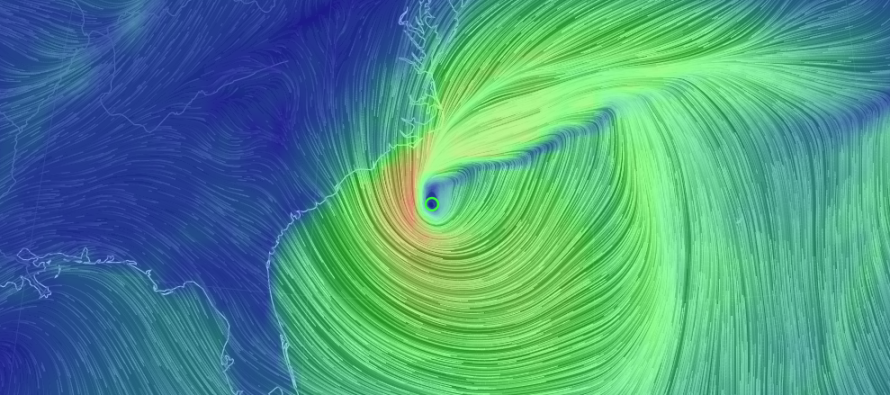
The coastal low has deepened down to about 986mb. Coastal New Jersey should already be feeling the NE winds associated with the cyclonic flow to the north of the low. This should begin elevating tides above normal. Once the winds eventually switch to the north tomorrow morning, the storm surge flooding threat will subside. Allow 1-2 high tides after that for back bays to drain out of inlets and then the barrier islands should be good both ocean and bayside. I don’t think we’re looking at blizzard sea levels but definitely above normal.
The clipper system is moving into the Great Lakes region. It is starting to interact with the coastal low in the sense of pushing it into the Atlantic Ocean. The problem is that a coastal low of this magnitude isn’t going to just fall head over heals for the clipper. It will take some caressing and time to eventually kick it out to sea.
At the upper levels, the low is completely closed off at 500mb just SE of the SE US coast. 700mb, 850mb, 925mb levels and the surface are all stacked underneath obviously closed as well. The trough axis is negative but pushing eastward. This all comes down to how much the coastal low will be sucked westward to the north of the negative-tilting trough—before everything is eventually kicked out to sea. The slightest tug west could have tremendous impact on eastern parts of New Jersey come sunrise.
Short range model guidance is hinting at least at a period of light to moderate snowfall for coastal counties (Monmouth and Ocean moreso than Atlantic and Cape May. I don’t see much happening for western parts of New Jersey. If the precip gets that far in then eastern NJ will have a serious thumping of snow. This is the latest HRRR (High Resolution Rapid Refresh) radar simulation showing show for eastern NJ:
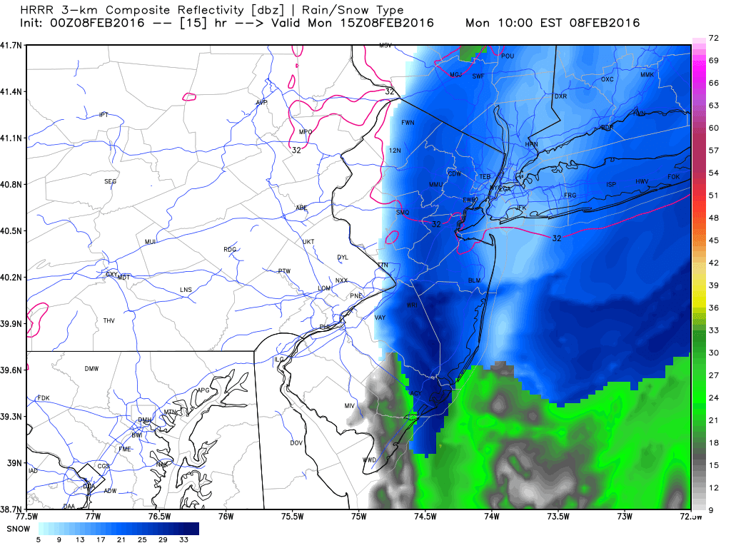
As you can see, the western cut-off is very sharp. Also, the line of freezing is near the NNJ/CNJ border. So light snow would melt. Heavier snow would overcome the surface by dragging cold air down. This next image is the most recent high-resolution NAM also showing snowfall for eastern NJ tomorrow morning:
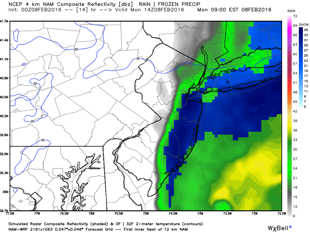
What’s most important to me right now is that these models initialized fairly close to real observations. Also the current satellite water vapor loop IMO is showing a system that wants to kick a lots of moisture as far NW as it can.

With all of this being said, I’m leaning towards at least Monmouth and Ocean Counties seeing a decent burst of snow after some rain to start. The surface will be slightly warm (just like Friday) however we all learned that snowfall rates can overpower a warmer surface. So if we only have light snow in the morning, it will likely melt on paved surfaces and only temporarily stick to natural surfaces. If the snow is heavier than we could see a few slushy inches in the streets and higher accumulations on natural surfaces.
In English: Expect possible rain turning to snow before, during and slightly after rush hour tomorrow morning for eastern counties of NJ (Monmouth and Ocean especially). If the snow is lighter then it will be less of a problem. If heavier than accumulations could happen just like Friday. It will all come down to the intensity of any snow bands that push onshore. Coastal regions should be cautious of flooding as the storm continues to intensify and track E/NE.
Jonathan Carr (JC) is the founder and sole operator of Weather NJ, New Jersey’s largest independent weather reporting agency. Since 2010, Jonathan has provided weather safety discussion and forecasting services for New Jersey and surrounding areas through the web and social media. Originally branded as Severe NJ Weather (before 2014), Weather NJ is proud to bring you accurate and responsible forecast discussion ahead of high-stakes weather scenarios that impact this great garden state of ours. All Weather. All New Jersey.™ Be safe! JC


LOCAL FORECAST | INTERACTIVE RADAR | LATEST NJ WEATHER ALERTS | WEDDING FORECAST| PRIVACY POLICY
© Copyright 2026 Weather NJ LLC. All Rights Reserved.
Some information that can be found on our website is provided by a private weather station and is not an officially recognized station for weather reporting. Though we always strive to achieve accurate reporting for our own use, it is important that you do NOT depend on the data provided here for any purpose.
