

Feb 8: Final Call on Winter Storm
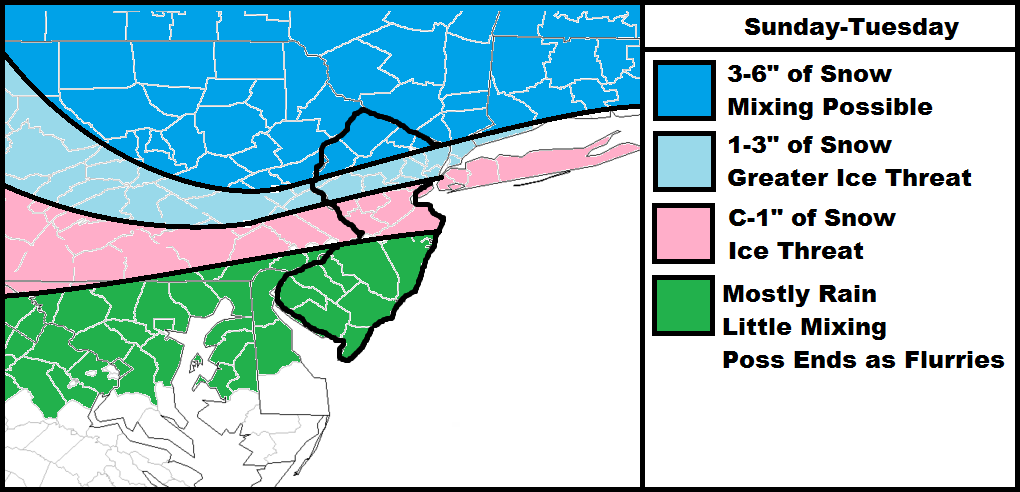
The main headline for this storm will be ice in CNJ and NNJ. Snow has become a much lesser concern regardless of the significant accumulations still possible in NNJ. SNJ will have the least amount of wintry impact with mostly rain but could still end as flurries.
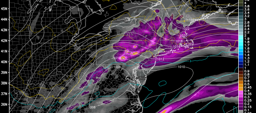
Precipitation has already begun in extreme NNJ and will continue to work into points south through this evening and overnight. Precipitation should be filled in tomorrow morning. The main period of interest will be Monday between noon and sunset. This is when the temperatures are expected to crash from NW to SE. If you remember last Friday a similar scenario could develop for CNJ and NNJ during this time frame. Ending precipitation should taper off by early Tueday morning.
In English: NNJ: Snow to mix to snow starting now and ending early Tueday. CNJ: Snow/mix to rain to ice to snow starting later this evening and ending early Tuesday morning. SNJ: Mixing possible to start overnight but mostly rain possibly ending as flurries early Tuesday morning.
Model image used with permission from WeatherBell Analytics.

Jonathan Carr (JC) is the founder and sole operator of Weather NJ, New Jersey’s largest independent weather reporting agency. Since 2010, Jonathan has provided weather safety discussion and forecasting services for New Jersey and surrounding areas through the web and social media. Originally branded as Severe NJ Weather (before 2014), Weather NJ is proud to bring you accurate and responsible forecast discussion ahead of high-stakes weather scenarios that impact this great garden state of ours. All Weather. All New Jersey.™ Be safe! JC


LOCAL FORECAST | INTERACTIVE RADAR | LATEST NJ WEATHER ALERTS | WEDDING FORECAST| PRIVACY POLICY
© Copyright 2026 Weather NJ LLC. All Rights Reserved.
Some information that can be found on our website is provided by a private weather station and is not an officially recognized station for weather reporting. Though we always strive to achieve accurate reporting for our own use, it is important that you do NOT depend on the data provided here for any purpose.
