

First Snow Possible Tonight for NWNJ
Discussion: Precipitation is approaching New Jersey from the SW and is already falling in some areas. No one should get too excited just yet. The snow that could happen tonight is mainly for the higher NWNJ elevations and will probably struggle to stick given the marginal lower-level/surface temperature profile. For the rest of (most of) New Jersey, this will likely be just a cold rain.
A trough swung through this past Sunday into Monday which transitioned us from the abnormally mild weekend weather to a colder pattern. Another trough is on the way and it’s even colder than the current setup. This trough will swing through between Wednesday night into the weekend. The current approaching disturbance is on the front of that trough in the common area of positive vorticity advection. The trough will have a positive axis and therefore produce a progressive steering flow for the low (a fast mover).
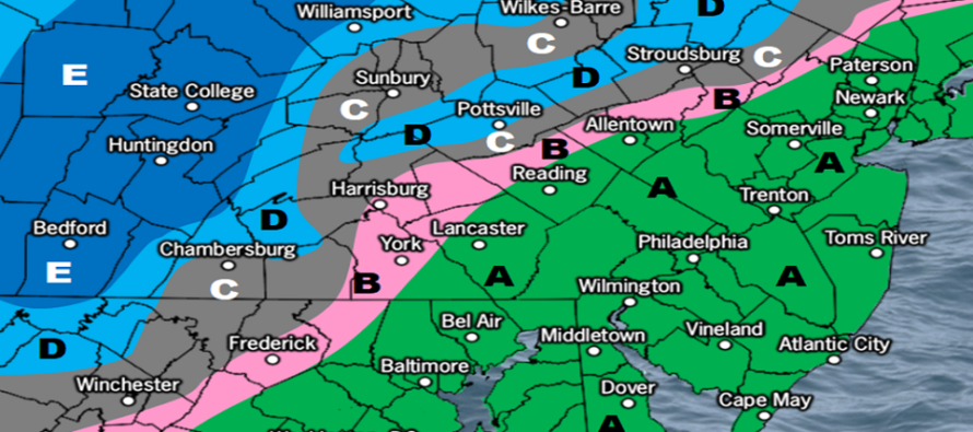
Most of New Jersey is currently (as of Tues afternoon) above freezing and will stay that way tonight/tomorrow morning as precipitation occurs. The higher elevations of NWNJ however are only just above freezing and should tick down a few degrees through this evening’s sunset as precipitation moves in. Therefore, the snow interest is only at the front end of beginning precipitation. With the low tracking to our W and N, warm air will eventually advect even into NWNJ and change precipitation type to all rain. But before that happens, anything from a mix of snow, ice, and cold rain is possible N of I-80/NW of I-287. Little-to-no accumulation is expected before the changeover. Perhaps the High Point Monument area of Sussex County could see a sloppy coating to an inch or two at best. Below is our snow map for this evening:
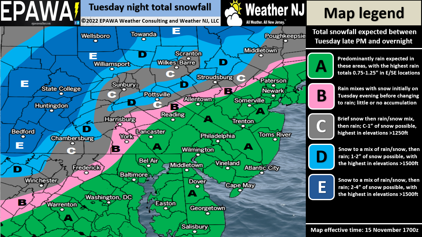
Please click here for a full-resolution snow map.
By sunrise tomorrow morning (Wednesday), the precipitation should shut off and pull away to the E with the departing system. So this is really a dark hours precip event only…from sunset tonight through sunrise tomorrow. Conditions should gradually improve through late Wednesday morning with sun back out by afternoon if not sooner. We then turn colder from Wednesday night all the way through the weekend. It might be Monday before the cold shot relaxes and moderates.
I’m seeing a few potentially potent cold shots through the rest of November mainly due to ridging over Western North America. This should produce a reciprocating trough pattern for the E US however with inadequate North Atlantic blocking to slow down and wrap up a winter storm. So cold with progressive flow. Other than tonight’s possible snow for the highest NJ elevations, we could also see some lake-effect streamers of flurries and snow showers behind the departing low…or any other orientation of cold NW flow over the still-unfrozen Great Lakes.
In English: Most of New Jersey should expect a cold rain between now and sunrise tomorrow morning. Precipitation is approaching from the SW and already into some areas of NJ. Most areas are looking at anything from a quarter-inch of rain up to maybe 1.5 inches of rain. NWNJ elevations could see a wintry mix, possibly a period of all snow, this evening before eventually changing over to all rain by tomorrow morning. This would likely only occur N of I-80 and NW of I-287. High Point Monument area of Sussex has the best chance to see the most amount of snow. Please see our expected snow map above for a more precise expectation. I’ll check in later this evening as precipitations spreads further into NJ from the SW. Have a great rest of your Tuesday and please be safe! JC
Premium Services
KABOOM Club offers inside info forecast discussion, your questions answered, and early storm impact maps (ahead of the public). At a buck per month, it’s an extremely feasible way to show support.
My Pocket Meteorologist (MPM), in partnership with EPAWA Weather Consulting, offers professional/commercial interests, whose businesses depend on outdoor weather conditions (snow plowing, landscaping, construction, etc.), with hyper-local text message alerts/forecasts and access to the MPM premium forum—the most comprehensive and technical forecast discussion available for PA and NJ.
Jonathan Carr (JC) is the founder and sole operator of Weather NJ, New Jersey’s largest independent weather reporting agency. Since 2010, Jonathan has provided weather safety discussion and forecasting services for New Jersey and surrounding areas through the web and social media. Originally branded as Severe NJ Weather (before 2014), Weather NJ is proud to bring you accurate and responsible forecast discussion ahead of high-stakes weather scenarios that impact this great garden state of ours. All Weather. All New Jersey.™ Be safe! JC


LOCAL FORECAST | INTERACTIVE RADAR | LATEST NJ WEATHER ALERTS | WEDDING FORECAST| PRIVACY POLICY
© Copyright 2026 Weather NJ LLC. All Rights Reserved.
Some information that can be found on our website is provided by a private weather station and is not an officially recognized station for weather reporting. Though we always strive to achieve accurate reporting for our own use, it is important that you do NOT depend on the data provided here for any purpose.
