

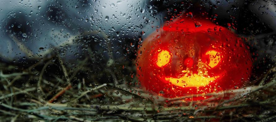
Halloween Trick or Treat Forecast
Discussion: I wish to extend great empathy for parents and guardians worried about their children tomorrow night during primary trick or treat hours. There are some articles out there calling for Book of Genesis rainfall and Wizard of Oz winds. I’ve been getting a lot of messages about it and figured it would be best to address it in article form. First let’s get through the advanced meteorological discussion about what’s going on up there.
250mb jet analysis shows that a strong upper-level jet streak, correlating with the front of an upper-level trough, will pass through the region between Halloween (Thursday) and Friday morning. 500mb analysis shows the upper-level trough (with internal upper-level low) swinging from a positive axis to a negative axis across the northern-central and northern-east US from tonight through Friday afternoon. The upper-level low is modeled with a very strong vorticity signature. The Positive Vorticity Advection (PVA) ahead of the trough is equally impressive and correlates with the best area frontogenic forcing and surface pressure drops. This all is pointing to a very strong mid-latitude cyclone that should track across the Great Lakes through the NE US and SE Canada. 850mb analysis shows a S/SW Lower Level Jet (LLJ) of 60-70 kts (70-80mph).
In New Jersey we’re going to deal with the common symptoms of a Norwegian Cyclone Model passing to our (NJ’s) NW. A warm front should push through overnight tonight from S to N. That will put us in the warm sector for most of tomorrow. A cold front is then expected to push through during the early AM hours of Friday and set the stage for a cold fall weekend.
Typically the above-described setup would produce a heck of a wind storm for NJ. However there is an inhibiting factor known as a temperature inversion (please see circled area of below image – red line is represents decrease or increase in temp with altitude).
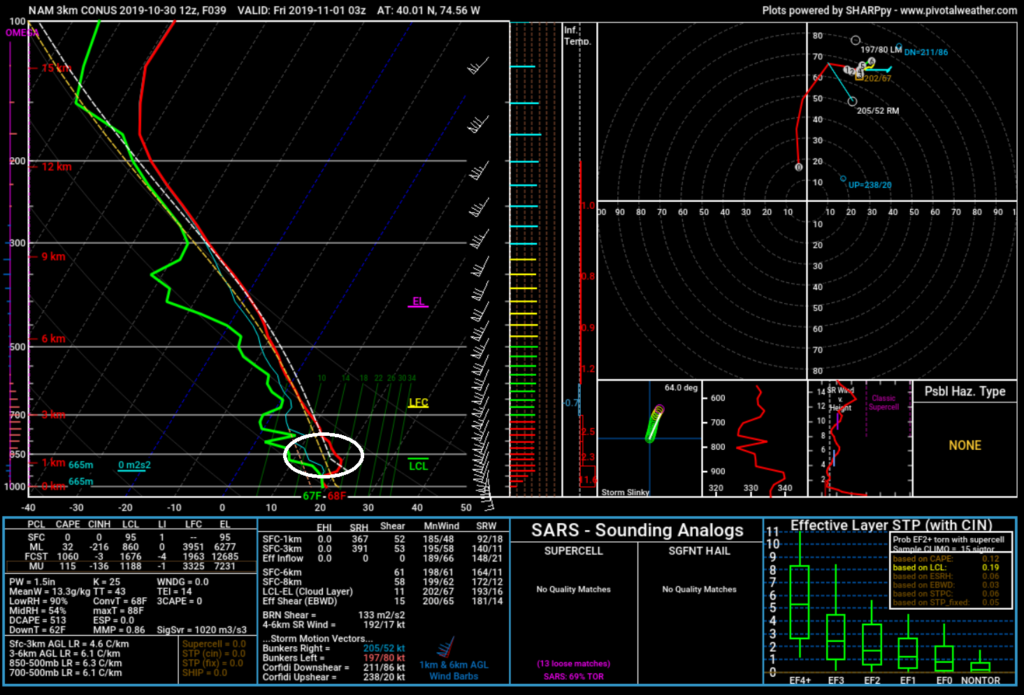
In a normal stabilized low-to-mid atmosphere temperatures decrease as you increase in altitude (until you hit the tropopause). Therefore warmer air at the surface naturally wants to rise into the colder air aloft. When it does we know this as instability. In tomorrow-Friday’s setup temperatures actually increase from 4000 ft to about 8000 ft above ground level (due to the strong LLJ out of S/SW). Therefore the warmer surface air is stunted from rising aloft into even warmer temperatures. This prevents lifting and in-return prevents convective sinking. Convective sinking is the force that could bring the crazy 70-80mph LLJ winds down to the surface. With that said the lower-level temperature inversion should act as a shield to prevent the strongest winds from reaching the surface. The best chance for it to happen, if it does, is right along the thin strip of heavy downpours associated with the cold front passage (during early Friday AM hours).
With all of the above stated lets arrive at a reasonable expectation. I’m seeing rain Halloween (Thursday) morning between early and late-morning hours associated with the warm front passage. I am then seeing a break in the rain for Halloween afternoon through evening hours as the warm sector passes over NJ. It might be breezy (sustained 15-20mph with gusts to 30mph) but rainfall should be limited during this time to occasional misty sprinkle at most. NWNJ has a better shot of rain during this period. Everyone SE of the turnpike could actually get a good trick or treating period in. The strongest aspects of this entire system should then arrive in NJ during early-Friday AM hours (possibly late tomorrow night) with the cold front. In these hours NJ will likely see a thin strip of heavy downpours. You might even hear a rumble. The heavy rainfall is a downward force that could bring some of the stronger winds to the surface. I am not saying there will be gusts of 70-80mph but maybe a few in the 40-50mph range with a big IF caveat – IF there’s enough downward convection generated by the heavy rainfall. This should occur when most are sleeping (after trick or treat hours and before sunrise Friday). We then deal with stable NW flow (clear and cold) for most of the weekend.
In English: Expect Halloween (Thursday) to start rainy statewide during morning hours. Then expect a break in the rain (especially along the turnpike and points SE of the turnpike) for afternoon-evening hours (during primary trick or treat hours). Areas in NJ NW of the turnpike have a better chance of trick or treat rain but it shouldn’t be too bad (light misty drizzle type stuff). Expect breezy, occasionally gusty, winds during trick or treat hours statewide but nothing over and above the nuisance category. The heaviest rain and wind should hold off until early Friday morning hours. This could be a problem for loose Halloween decorations and small human beings but most will be asleep during it. A tell sign of how strong the winds will be is lightning. If there is frequent lightning then the late-Thursday/early-Friday winds will be worse. If no lightning then meh. With that said trick or treating should be fine for most areas S of I-78/E of I-287. NWNJ elevations look wetter but likely manageable (have an umbrella/poncho/etc). The best hours for trick or treating should fall within late-afternoon and early-evening. Try to be finished by 9pm to safely beat the heavier rain and wind that could start as early as 10pm tomorrow night/as late as 3am Friday. Hopefully this article can better help you plan your trick or treating tomorrow. Have a great night and please be safe! JC
Download the new free Weather NJ mobile app on Apple and/or Android. It’s the easiest way to never miss Weather NJ content. Our premium services go even further above and beyond at the hyper-local level. Looking for industrial-caliber long-range forecasting data that I personally recommend? Check out WeatherTrends360!
Jonathan Carr (JC) is the founder and sole operator of Weather NJ, New Jersey’s largest independent weather reporting agency. Since 2010, Jonathan has provided weather safety discussion and forecasting services for New Jersey and surrounding areas through the web and social media. Originally branded as Severe NJ Weather (before 2014), Weather NJ is proud to bring you accurate and responsible forecast discussion ahead of high-stakes weather scenarios that impact this great garden state of ours. All Weather. All New Jersey.™ Be safe! JC


LOCAL FORECAST | INTERACTIVE RADAR | LATEST NJ WEATHER ALERTS | WEDDING FORECAST| PRIVACY POLICY
© Copyright 2026 Weather NJ LLC. All Rights Reserved.
Some information that can be found on our website is provided by a private weather station and is not an officially recognized station for weather reporting. Though we always strive to achieve accurate reporting for our own use, it is important that you do NOT depend on the data provided here for any purpose.
