

Hurricane Erin to Stay Offshore of NJ
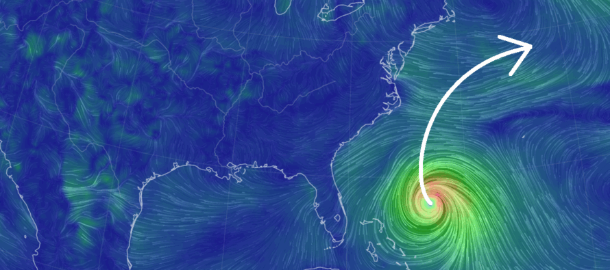
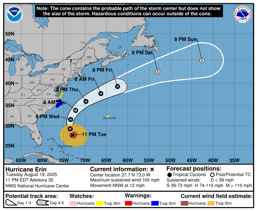
Discussion: Hurricane Erin’s track is pretty locked in at this point. She’s a few hundred miles NE of the Bahamas and has turned well to the NW. Erin will pass between two ridges (an area of weakness), one over SC/SE US and the other out in the Atlantic Ocean. This will turn Erin to the N before reaching the E US coast and then the upper jet, defining the NE US/Mid-Atlantic US trough will provide NW flow to turn Erin to the NE away from the E US coast. No US landfall. No crippling winds or rain. Just some coastal battering, run-of-mill ocean storm winds, and possibly some showers/thunderstorms. Here’s the latest update from the NOAA National Hurricane Center:
Again, rainfall will not be a “tens of inches” event. Not sure about even one inch but certainly showers at times in an on-and-off nature. Winds will be felt most along the coast (lesser away from the ocean) but likely short of even tropical storm force winds. Sustained winds of 15-25mph with gusts in the 30-40 mph range right along the immediate coast starting out of the NE, switching to N, and then finishing out of the NW. You’ve seen this kind of rain and wind many times before.
The true hazard from Erin for NJ will be along the coast. First, a tropical cyclone radiates large swell outwards. This swell will hit the NJ beaches in the form of larger waves. The larger waves will need to recede back into the ocean in the form of rip currents (thinner offshore currents and channels between wider onshore waves). With that said, it’s a bad week for swimmers, especially inexperienced swimmers. Whether or not the surf will be large sets of swells (surfer’s paradise) or a choppy angry surf is yet TBD. Regardless, rip currents present a safety hazard for anyone in the ocean. Coastal flooding is also a possibility since the N side of Erin’s circulation will be driving a bit of surge into the NJ coast. Minor coastal flooding is likely. Moderate is possible. Beach erosion will have to be analyzed afterwards but we should expect a few dune cliffs when Erin departs Friday.
OBX will see the greatest of all E US coast impacts. Whatever they see Wednesday night into Thursday morning, NJ should see about a third to a half of Thursday into early Friday AM hours. After that, Erin will pull away and pull down drier air behind it for the weekend in NJ (lower humidity). The drier Friday air should allow temps to rise above 80 again but with low dews, it should feel amazing. A close call for the US but Erin shall sleep with the fish. It’s the W African waves after Erin that has my interest at this point. More to come on that as they evolve.
In English: Erin will miss the US regarding direct impact but provide fringe effects in the form of rain showers, breezy/gusty winds along the immediate coast, rough surf, dangerous rip currents, minor-to-moderate coastal flooding, and beach erosion. The overall window of timing for NJ is Wednesday afternoon through early Friday AM with Thursday likely the peak of what we’re going to see. We’re now in peak hurricane season and I will be monitoring. Have a great rest of your Tuesday night and please be safe! JC
Jonathan Carr (JC) is the founder and sole operator of Weather NJ, New Jersey’s largest independent weather reporting agency. Since 2010, Jonathan has provided weather safety discussion and forecasting services for New Jersey and surrounding areas through the web and social media. Originally branded as Severe NJ Weather (before 2014), Weather NJ is proud to bring you accurate and responsible forecast discussion ahead of high-stakes weather scenarios that impact this great garden state of ours. All Weather. All New Jersey.™ Be safe! JC


LOCAL FORECAST | INTERACTIVE RADAR | LATEST NJ WEATHER ALERTS | WEDDING FORECAST| PRIVACY POLICY
© Copyright 2026 Weather NJ LLC. All Rights Reserved.
Some information that can be found on our website is provided by a private weather station and is not an officially recognized station for weather reporting. Though we always strive to achieve accurate reporting for our own use, it is important that you do NOT depend on the data provided here for any purpose.
