Jan 13: South Jersey Express Snow Detected!

First, it’s my birthday today so let me say that this is a wonderful natural gift! Light snow in SNJ on Wednesday has been showing up on model guidance for the past 36 hours or so and it now looks likely. Here’s the details…
A weak area of low pressure will be moving out to sea—east of OBX and east of a traditional benchmark track. The precipitation shield to the north and west of this weak low should graze SNJ/SENJ with light snow. Before we get too excited here…we’re talking anything from a coating-few inches up to a surprise 3 inches plus. We’ll see! Major cities along I-95 (Philly, NYC, etc) need not worry about this. Snow lovers in NNJ/CNJ will likely be measured, weighed and found wanting with sunny skies. This is a SNJ special which means the northern cut-off of precipitation could fall anywhere between the Atlantic City Expressway and I-195.
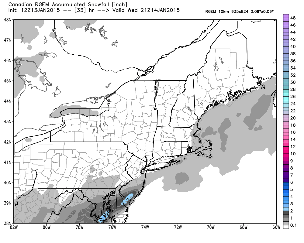
The longer-range Canadian first showed this possible solution when it came out late Sunday night. That’s why I included the possibility in my Monday-Friday Outlook. It’s now showing on short-range model guidance which greatly increases the likelihood of it happening. This is the shorter range Canadian RGEM showing estimated snowfall through Wednesday afternoon. This model starts precipitation between 7AM and 10AM Wednesday morning.
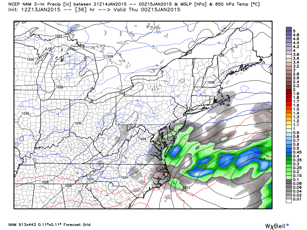
Next up is the American NAM short range model showing 850mb pressure, temperature and precipitation between 1PM and 4PM on Wednesday. Notice the line of freezing is all the way to the coast. Also, keep in mind this is only a 3-hour model slide. Light snow is also modeled on this model to begin between 7AM-10AM.
In English: SNJ, especially SENJ, should expect a light snow event starting tomorrow morning and ending by afternoon. I would say a coating to a couple of inches is the most likely scenario (jackpot zone should be extreme SENJ). I’ll be live-casting in case there are any surprises. With most of this snowfall happening to the S and SE of major network markets, assume it will be downplayed and neglected. Not here! Be safe! JC
Jonathan Carr (JC) is the founder and sole operator of Weather NJ, New Jersey’s largest independent weather reporting agency. Since 2010, Jonathan has provided weather safety discussion and forecasting services for New Jersey and surrounding areas through the web and social media. Originally branded as Severe NJ Weather (before 2014), Weather NJ is proud to bring you accurate and responsible forecast discussion ahead of high-stakes weather scenarios that impact this great garden state of ours. All Weather. All New Jersey.™ Be safe! JC


