

Jan 14: Early Thoughts on Weekend Snow
Discussion: Our weekend winter storm system has trended warmer since yesterday. The main reason? The upper-level low associated with the trough that will be swinging in is now modeled stronger. This propagates down to the surface by intensifying the primary surface low that will initially track near the Great Lakes. A stronger surface low means more of a northward surge of warm air from the S ahead of it. This has therefore come across in the model guidance as a quicker transition to rain especially for E CNJ and SENJ.
W CNJ and NNJ are still looking at plowable snow. From this range right now I’d say areas N of I-78/NW of I-287 have the best chance for plowable snowfall. Areas along I-95 (NJTP) are now showing as barely plowable. Areas SE of I-95, especially SENJ, are looking at a very quick switch to rain after a quick initial snow burst.
There are a lot of components involved here. The overrunning precipitation is what will bring us the snow. This precip will encounter dry air at first which means virga (precip that evaporates before hitting the surface). The low placement to our N and W is not ideal for cold surface conditions. The low-mid levels should advect with warmth more aggressively if today’s guidance (stronger low) is true. We also have to allow for typical variance in model guidance from this range (mid-range). Models like to swing back and forth (cold to warm and warm to cold) as associated storm energy moves over more or less-abundant regions of weather sensors. For this reason there will likely still not be a snow map tomorrow but rather Thursday.
I would like to remind everyone that this weekend system is only just ushering in a prolonged/sustained pattern of cold with several more winter storm signals showing once the cold settles throughout the E US specifically the Mid-Atlantic US. It’s going to be cold with snow chances throughout the rest of January and well into February. For now here is a probabilities-based expectation for this weekend. I wouldn’t take it as gospel yet as it’s only Tuesday. Tomorrow’s another day and we’ll report accordingly.
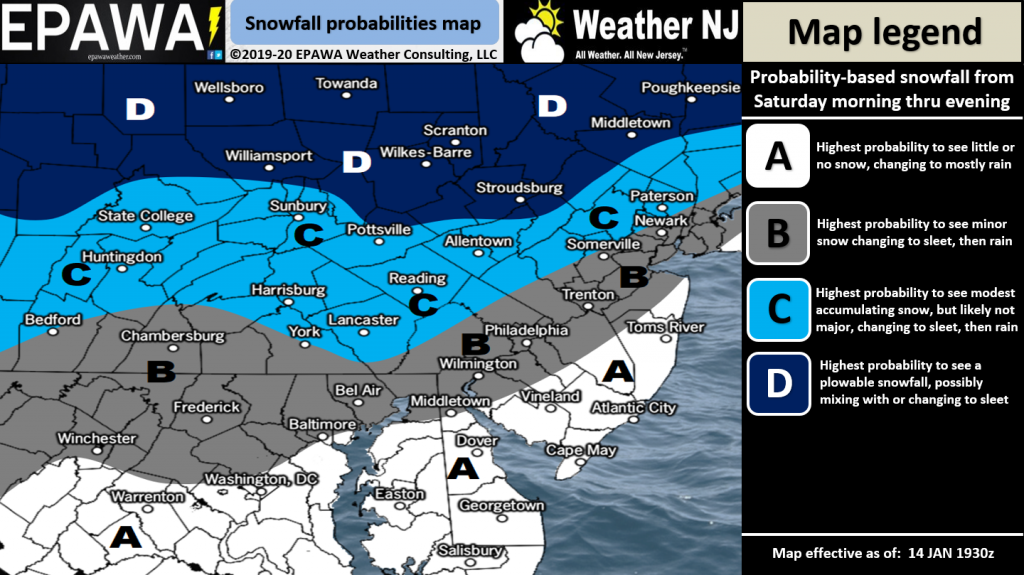
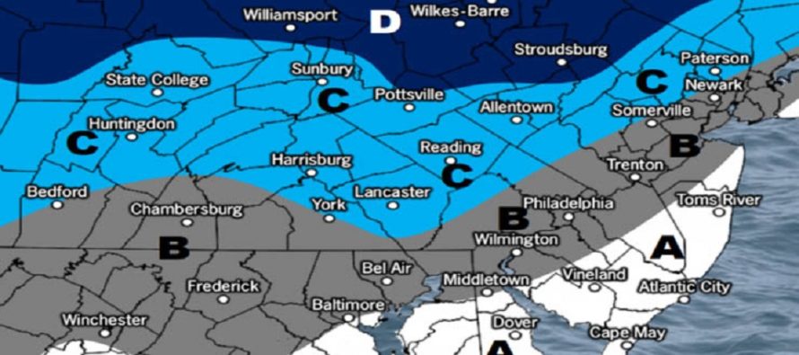
Click here to view full-resolution snow map!
In English: The weekend storm has trended warmer since yesterday on last night’s and this morning’s model guidance but is still showing a decent event for at least NWNJ (N of I-78/NW of I-287) possibly lower areas in SWNJ, WCNJ and NENJ (along I-95). The latest 18Z GFS actually just came in minutes ago colder again which would bring I-95 back into plowable snow. This is starting to not look like ECNJ and SENJ’s winter storm however. The above probabilities map might be a little warm. We’ll see. Expect model mayhem to continue before we can observe properly sampled live data (by Thursday morning). Daily articles will continue so long as there is plowable snow expected in any part of New Jersey. Exact predicted amounts will come with Thursday’s snow map. Have a great night and please be safe! JC
Download the new free Weather NJ mobile app on Apple and/or Android. It’s the easiest way to never miss Weather NJ content. Our premium services go even further above and beyond at the hyper-local level. Looking for industrial-caliber long-range forecasting data that I personally recommend? Check out WeatherTrends360! Visit the Weather NJ Kaboom Shop for hoodies, tees and infant onesies.
Jonathan Carr (JC) is the founder and sole operator of Weather NJ, New Jersey’s largest independent weather reporting agency. Since 2010, Jonathan has provided weather safety discussion and forecasting services for New Jersey and surrounding areas through the web and social media. Originally branded as Severe NJ Weather (before 2014), Weather NJ is proud to bring you accurate and responsible forecast discussion ahead of high-stakes weather scenarios that impact this great garden state of ours. All Weather. All New Jersey.™ Be safe! JC


LOCAL FORECAST | INTERACTIVE RADAR | LATEST NJ WEATHER ALERTS | WEDDING FORECAST| PRIVACY POLICY
© Copyright 2026 Weather NJ LLC. All Rights Reserved.
Some information that can be found on our website is provided by a private weather station and is not an officially recognized station for weather reporting. Though we always strive to achieve accurate reporting for our own use, it is important that you do NOT depend on the data provided here for any purpose.
