

Jan 15: Coastal Storm Approaching!
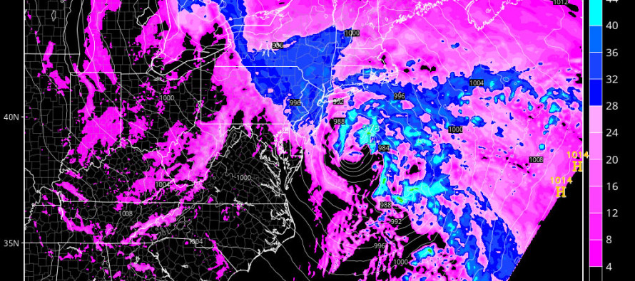
A powerful coastal storm will track from OBX to the benchmark tonight through tomorrow morning. The latest short-range model guidance (4k NAM + RGEM) suggest a low pressure intensity of ~990mb when it ejects over OBX and a sub-980mb intensity when passing just SE of the benchmark (40N/-70W). The good news is that this system will be passing relatively quickly (between tonight and tomorrow morning). But for that short period of time (let’s call it between 9PM tonight and 9AM tomorrow with heaviest period of midnight-6AM), precipitation could be heavy and winds could be gusty. Here’s a few frames off of the latest high-res NAM to support:
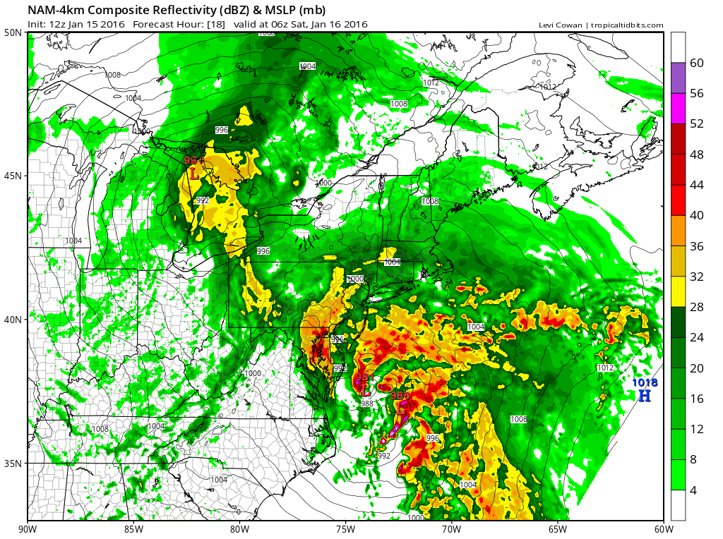
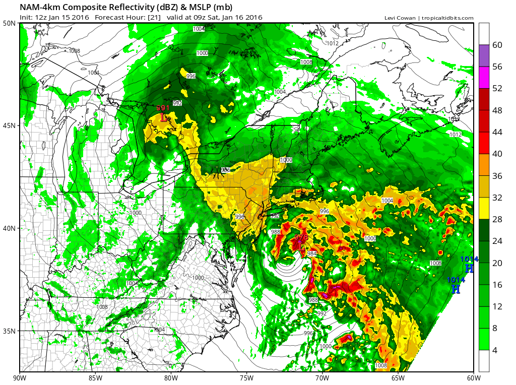
As the coastal low moves from our southern side to our eastern side, cyclonic (counter-clockwise) winds will shift accordingly around the low. Therefore onshore easterly winds should pick up at first, advecting warm and moist marine air across most of our region. When the coastal gets to our dead-east, winds should then change to a northerly flow which will try to bring colder air back into our environment. Most model guidance suggests a temperature profile mostly non-supportive for ice or snow. I have a hard time believing this given the low’s strength so just in case…use a little extra caution overnight just in cast temps crash faster (wildcard scenario) than precipitation is pulling out. This would be much more of a concern for NNJ/NWNJ (especially elevations) rather than CNJ and especially SNJ.
As far as precipitation goes, I do expect a few periods of heavy rainfall. Given the short duration of the storm’s impact, I think half an inch to two inches is a good expectation, all between 9PM tonight and 9AM tomorrow.

As far as wind goes, this is a very hard prediction to make given the proximity of another low to our NW. If there were only this coastal low then I’d be going with gale-force gusts first out of the E/SE and ending out of the N. The NW low however might disrupt the wind field but by how much is uncertain. With that said expect winds to be anything from breezy to gusty and again, rocking in direction from E/SE to N over the course of the system’s passage.
Coastal flooding shouldn’t be too much of a problem given the short duration of onshore flow. With that said, only minor coastal flooding is possible for barrier islands and bays, especially during high tide.
In English: A coastal storm should bring a period of moderate-to-heavy rain and possibly gusty winds between later this evening and tomorrow morning. The meat and potatoes of the storm will likely occur between midnight and 6AM. SENJ should feel the strongest coastal impact (winds off ocean and minor flooding) while NWNJ could possibly end colder than expected (rain changing to ice/snow). Tomorrow afternoon through Sunday afternoon we should dry out with W/NW flow before temperatures take a dive into Monday. Please be safe! JC
Model images from Tropical Tidbits
Jonathan Carr (JC) is the founder and sole operator of Weather NJ, New Jersey’s largest independent weather reporting agency. Since 2010, Jonathan has provided weather safety discussion and forecasting services for New Jersey and surrounding areas through the web and social media. Originally branded as Severe NJ Weather (before 2014), Weather NJ is proud to bring you accurate and responsible forecast discussion ahead of high-stakes weather scenarios that impact this great garden state of ours. All Weather. All New Jersey.™ Be safe! JC


LOCAL FORECAST | INTERACTIVE RADAR | LATEST NJ WEATHER ALERTS | WEDDING FORECAST| PRIVACY POLICY
© Copyright 2026 Weather NJ LLC. All Rights Reserved.
Some information that can be found on our website is provided by a private weather station and is not an officially recognized station for weather reporting. Though we always strive to achieve accurate reporting for our own use, it is important that you do NOT depend on the data provided here for any purpose.
