

Jan 17: Winter Storm Update
Discussion: I’m feeling a little better today but my wife and daughter
are in the worst stage of the flu. I’m about 2 days ahead of them regarding
symptoms and timing. Thank you so much for your thoughtful expressions and well
wishes yesterday! They mean a lot and we are grateful for such an awesome
following of people. Onto Saturday’s storm system…
Our low pressure system of interest has formed over Wyoming and will now track eastward
over the southern Great Lakes. As it does so it will encounter a strong area of
high pressure, also moving eastward, over SE Canada. The low has already
produced a precipitation shield currently over the Midwest US.
The strong Canadian high is what brought the current cold air. Today’s high temperatures failed to rise above freezing in many areas. All of NJ will dip well-below freezing overnight tonight. This sets the stage for instant snow stickage when precipitation begins on Saturday. The strong high comes with a double-edged sword however. It has dried the air (very low dew points/humidity). This could lead to initial virga as precipitation needs time to saturate the lower-levels. Until that saturation, precipitation will evaporate before hitting the ground.
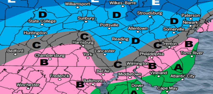
By late-morning tomorrow moisture should jump the warm-front and fall on NJ as overrunning precipitation. SENJ will be the quickest to change to rain thanks to flow alignment over marine air mass. SWNJ and ECNJ will changeover next as the warm front advances, possibly with a short period of sleet between. WCNJ and extreme NENJ (close to NYC) will be third to changeover to rain but with a longer period of sleet between. The rest of NNJ (we’ll call it N of I-78 and NW of I-95) will be last to change over to sleet but might not change all the way to rain. This area, especially the higher elevations of NWNJ, is most favored for wintry impact as our following map indicates:
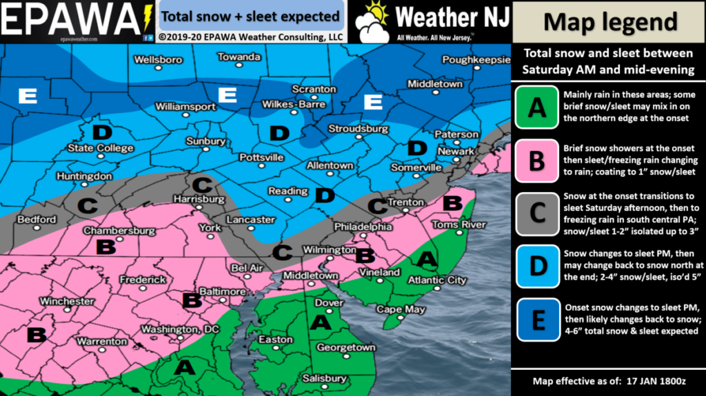
Click here to view full resolution snow map!
Wildcards: If there is more initial dry air than expected and/or Warm Air Advection (WAA) is more aggressive between the 700-850mb layers then wintry accumulations will be on the lower end of our map’s expectations, possibly even below the lowest range. If the strong high puts up an Arctic wall of cold air in the 925-700mb layers then wintry accumulations will be on the higher end of our map’s expectations, possibly even above the highest range. These wildcards can only be called last-minute/in real-time and this is what makes meteorology an inexact science. The only thing we forecasters can do is present you with the full range of possibilities so you can best prepare for the worst and hope for the best…in the interest of safety awareness.
In English: After a cold Friday night into Saturday morning, much of New Jersey should start out as snow by ~noon Saturday. Snow should change first to sleet and then to rain from S to N by Saturday afternoon/early-evening. Parts of NNJ, especially NWNJ elevations, will be last to change over and maybe not at all. For these reasons NNJ/NWNJ are favored for the wintriest impact as our above map illustrates. Keep in mind that snow and sleet are both counted in expected accumulations. The above wildcards indicate what could go wrong with this forecast. Precipitation should taper off by late-Saturday evening. Everyone have a great night and please be safe! JC
Download the new free Weather NJ mobile app on Apple and/or Android. It’s the easiest way to never miss Weather NJ content. Our premium services go even further above and beyond at the hyper-local level. Looking for industrial-caliber long-range forecasting data that I personally recommend? Check out WeatherTrends360! Visit the Weather NJ Kaboom Shop for hoodies, tees and infant onesies.
Jonathan Carr (JC) is the founder and sole operator of Weather NJ, New Jersey’s largest independent weather reporting agency. Since 2010, Jonathan has provided weather safety discussion and forecasting services for New Jersey and surrounding areas through the web and social media. Originally branded as Severe NJ Weather (before 2014), Weather NJ is proud to bring you accurate and responsible forecast discussion ahead of high-stakes weather scenarios that impact this great garden state of ours. All Weather. All New Jersey.™ Be safe! JC


LOCAL FORECAST | INTERACTIVE RADAR | LATEST NJ WEATHER ALERTS | WEDDING FORECAST| PRIVACY POLICY
© Copyright 2026 Weather NJ LLC. All Rights Reserved.
Some information that can be found on our website is provided by a private weather station and is not an officially recognized station for weather reporting. Though we always strive to achieve accurate reporting for our own use, it is important that you do NOT depend on the data provided here for any purpose.
