

Jan 21: Weekend Snow Storm a GO!
Model guidance continues to advertise a major coastal low pressure system in the ideal “Benchmark 40N/70W” track/location this weekend. This would mean significant to major snowfall throughout most of New Jersey and surrounding big cities this Saturday. Let’s go right to the latest guidance:
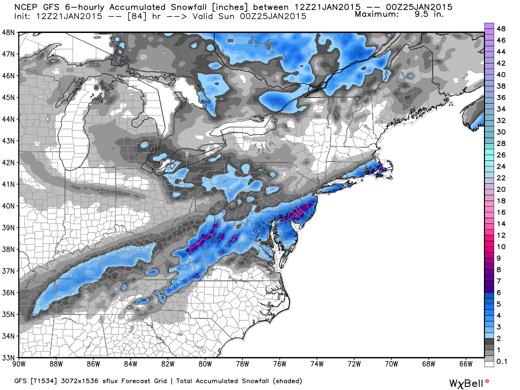
The 12Z GFS is the furthest SE with track and snowfall but still achieves significant amounts from the I-95 corridor to the coast:
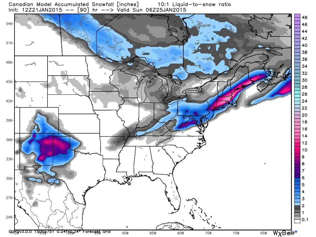
The 12Z Canadian is a bit NW of the GFS with significant accumulations in SNJ and heavy accumulations in NNJ:
The 12Z European delivers the most crushing snow map (from DC to Boston) with 6-12″ throughout most of New Jersey. There’s a decent chance of localized 12″+ amounts along/just NW of the I-95 corridor should the 12Z European verify.
In English: The snow storm for Saturday is a go. Timing is still uncertain but right now it looks like a Saturday morning-evening event that maybe spills into early Sunday. Anything from significant to heavy accumulations are possible. My first snow map will be posted tomorrow evening but you should start making preparations for this event to happen. Be safe! JC

Jonathan Carr (JC) is the founder and sole operator of Weather NJ, New Jersey’s largest independent weather reporting agency. Since 2010, Jonathan has provided weather safety discussion and forecasting services for New Jersey and surrounding areas through the web and social media. Originally branded as Severe NJ Weather (before 2014), Weather NJ is proud to bring you accurate and responsible forecast discussion ahead of high-stakes weather scenarios that impact this great garden state of ours. All Weather. All New Jersey.™ Be safe! JC


LOCAL FORECAST | INTERACTIVE RADAR | LATEST NJ WEATHER ALERTS | WEDDING FORECAST| PRIVACY POLICY
© Copyright 2026 Weather NJ LLC. All Rights Reserved.
Some information that can be found on our website is provided by a private weather station and is not an officially recognized station for weather reporting. Though we always strive to achieve accurate reporting for our own use, it is important that you do NOT depend on the data provided here for any purpose.
