

Jan 22: Watching Monday for Snow
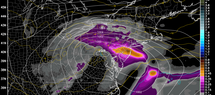
Regardless of how the snow/rain line plays out tomorrow night through Saturday, the associated low will be powerful. Guidance is unanimous on a sub 980mb low once it begins impacting New England on Saturday night-Sunday. This will pull very cold air into the region behind it and set the stage for a northern stream clipper-transfer much stronger than we’ve had in a while. Whether or not it’s cold enough will not be an issue with this storm. There is no threat of rain. The line of freezing will be well to the S/SE of coastal New Jersey. Here’s what the latest GFS has to say which is in close agreement with other guidance:
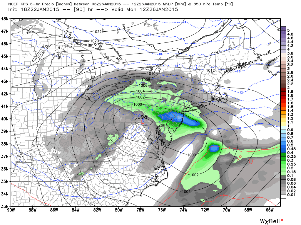
Monday morning (1AM to 7AM):
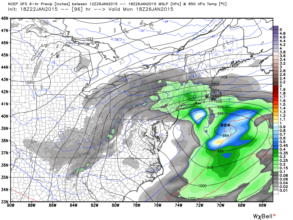
Monday morning-afternoon (7AM to 1PM):
Given recent model accuracy, I’m going to approach this event with extreme caution and skepticism. Longer-range models have cried wolf a few times now this year where substantial snow events have fizzled in short-range guidance. The only reason I’m mentioning this system now is to help aggregate safety awareness for a potential travel-impact Monday morning. I’ll continue to monitor.
In English: After the Saturday storm moves out, another storm will move in from Canada Sunday night into Monday with very cold air. No rain is expected only snow but exact details will have to be ironed out mid-weekend. Be safe! JC

Jonathan Carr (JC) is the founder and sole operator of Weather NJ, New Jersey’s largest independent weather reporting agency. Since 2010, Jonathan has provided weather safety discussion and forecasting services for New Jersey and surrounding areas through the web and social media. Originally branded as Severe NJ Weather (before 2014), Weather NJ is proud to bring you accurate and responsible forecast discussion ahead of high-stakes weather scenarios that impact this great garden state of ours. All Weather. All New Jersey.™ Be safe! JC


LOCAL FORECAST | INTERACTIVE RADAR | LATEST NJ WEATHER ALERTS | WEDDING FORECAST| PRIVACY POLICY
© Copyright 2026 Weather NJ LLC. All Rights Reserved.
Some information that can be found on our website is provided by a private weather station and is not an officially recognized station for weather reporting. Though we always strive to achieve accurate reporting for our own use, it is important that you do NOT depend on the data provided here for any purpose.
