

Jan 24: Snow Storm Detected!
Up until today, models have been advertising another clipper for Monday with just light accumulations from a few passing showers. Today’s guidance has trended towards a possible major snow storm in the Sunday night-Tuesday time-frame. Here’s the details…
First, I’d like to thank you for your patience given all the weather model developments today. I literally just finished packing a 26′ Uhaul in Maryland (with 12 foot trailer attached). Tomorrow I come home to the state I grew up in and love! Let’s dive in.
The main idea behind this next winter event is a clipper that dives in from the NW and then bombs out near the benchmark. When I say bomb out I’m referring to a meteorological term called bombogenesis: a 24mb drop in pressure within a 24-hour period. When this happens in just the right location (near the benchmark), explosive snow is possible for the mid-Atlantic and Northeast US.
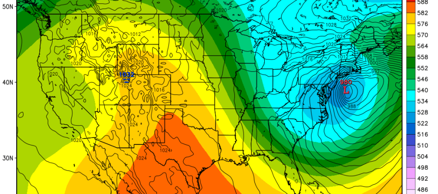
Right now the European model and most of its ensemble members indicate a storm that could drop well over 12 inches of snow throughout most of New Jersey. Let’s tread lightly though. Not all guidance is on board with such an aggressive solution:
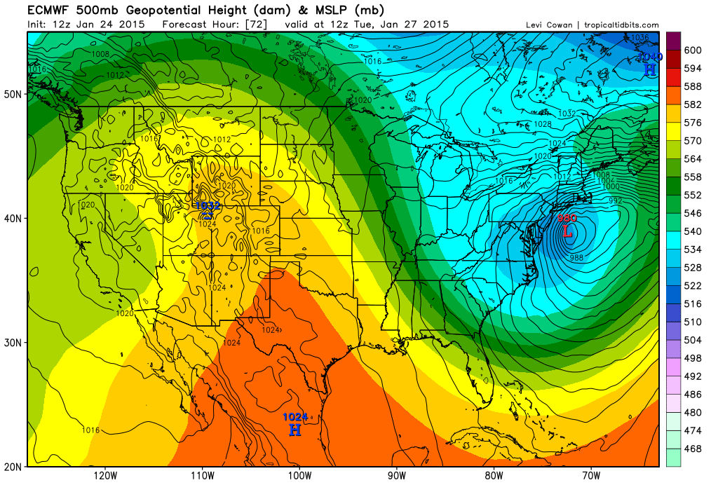
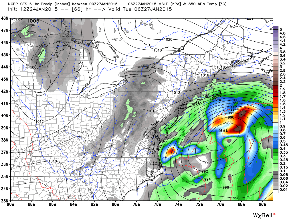
Here’s the GFS showing the same idea (clipper-bomb out) but with less snowfall across the state (maybe only a significant event):
Here’s the Candian:
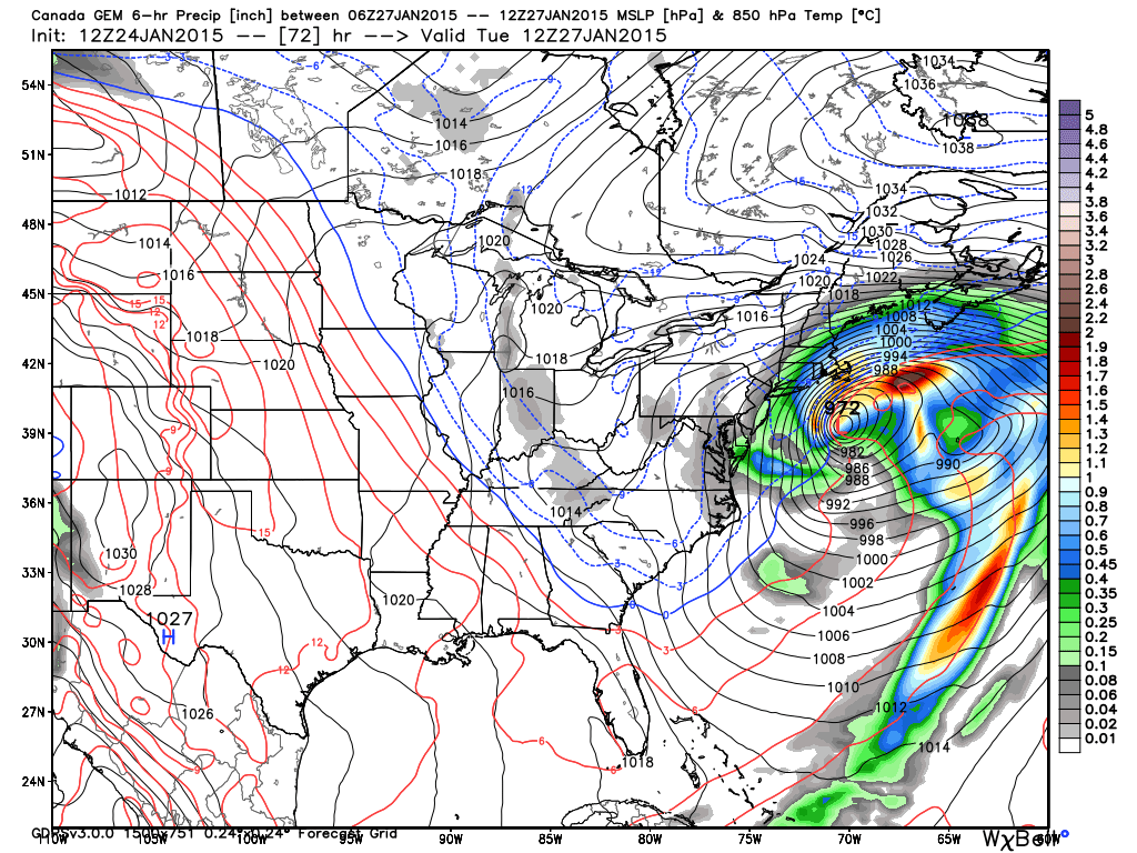
As you can see, both of these models bomb out the storm but only clip coastal New Jersey with significant snowfall amounts. I’m not saying this isn’t going to happen. I’m just approaching cautiously given recent model performance. I definitely sense a strong winter snow storm brewing but I’m skeptical of the 12-24 inch snowfall amounts being shown by the Euro. We have two more HUGE model suites to analyze…tonight’s 00Z and tomorrow’s 12Z. By tomorrow afternoon we should have a better idea whether this will be just another significant snowfall or the bomb-diggity “K” word. One thing is for sure…it will be cold enough. Patience…
In English: The entire state of New Jersey should prepare for anything from significant to major snowfall in the late-Sunday night to Tuesday time-frame. I’ll be following very closely. Given how close we are due to sudden guidance there will be one snow map only posted tomorrow evening. Be safe! JC

Jonathan Carr (JC) is the founder and sole operator of Weather NJ, New Jersey’s largest independent weather reporting agency. Since 2010, Jonathan has provided weather safety discussion and forecasting services for New Jersey and surrounding areas through the web and social media. Originally branded as Severe NJ Weather (before 2014), Weather NJ is proud to bring you accurate and responsible forecast discussion ahead of high-stakes weather scenarios that impact this great garden state of ours. All Weather. All New Jersey.™ Be safe! JC


LOCAL FORECAST | INTERACTIVE RADAR | LATEST NJ WEATHER ALERTS | WEDDING FORECAST| PRIVACY POLICY
© Copyright 2026 Weather NJ LLC. All Rights Reserved.
Some information that can be found on our website is provided by a private weather station and is not an officially recognized station for weather reporting. Though we always strive to achieve accurate reporting for our own use, it is important that you do NOT depend on the data provided here for any purpose.
