

Jan 24: Snow Update
Discussion: This map and discussion might seem unnecessary for a minor snow event. But there will be multiple forms of wintry precipitation capable of impacting travel and safety this Monday night through most of Tuesday. With that said, let’s focus on the first system.
We’ll get pretty cold again tonight but temperatures will climb above freezing on Monday. Most spots should just reach about 40 on Monday with dry conditions before temperatures fall back below freezing shortly after sunset. Precipitation should then approach from the SW around late Monday night/early Tuesday morning. It will be just ahead and along of an advancing warm front.
At least a light thump of initial snow is expected for extreme SWNJ and possibly areas further to the N and E in SNJ. There will likely be a battle between moisture trying to saturate the column and dry air over places like Burlington and Ocean Counties. For this reason we expect a sharp cutoff for this first piece of precipitation. This would be from midnight until sunrise Tuesday morning. Snow would then change over to rain from S to N (as the warm front advances) and present a sleet and/or freezing rain surface scenario for interior CNJ/SNJ during the mid-to-late morning hours. By about noon and for the rest of Tuesday, most of SNJ (along and S of I-195) should see periods of light rain. The warm front should reach its northernmost extent at that point.
For areas N of I-195, you really do not see much of anything until Tuesday PM hours (starting around noon) when the precipitation shield moves in and spreads through the rest of NNJ. But anything that does fall Tuesday PM, possibly into Wednesday AM, will likely be in the form of snow and should accumulate on untreated surfaces. Through mid-Wednesday morning we expect periods of light snow adding up to a general 1-3/2-4 as you head N through NNJ from I-195. Conditions should improve for Wednesday daytime hours before temperatures fall back below freezing for all of NJ Wednesday night. The front that came in as a warm will be pushed well to our S as a cold front behind the departing weak wave. This leads us into whatever Thursday is going to do. The two systems are technically separate (the first wave Tuesday-Wednesday AM and the coastal Thursday). But it’s possible that strands of precipitation connect them in transition through parts of NJ during the day Wednesday. Here is our wintry impact map for the first event (late Monday PM through early Wednesday AM):
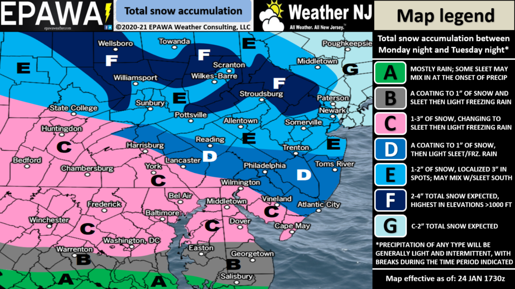
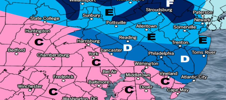
Full resolution wintry impact map.
Right now, Wednesday overnight into Thursday daytime looks cold enough to support snow statewide. A low will be transferring through well to the S of NJ and will eject into the Atlantic Ocean near OBX. Most model guidance is bombing the low out (from ~1000mb down to sub-980mb) just off OBX during a phase. This would happen between early Thursday morning and Thursday afternoon. In theory this should produce a strong snow storm for at least SENJ, possibly all of SNJ and CNJ. But the system is moving fast W to E to allow the precip shield to extend further N into a drier environment. I think we’re in for some wild model run swings with the Thursday system over the next few days as models process what happens with the first weak wave on Tuesday. There are a lot of moving components with the timing of the phase on a quick track. The first system will lower height fields along the east coast in its wake (back-side cyclonic flow). The second system’s track will want to steer with these height lines. Therefore, the weaker the first system, the further N the second system can come. The stronger the first system, the further S the second system will pass. As it currently stands, the S Mid-Atlantic US is currently the modeled jackpot. Almost every system has trended N/NW in track this season. It wouldn’t take much to bring all of NJ into the game. Given the extreme uncertainty in short-to-mid range model data, it’s best to take more time. Just know that a weak wave is happening Tuesday with a potential coastal snow storm Thursday.
In English: Monday looks uneventful, cold, and dry. Highs make it to about 40 before dropping below freezing overnight into Tuesday. For Tuesday, let’s cut NJ in half at I-195:
N of I-195: Likely all light snow from ~noon on Tuesday until sunrise Wednesday morning. Isolated pockets of heavier snow are possible but looks widespread overall. Elevations should behave the coldest and snowiest as our snow map reflects.
S of I-195: Snow likely to start early Tuesday AM for extreme SWNJ (zone C) and possibly further into SNJ (zone D). A few inches of snow possible (especially for zone C) before everyone S of I-195 eventually changes to rain by 9AM Tuesday. Sleet and freezing rain are possible during the changeover that will occur from S to N mid-to-late Tuesday morning. Periods of light rain are then expected for the rest of Tuesday. If there’s any precipitation left over SNJ by pre-dawn Wednesday AM, it might go back to snow for at least interior CNJ/SNJ but nothing worthy of accumulation concern.
A coastal winter storm is then expected to bring at least light snow to SENJ on Thursday. If that trends N, it would bring more of NJ into a bigger snow game. For now, SNJ is more favored for snow on Thursday than NNJ. The first system affects the second so more time is needed to generate a forecast.
Download the free Weather NJ mobile app on Apple or Android. It’s the easiest way to never miss Weather NJ content. Our premium services go even further above and beyond at the hyper-local level. Get your merch on at the KABOOM shop in time for the holidays.
Jonathan Carr (JC) is the founder and sole operator of Weather NJ, New Jersey’s largest independent weather reporting agency. Since 2010, Jonathan has provided weather safety discussion and forecasting services for New Jersey and surrounding areas through the web and social media. Originally branded as Severe NJ Weather (before 2014), Weather NJ is proud to bring you accurate and responsible forecast discussion ahead of high-stakes weather scenarios that impact this great garden state of ours. All Weather. All New Jersey.™ Be safe! JC


LOCAL FORECAST | INTERACTIVE RADAR | LATEST NJ WEATHER ALERTS | WEDDING FORECAST| PRIVACY POLICY
© Copyright 2026 Weather NJ LLC. All Rights Reserved.
Some information that can be found on our website is provided by a private weather station and is not an officially recognized station for weather reporting. Though we always strive to achieve accurate reporting for our own use, it is important that you do NOT depend on the data provided here for any purpose.
