

Jan 29: Snow Storm Detected!
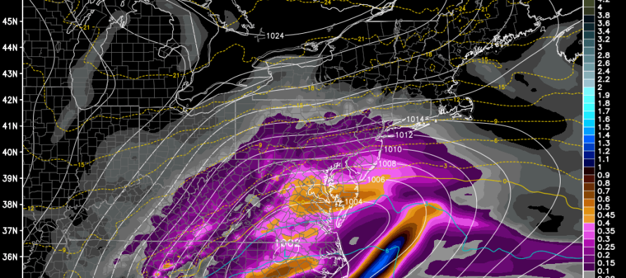
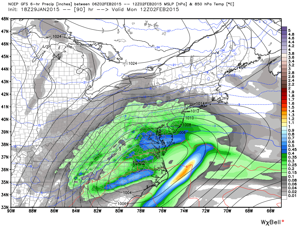
Model guidance is in pretty strong agreement that a snow storm will impact New Jersey in the Sunday evening-Monday evening time period. With this system an overall weak low pressure disturbance will pass to the south of NJ…somewhere near the Virginia/North Carolina border. The northern side of the low’s precipitation shield should bring significant snowfall throughout the region. Let’s look at the supporting guidance, specifically 850 temp, pressure, and precip maps:
18Z GFS (1AM-7AM Monday):
12Z Canadian GEM (7AM-1PM Monday):
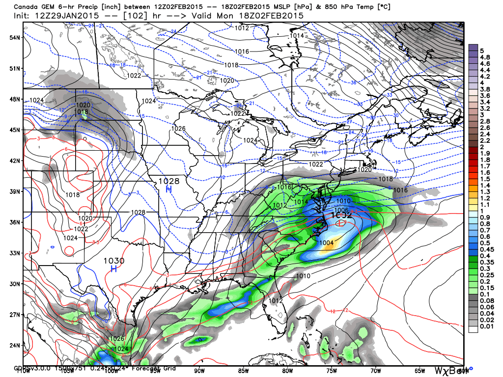
The 12Z Euro is almost a carbon copy of the 18Z GFS. The Canadian is a little slower and further south but still brings significant snowfall to at lease CNJ and SNJ. This is pretty decent model guidance agreement so at this point we should prepare for widespread significant snowfall accumulations.
In English: Snow should begin on Sunday evening sometime during or just after the big game. It should snow overnight and well into Monday. I’ll release a first call snow map tomorrow night but as of right now, widespread 4-8/6-10 inch snowfall accumulations are likely when everything clears out by Monday evening. Current model guidance favors SNJ over NNJ but let’s see how that evolves over the weekend. Be safe! JC
Model images used with permission from WeatherBell Analytics.

Jonathan Carr (JC) is the founder and sole operator of Weather NJ, New Jersey’s largest independent weather reporting agency. Since 2010, Jonathan has provided weather safety discussion and forecasting services for New Jersey and surrounding areas through the web and social media. Originally branded as Severe NJ Weather (before 2014), Weather NJ is proud to bring you accurate and responsible forecast discussion ahead of high-stakes weather scenarios that impact this great garden state of ours. All Weather. All New Jersey.™ Be safe! JC


LOCAL FORECAST | INTERACTIVE RADAR | LATEST NJ WEATHER ALERTS | WEDDING FORECAST| PRIVACY POLICY
© Copyright 2026 Weather NJ LLC. All Rights Reserved.
Some information that can be found on our website is provided by a private weather station and is not an officially recognized station for weather reporting. Though we always strive to achieve accurate reporting for our own use, it is important that you do NOT depend on the data provided here for any purpose.
