

Jan 6: Arctic Cold Air Approaching!
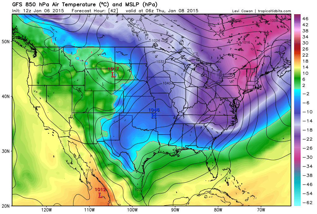
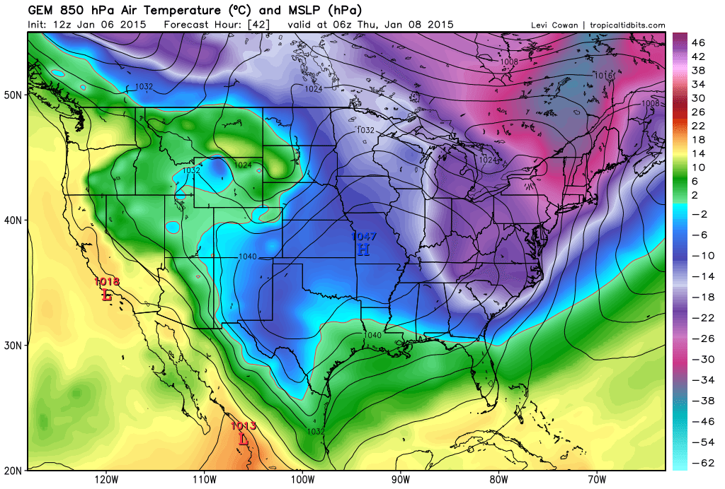
Now that the clipper has moved through, very cold Arctic air will move in behind and keep temperatures well below-average starting tonight and heading into the weekend. The coldest moment of this Arctic wave appears to be early Thursday AM when surface temperatures will dip into the single digits and threaten the below-zero mark. The main driver of these temperatures will be a strong Arctic high pressure system that will dive into the central US from Canada and pass well to our south into the Atlantic Ocean. This high will hurl bitter-cold air-mass southward along it’s eastern side (anti-cyclonic flow). Let’s look at some supporting guidance at the 850mb level (~5,000 feet altitude).
First is the 12Z American GFS showing temperatures (in degrees Celsius) at 1AM Thursday AM:
Next up is the 12Z Canadian GEM also showing temperatures (in degrees Celsius) at 1AM Thursday AM:
Last but not least is the 12Z European ECMWF showing temperatures (in degrees Celsius) at 7AM Thursday AM:
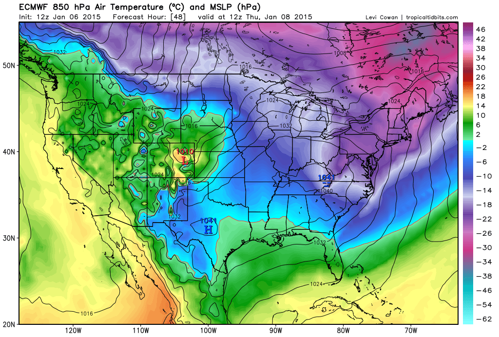
In English: Most model guidance is supporting a very cold period that starts tonight and lasts into at least Friday with the coldest moment occurring Thursday morning. During this period, expect daytime high temperatures to fail to escape the 20s with overnight lows dipping into single digits/teens. There’s a small chance some interior/elevated areas dip below zero but we’ll see. Lake effect snow showers are possible over the next few days with such strong NW flow over the Great Lakes…just passing snow showers though nothing crazy. I’ve been tracking a potential snow storm in the January 13-14 period for a few model runs now. Will report more as we approach.
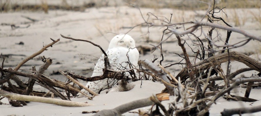
Snowy Owl image credit: Donna Ortuso. While I acknowledge that the Snowy Owls are here primarily for hunting and are not indicators of a cold winter overall—the correlation between their increased social media photo presence and Arctic fronts that follow 5-10 days later cannot be ignored. With that said, they are some of my best forecasters of Arctic air mass invasions in the mid-range 8) Be safe! JC

Jonathan Carr (JC) is the founder and sole operator of Weather NJ, New Jersey’s largest independent weather reporting agency. Since 2010, Jonathan has provided weather safety discussion and forecasting services for New Jersey and surrounding areas through the web and social media. Originally branded as Severe NJ Weather (before 2014), Weather NJ is proud to bring you accurate and responsible forecast discussion ahead of high-stakes weather scenarios that impact this great garden state of ours. All Weather. All New Jersey.™ Be safe! JC


LOCAL FORECAST | INTERACTIVE RADAR | LATEST NJ WEATHER ALERTS | WEDDING FORECAST| PRIVACY POLICY
© Copyright 2026 Weather NJ LLC. All Rights Reserved.
Some information that can be found on our website is provided by a private weather station and is not an officially recognized station for weather reporting. Though we always strive to achieve accurate reporting for our own use, it is important that you do NOT depend on the data provided here for any purpose.
