

Jan 8: Clipper Approaching and Update on Next Week
Another clipper is approaching and next week’s winter storm possibility is still on the table. Let go right into detail.
Current radar observations indicate snow showers and squalls moving through Ohio and approaching western PA. That puts it on the doorstep of western NJ in the pre-sunset hours tomorrow morning. This is another light event where anything from a coating to a few inches is possible. It just happens to be falling during rush hour which all but guarantees morning traffic nuisances. I think NNJ has the best chance and SNJ the worst since the clipper will be passing to our north. The only reason snow is possible for us is because the Great Lakes will enhance the squalls once they are over PA.
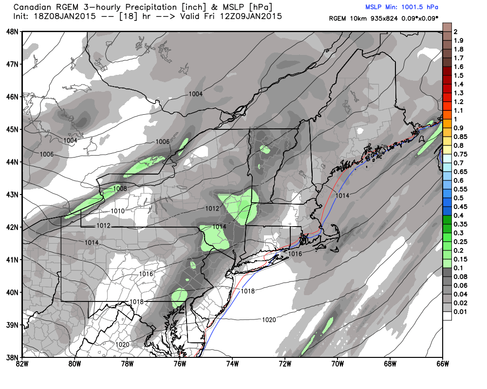
In my experience, the Canadian does a great job on Arctic/polar events such as clippers, lake effect snow, and PV-influenced disturbances. With that said, lets look at the short-range Canadian RGEM for two specific time frames. First is for precipitation falling between 4AM and 7AM tomorrow morning. Notice the precipitation is already into NWNJ and even parts of SWNJ. Remember, we are dealing with higher snow ratios so a tenth of an inch of liquid could possibly equal 2 inches of snow if not slightly more.
Next, lets look at the same model but for precipitation falling between 7AM and 10AM. Notice the main squall area has moved over the I-95 corridor?
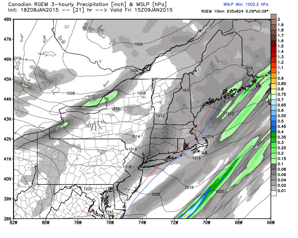
Again, this isn’t a big deal. It’s most likely a coating in SNJ and up to a few inches in NNJ. CNJ could go either way. It should clear by noon with minimal impact once roads are treated. Now let’s look at next week.
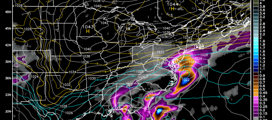
Models seem to be agreeing on an overrunning system in the Tuesday-Wednesday window. We’re going to have some pretty strong high pressure to our north and west. Unanimous model guidance puts it at 1042mb or higher. That should literally create a wall of cold that should set up anywhere between DC<->Cape May and Lehigh Valley<->NYC. A weak low pressure system will be transporting moisture from the south into the wall of cold which could result in all forms of wintry precipitation. It all depends on where that wall ultimately sets up. Given the strength of the high and the weakness of the low, I’m currently thinking it will be further SE than modeled. Speaking of, here’s the 12Z Canadian for next Tuesday evening. As modeled, it would be a snow to rain to snow situation for New Jersey. This is the first potential for next week.
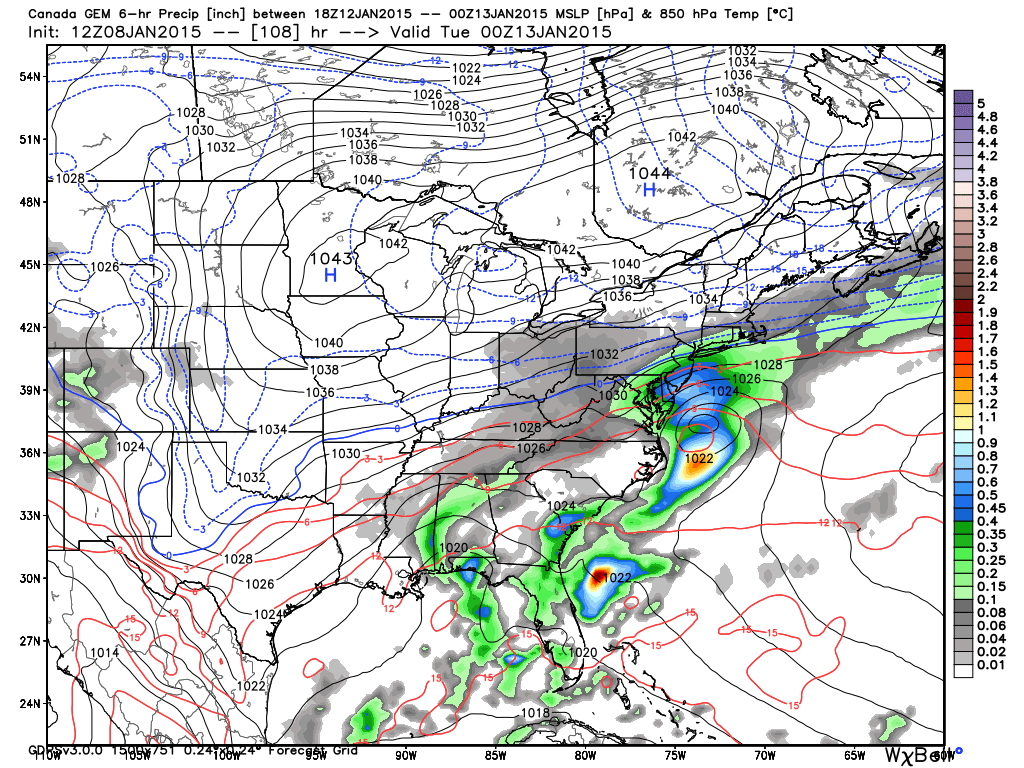
The next system is on the table for Thursday, January 15th. The Canadian goes on to bring snow for the entire state of New Jersey. The GFS is SE and out to sea. The European splits the difference but still brings decent snow to the state. I’m going to stay focused on the Tuesday system for now while the Thursday system evolves a little bit further.
In English: A period of light snow is possible tomorrow morning from sunrise through late-morning. Expect anything from just a coating in SNJ to a few inches in NNJ. Two systems are sorting themselves out next week, both featuring wintry precipitation—one arriving Tuesday and the other on Thursday. At this point the best consensus on the models is that something is going to happen in that time frame. I’ll have more for you tomorrow. Be safe and stay warm! JC
Jonathan Carr (JC) is the founder and sole operator of Weather NJ, New Jersey’s largest independent weather reporting agency. Since 2010, Jonathan has provided weather safety discussion and forecasting services for New Jersey and surrounding areas through the web and social media. Originally branded as Severe NJ Weather (before 2014), Weather NJ is proud to bring you accurate and responsible forecast discussion ahead of high-stakes weather scenarios that impact this great garden state of ours. All Weather. All New Jersey.™ Be safe! JC


LOCAL FORECAST | INTERACTIVE RADAR | LATEST NJ WEATHER ALERTS | WEDDING FORECAST| PRIVACY POLICY
© Copyright 2026 Weather NJ LLC. All Rights Reserved.
Some information that can be found on our website is provided by a private weather station and is not an officially recognized station for weather reporting. Though we always strive to achieve accurate reporting for our own use, it is important that you do NOT depend on the data provided here for any purpose.
