

Jan 9: Monday Storm Update!
There’s enough model support, in my opinion, to start getting ready for a winter event to start the week as early as late Sunday night. In tracking the evolution of next week’s weather pattern, here’s where we’re at right now.
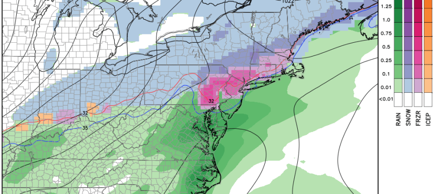
We have another bitter-cold period tonight through Sunday morning. That’s pretty much a given. By Sunday night high pressure departs the mid-Atlantic US and brings warmer southerly flow directly over a very cold surface. There’s also a low pressure disturbance that will bring over-running precipitation with it as it slides into the Atlantic Ocean through Monday. Normally this would paint a very warm and rainy event but there’s a few problems. The surface will still be cold from being in the single digits and teens just 12-18 hours beforehand. Also, there will be a 1045mb+ high sitting over the Great Lakes area. This should create quite an overlap of the colder surface and warmer mid-levels. What this does is create a big freezing rain zone that’s currently modeled right through central and northern New Jersey. Current guidance indicates “some” snow for NNJ and rain for SNJ but the ice potential between is definitely a threat, especially since this will be happening during the Monday AM hours. It’s the kind of event where snow changes to freezing rain and then changes to rain from south to north. There would be delayed-openings galore Monday AM if this verified as verbatim.
There’s a lot of volatility from this far out which means a lot of bust potential between now and then. It could trend colder or warmer than this but this is where we’re at now for the first event next week. This is the latest GFS for Monday morning. The first slide is early Monday morning. The second slide is late Monday morning.
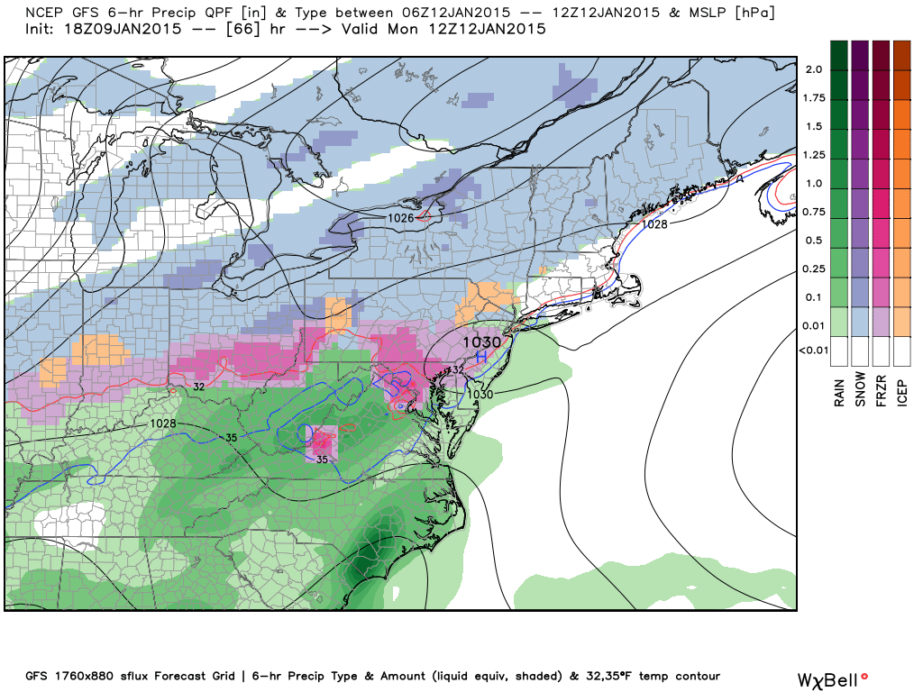
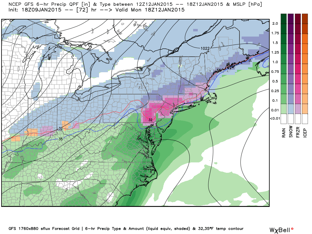
In English: It’s not pretty. All forms of wintry precipitation are on the table still. The time frame is likely early Monday AM through Monday afternoon. We’re still a few days out so I’ll let you know about any trends as soon as I see any. I told you this would be an emotional roller coaster and the Thursday coastal event is far from off the table. Be safe! JC
Jonathan Carr (JC) is the founder and sole operator of Weather NJ, New Jersey’s largest independent weather reporting agency. Since 2010, Jonathan has provided weather safety discussion and forecasting services for New Jersey and surrounding areas through the web and social media. Originally branded as Severe NJ Weather (before 2014), Weather NJ is proud to bring you accurate and responsible forecast discussion ahead of high-stakes weather scenarios that impact this great garden state of ours. All Weather. All New Jersey.™ Be safe! JC


LOCAL FORECAST | INTERACTIVE RADAR | LATEST NJ WEATHER ALERTS | WEDDING FORECAST| PRIVACY POLICY
© Copyright 2026 Weather NJ LLC. All Rights Reserved.
Some information that can be found on our website is provided by a private weather station and is not an officially recognized station for weather reporting. Though we always strive to achieve accurate reporting for our own use, it is important that you do NOT depend on the data provided here for any purpose.
