

Jan 9: Rainfall Approaching
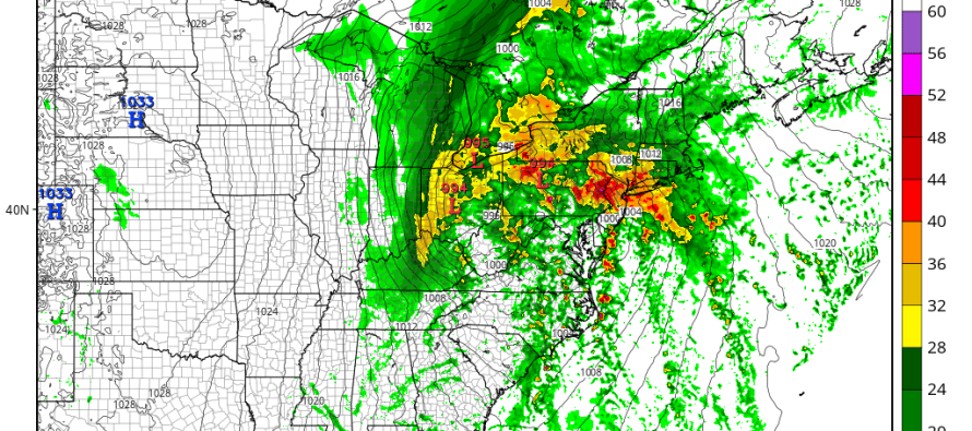
Low pressure will track to our NW, putting New Jersey in the warm sector of an intensifying mid-latitude cyclone. This should bring seasonably mild temperatures, periods of heavy rainfall, gusty winds and possible tidal flooding to our region overnight and well into Sunday.
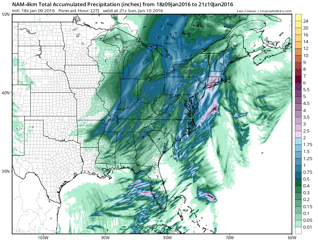
Most short-term model guidance is suggesting up to 2+ inches of rainfall by the time the cold front passes through and cuts off precipitation by tomorrow afternoon. Given that the precipitation will be slightly convective in nature, I would expect some areas outperform others with a general range of .75 to 2.5 inches of rainfall. Also with convective precipitation comes the possibility of embedded thunderstorms. Therefore, let’s allow for some rolling thunder. Here’s the latest high-resolution NAM showing expected rainfall through 5PM on Sunday:
As far as winds go, expect gusty winds out of the S/SW before the frontal passage (with the rain) and also gusty winds out of the W/NW once the front is through.
Temps will take a noticeable dive after the frontal passage tomorrow evening. Any free-standing puddles or wet surfaces that do not evaporate (most should) could freeze Sunday night into Monday morning. Obviously this will only be a concern for areas that dip below freezing but most of New Jersey should (maybe not the SENJ coast).
Coastal flooding is possible tomorrow morning when onshore flow times with high tide and expected heavy rainfall. Just use some extra caution along the barrier islands and coastal regions in general.
It is very important to note that temperatures will be taking a sustained dive into winter territory this coming week. I’ll speak more to it in the Monday-Friday outlook tomorrow but expect some possible light snow in the Tuesday-Wednesday period followed by brutal Arctic temperatures mid-week leading into a potentially larger snow event around next weekend. I’ll be tracking this closely this week.
In English: Clouds should increase tonight ahead of periods of heavy rain starting as early as midnight and clearing as late as tomorrow afternoon. Expect breezy-to-gusty conditions to accompany the rainfall along with mild temperatures. Watch out for coastal flooding in the morning along the shore. Once clear by tomorrow afternoon/evening, it’s winter time for as far as I can see with lots of snowy potential. Be safe! JC
Model images courtesy of Tropical Tidbits.
Jonathan Carr (JC) is the founder and sole operator of Weather NJ, New Jersey’s largest independent weather reporting agency. Since 2010, Jonathan has provided weather safety discussion and forecasting services for New Jersey and surrounding areas through the web and social media. Originally branded as Severe NJ Weather (before 2014), Weather NJ is proud to bring you accurate and responsible forecast discussion ahead of high-stakes weather scenarios that impact this great garden state of ours. All Weather. All New Jersey.™ Be safe! JC


LOCAL FORECAST | INTERACTIVE RADAR | LATEST NJ WEATHER ALERTS | WEDDING FORECAST| PRIVACY POLICY
© Copyright 2026 Weather NJ LLC. All Rights Reserved.
Some information that can be found on our website is provided by a private weather station and is not an officially recognized station for weather reporting. Though we always strive to achieve accurate reporting for our own use, it is important that you do NOT depend on the data provided here for any purpose.
