

January Thaw Detected after this Weekend
Discussion: This article/report will be looked down upon by the winter/snow lover. But it cannot stay cold and snowy the entire winter. Let’s recap for a moment.
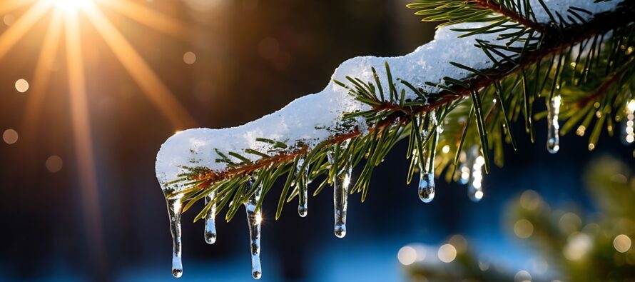
Since Thanksgiving Weekend 2025 (Black Friday to be exact), New Jersey has seen a prolonged period of below-average temperatures with above-average snowfall. Temperatures for the month of December finished out between 5-7F degrees below average with most locations seeing 2-3 inches above average December snowfall. All this based on a traditional 30-year climatological average. We only saw about 4-5 days in December where temperatures verified above average, not a torch, but just slightly above average. We did see two 6-12-hour periods where temperatures did surge well above-average just ahead of a windy frontal passage but well below-average temperatures immediately came through after the frontal passage. We saw our wintry precipitation from a Significant East Coast Snowstorm (SECS) on Dec 14, an ice storm last week (a few more inches of snow for NNJ), and several statewide nickel and dime events of a coating to an inch or two. The last several nights have featured a snow squall, weak clippers and several instances of lake effect snow showers/flurries. This status quo is expected to last through about Monday.
With that said, we’ll stay under colder W/NW flow from the northern stream this entire weekend with random flurries/snow showers possible at any time but likely with little-to-no accumulation. A more concentrated instance of snow showers is possible for late Saturday night into Sunday morning. This has been a storm signal that we’ve been watching involving a clipper on the N stream and a more potent coastal low on the S stream that will push through the SE US from W to E this weekend. Had the two systems interacted more, then they would have combined into a larger Mid-Atlantic snowstorm. But at this point, we’re too close to it and it’s just not in the cards. About the only thing NJ can see at this point is snow from the N stream only (the clipper) and we’ll be watching this heading into Saturday night. Best guess at this point is another wave of scattered snow showers capable of producing another coating to an inch or so. Monday remains colder in the wake of that with snow showers likely just missing NJ to the N Monday night into Tuesday morning and that should complete the 5-6 week period of cold and snow.
On Tuesday, Jan 6, we’ll enter a common occurrence during winter known as a January thaw. The E US trough pattern will move out and push the Greenland block out of the way. This will set up a trough in the W US (-PNA) and downstream ridge for the E US. At the lower levels, we’ll see high pressure park over the W Atlantic Ocean (offshore of NJ/E US) and provide warmer southerly return flow into the E US. This should set up the January thaw to happen between about Jan 6-11 (most of next week). On these days, expect high temperatures to warm to a range of 40-50 NNJ to SNJ with overnight lows 30-40 also NNJ to SNJ. I see two days where temperatures could anomalously spike into the 50s and maybe even 60s for CNJ/SNJ (Jan 9-10) but that surrounds synoptic driven warmth with rain involved ahead of a cold front. We’ve been watching two storm signals near the 7th and 10-11th. They still exists but will likely feature rain. With NNJ elevations, you never know if it hits overnight, but likely rain for at least the lower 2/3 of NJ. The January thaw should then come to a conclusion Jan 11 with an aggressive cold front (ending with wind and rain).
January 12-forward we should return to a colder pattern as the Tropical Northern Hemisphere (TNH) pattern retakes control of the US and forces back the E US trough pattern via cross polar flow. Once we’re closer to that, I imagine we’ll be tracking more snow signals being in the coldest and snowiest (traditionally) part of the year for the back half of January. I’m going to take it easy for the rest of this weekend, outside of some live observation posts/reels when we get closer to late-Saturday night/Sunday morning. If it warrants a snow map, we’ll put one out but not likely if just snow showers are the expectation. Therefore, the next article will likely come Monday in the traditional Weekly Outlook format.
In English: The weekend will remain cold with flurries possible any time and a more concentrated instance of snow showers possible late Saturday night into Sunday morning. Not a big deal. We’ll likely stay cold through Monday and then enter a “January Thaw” from Tuesday until next weekend. This means above-average temperatures and a few rain events for most of NJ. NWNJ elevations aren’t completely off the hook for some mixed wintry precipitation but very likely NENJ/CNJ/SNJ is off the hook. We’ll then return to a colder wintry pattern at the end of next weekend with a rain system leading to an aggressive cold front. Winter/snow lovers, this isn’t the end of winter. No need to cancel winter 10 days into the season lol. We will be tracking more snow events after next weekend with a lot of winter to go. We’re only starting about the third inning of the overall snow season. Everyone have a great weekend and please be safe! JC
Premium Services
KABOOM Club offers an ad-free environment, inside info (Above and Beyond) forecast discussion, your questions prioritized, and early storm impact maps and video releases (ahead of the public). At $1.99 per month, it’s an extremely feasible way to show additional support for Weather NJ and you can turn it on and off for however many months you wish. Think of it as a tip jar with perks. Available onFacebook or Patreon.
My Pocket Meteorologist (MPM), in partnership with EPAWA Weather Consulting, offers professional/commercial interests, whose businesses depend on outdoor weather conditions (snow plowing, landscaping, construction, etc.), with hyper-local text message alerts/forecasts from real meteorologists and access to the MPM premium forum—the most comprehensive and technical forecast discussion available for PA and NJ commercial interests.
KABOOM Shop is live if you want some KABOOM or Weather NJ Merch!
Sign up for ZoneWatch Radar and get 10% off
Jonathan Carr (JC) is the founder and sole operator of Weather NJ, New Jersey’s largest independent weather reporting agency. Since 2010, Jonathan has provided weather safety discussion and forecasting services for New Jersey and surrounding areas through the web and social media. Originally branded as Severe NJ Weather (before 2014), Weather NJ is proud to bring you accurate and responsible forecast discussion ahead of high-stakes weather scenarios that impact this great garden state of ours. All Weather. All New Jersey.™ Be safe! JC


LOCAL FORECAST | INTERACTIVE RADAR | LATEST NJ WEATHER ALERTS | WEDDING FORECAST| PRIVACY POLICY
© Copyright 2026 Weather NJ LLC. All Rights Reserved.
Some information that can be found on our website is provided by a private weather station and is not an officially recognized station for weather reporting. Though we always strive to achieve accurate reporting for our own use, it is important that you do NOT depend on the data provided here for any purpose.
