

July 21: Thunderstorm Update
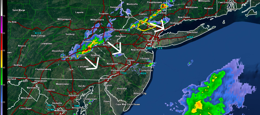
A cold front, which will bring relief from temperatures and humidity from Wednesday through at least Saturday, is currently moving through PA and NY State from NW to SE. Until that passes through later this evening, New Jersey is on the hook for showers and thunderstorms. A NNJ cell right now is currently severe-warned by the National Weather Service. Let’s look at the current surface map:
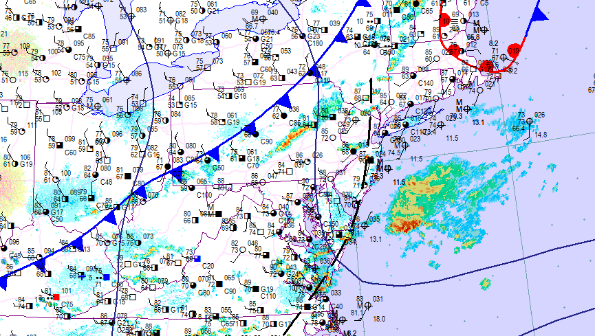
You can see a pre-frontal trough (striped black line) running through NJ which has touched-off a few showers and thunderstorms today. The most impressive thunderstorm activity is currently moving through NWNJ and EPA. I expect this energy to fizzle as it approaches and moves through NJ from NW to SE. I’d allow for showers and possibly even a remnant storm or two this evening until that front is through. With that said, NWNJ has the best chance for storms and SENJ has the least chance with everyone in between likely to ride out the fizzle.
In English: Expect showers and thunderstorms through this evening. I’d give it until about 9-10pm for the last line of storms to clear the SENJ coast. Only isolated instances of severe are possible. The most likely scenario are thunderstorms collapsing into just showers with a few boomers at most. Conditions should improve substantially (dry, sunny and low-80s) starting tomorrow morning which should last into at least the first part of Sunday. Be safe! JC
Jonathan Carr (JC) is the founder and sole operator of Weather NJ, New Jersey’s largest independent weather reporting agency. Since 2010, Jonathan has provided weather safety discussion and forecasting services for New Jersey and surrounding areas through the web and social media. Originally branded as Severe NJ Weather (before 2014), Weather NJ is proud to bring you accurate and responsible forecast discussion ahead of high-stakes weather scenarios that impact this great garden state of ours. All Weather. All New Jersey.™ Be safe! JC


LOCAL FORECAST | INTERACTIVE RADAR | LATEST NJ WEATHER ALERTS | WEDDING FORECAST| PRIVACY POLICY
© Copyright 2026 Weather NJ LLC. All Rights Reserved.
Some information that can be found on our website is provided by a private weather station and is not an officially recognized station for weather reporting. Though we always strive to achieve accurate reporting for our own use, it is important that you do NOT depend on the data provided here for any purpose.
