

July 21: Tropical Activity Detected
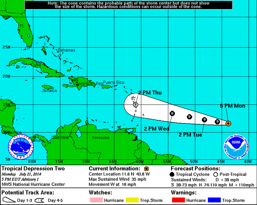
Tropical Depression 2 has formed in the Atlantic Ocean. Dry air from the Sahara Desert has hindered development but enough energy has escaped to set a course for the Lesser Antilles. That seems to be the modeled direction for the next 3-4 days. After that the track is uncertain but a good point of reference is the Haiti/Dominican Republic region. When a storm passes north of that, it normally means a curve north towards the east coast. A pass south of that area will almost always end up heading straight into the Gulf of Mexico. Here’s the NWS National Hurricane Center’s current projected path:
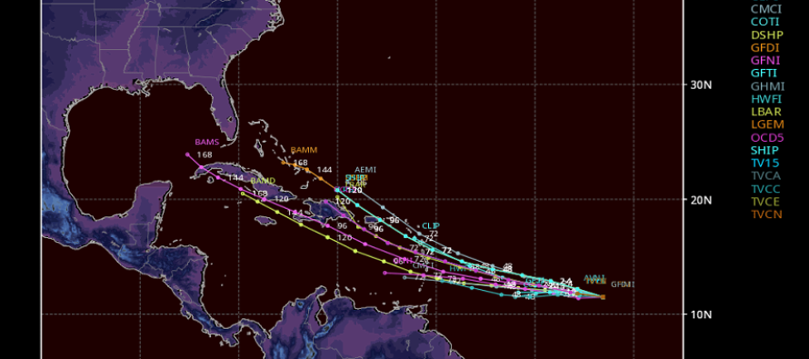
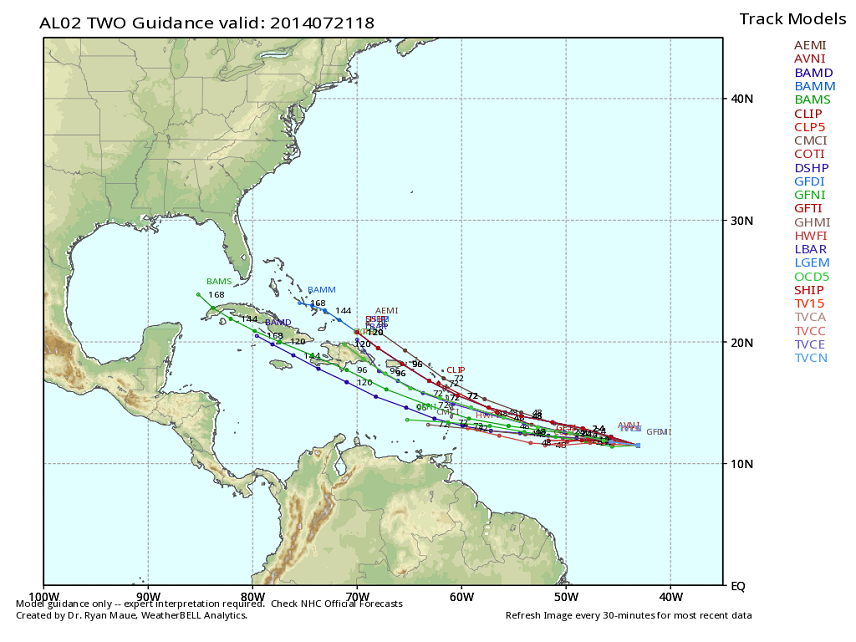
Here’s also some blended tropical model guidance (also known as a spaghetti plot) indicating a solid consensus for Lesser Antilles impact as a tropical depression:
So it looks like we have some tracking to do over the next few days. This storm is still only a tropical depression but further development is expected. Maximum impact to the Lesser Antilles would be tropical storm intensity early next week. At this point it’s on our radar until it either fizzles out or misses. Be safe! JC
Model images courtesy of NWS NHC and WeatherBell Analytics.
Jonathan Carr (JC) is the founder and sole operator of Weather NJ, New Jersey’s largest independent weather reporting agency. Since 2010, Jonathan has provided weather safety discussion and forecasting services for New Jersey and surrounding areas through the web and social media. Originally branded as Severe NJ Weather (before 2014), Weather NJ is proud to bring you accurate and responsible forecast discussion ahead of high-stakes weather scenarios that impact this great garden state of ours. All Weather. All New Jersey.™ Be safe! JC


LOCAL FORECAST | INTERACTIVE RADAR | LATEST NJ WEATHER ALERTS | WEDDING FORECAST| PRIVACY POLICY
© Copyright 2026 Weather NJ LLC. All Rights Reserved.
Some information that can be found on our website is provided by a private weather station and is not an officially recognized station for weather reporting. Though we always strive to achieve accurate reporting for our own use, it is important that you do NOT depend on the data provided here for any purpose.
