

July 22: The Wet Pattern Begins
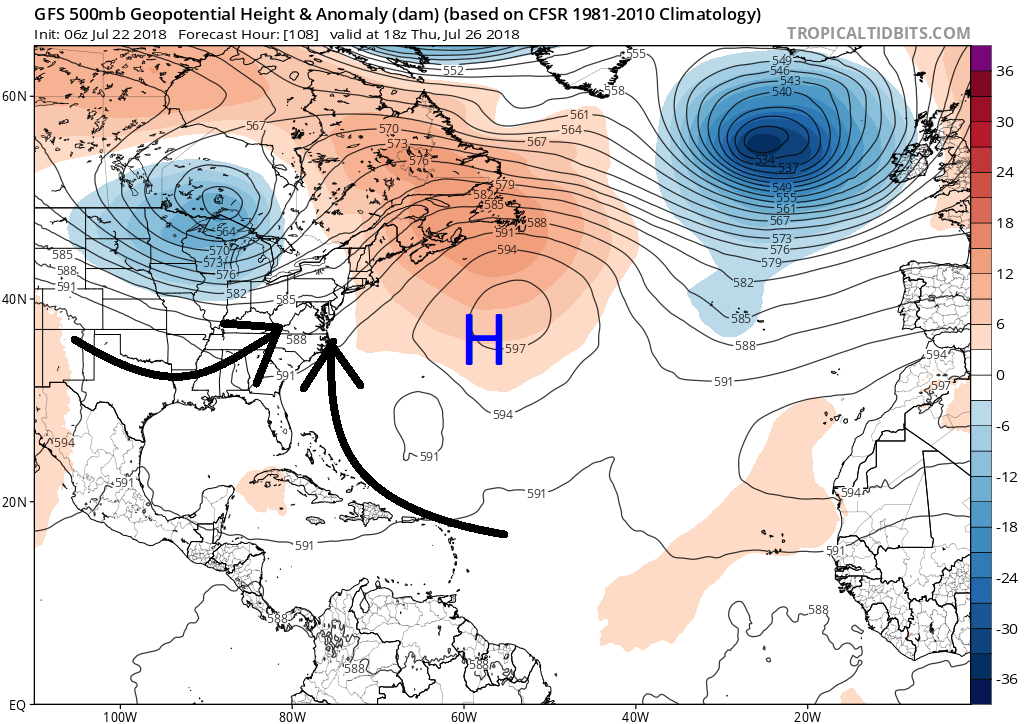
Discussion: Last night’s synoptic rain storm has passed through and is now absorbing into the upper-level low to our W. This upper-level low will fizzle into nothing as the SW US ridge teams up with the W Atlantic ridge to help break down the lower 500mb height anomalies. The newly-emerging pattern should mostly be driven by a very prolonged and stubborn Bermuda High. I’ve plotted the surface high on the following upper-level GFS map to show the converging return flow (with approaching warm sector flow from the W) that will generally drive the wetter pattern over the next 7+ days:
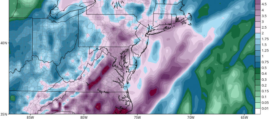
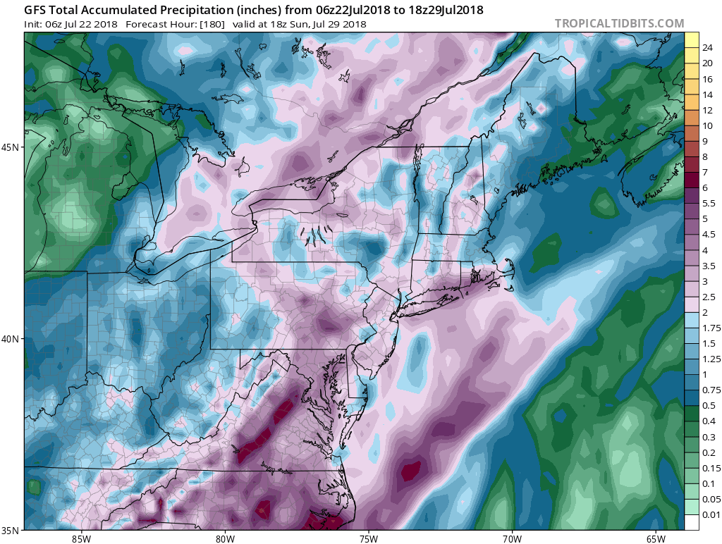
I don’t think any of the next 7+ days are complete washouts. Each day, rather, looks to feature isolated-to-scattered showers and thunderstorms especially during afternoon-evening hours. While convergence will drive, maybe assist is a better word, most convection…diurnal heating will have a big stake as well. The more sunlight that hits the surface cloud free, the easier the convergence will lift moist surface air into the atmosphere and spark the expected shower/storm activity. It obviously won’t take much lifting assistance with most model guidance suggesting 2-5+ inches of rainfall between now and next Sunday:
In English: Most areas should stay dry for the first half of today. Afternoon-evening hours today could feature isolated-to-scattered showers and thunderstorms moving from S to N. The next 7 days+ look to feature a lot of rainfall. However, the rainfall shouldn’t produce continuous 24/7 washout days. I would generally expect dry, maybe even sunny at times, morning to early afternoon hours for most days. Most rainfall should fall during afternoon-evening hours in the form of shower and thunderstorms that vary in nature from isolated-to-scattered. You might have a few days that are mostly cloudy but still not 24-hour washout days—a late-day shower/thunderstorm pattern (for the most part). I’ll have the detailed Monday-Friday outlook posted this evening. Everyone enjoy the rest of your Sunday and please be safe! JC
Model Image Source: Tropical Tidbits
Jonathan Carr (JC) is the founder and sole operator of Weather NJ, New Jersey’s largest independent weather reporting agency. Since 2010, Jonathan has provided weather safety discussion and forecasting services for New Jersey and surrounding areas through the web and social media. Originally branded as Severe NJ Weather (before 2014), Weather NJ is proud to bring you accurate and responsible forecast discussion ahead of high-stakes weather scenarios that impact this great garden state of ours. All Weather. All New Jersey.™ Be safe! JC


LOCAL FORECAST | INTERACTIVE RADAR | LATEST NJ WEATHER ALERTS | WEDDING FORECAST| PRIVACY POLICY
© Copyright 2026 Weather NJ LLC. All Rights Reserved.
Some information that can be found on our website is provided by a private weather station and is not an officially recognized station for weather reporting. Though we always strive to achieve accurate reporting for our own use, it is important that you do NOT depend on the data provided here for any purpose.
