

July 23: Evening Storms Approaching!
-
Hope you’re all staying cool today! Heat indices have exceeded 90F in many NJ locations already. This will set the stage for strong-to-severe thunderstorms tonight, especially for western and northwestern New Jersey. The entire I-95 corridor (from DC to at least NYC) are subject to such. As with most cases, coastal and southeastern New Jersey have the least chance for storms due to marine layer influence.
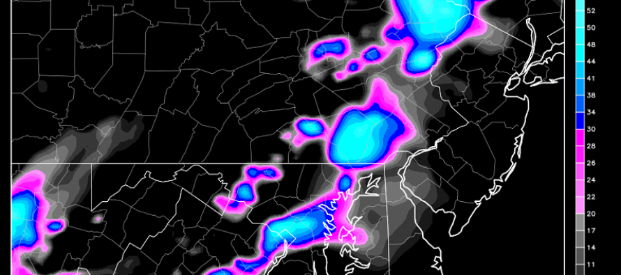
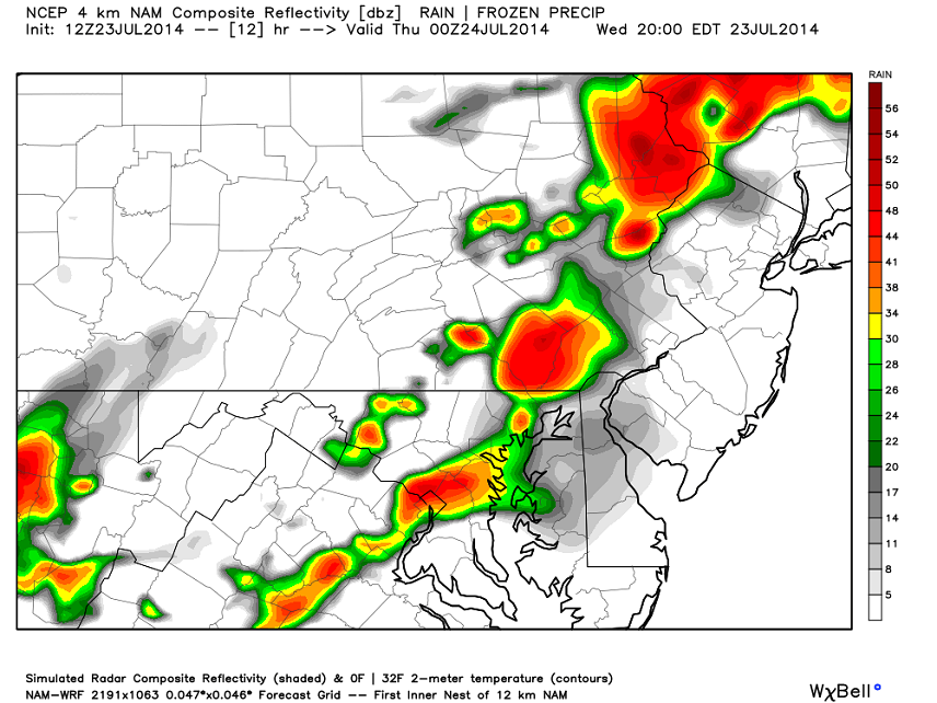
Let’s look at some short-range guidance. This is the 12Z NAM showing expected precipitation intensity for 8PM tonight. At that point storms should be knocking on western New Jersey’s door. Remaining storm energy wont make it to the Atlantic until a few hours later. Everything should clear the coast by 2AM at the latest:
There will be more than enough instability today which should help develop towering cumulonimbus storm clouds. This should result in a great light show. These storms will pulsate ahead of the pre-frontal trough as they move east. This map, also off the 12Z NAM, shows 7PM instability (just before storms), particularly surface-based CAPE (Convective Available Potential Energy) in j/kg (joules per kilogram). The higher the number, the more destabilized that area will be from diurnal surface heating. There’s enough for everyone to possibly see something tonight:
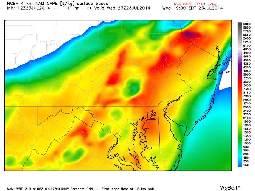
As you can see, western New Jersey will be more destabilized then coastal regions. Again, this is due to marine layer influence. This is why storms will likely approach WNJ as severe and fizzle to just strong storms/showers by the time they reach the barrier islands. The good news is that wind shear is lacking. Only areas directly under/just ahead of storm cells will have to worry about higher wind gusts. With the amount of instability and potential lift off the pre-frontal trough, isolated instances of hail cannot be ruled out.
In English: Expect today to remain warm and muggy until about 8PM when storms will likely move in from the west. If you get caught in a storm, expect gusty winds, possible hail, frequent lightning, and heavy rain downpours until everything clears out overnight. Tomorrow should feature more rain and weaker storms as the cold front finally pushes through and brings back the below-average July conditions we’ve gotten used to. By tomorrow night we should be sitting beautiful with an amazing Friday-Saturday on tap. Sunday looks unsettled but I’ll have a fully detailed weekend outlook posted tomorrow evening. Be safe! JC
Jonathan Carr (JC) is the founder and sole operator of Weather NJ, New Jersey’s largest independent weather reporting agency. Since 2010, Jonathan has provided weather safety discussion and forecasting services for New Jersey and surrounding areas through the web and social media. Originally branded as Severe NJ Weather (before 2014), Weather NJ is proud to bring you accurate and responsible forecast discussion ahead of high-stakes weather scenarios that impact this great garden state of ours. All Weather. All New Jersey.™ Be safe! JC


LOCAL FORECAST | INTERACTIVE RADAR | LATEST NJ WEATHER ALERTS | WEDDING FORECAST| PRIVACY POLICY
© Copyright 2025 Weather NJ LLC. All Rights Reserved.
Some information that can be found on our website is provided by a private weather station and is not an officially recognized station for weather reporting. Though we always strive to achieve accurate reporting for our own use, it is important that you do NOT depend on the data provided here for any purpose.
