

July 24: Cool Air Returns
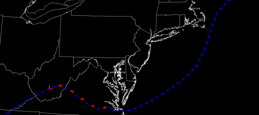
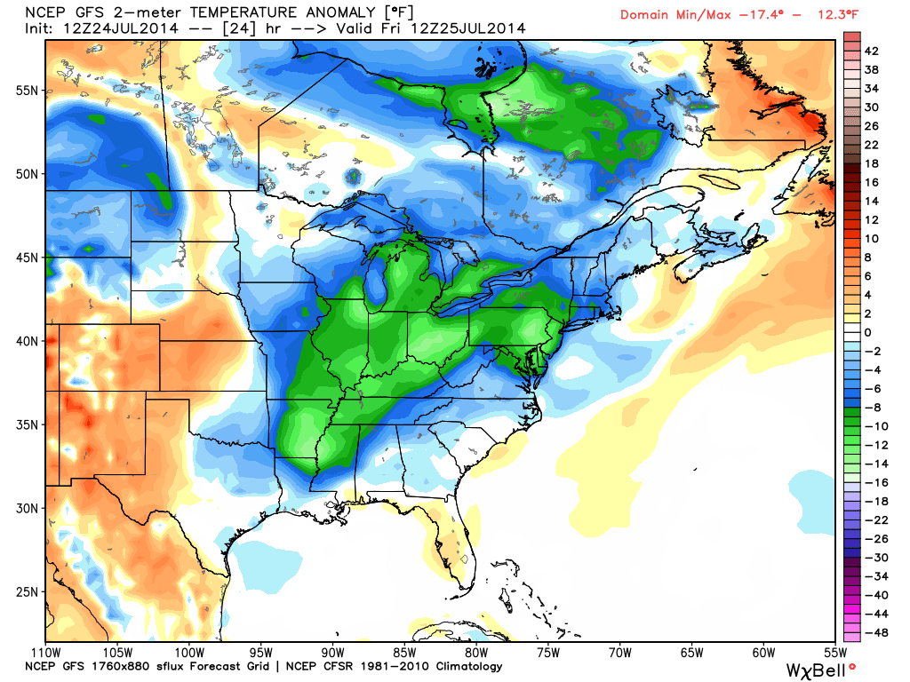
The above map shows current frontal boundary positions, courtesy of SimuAwips. As you can see, the cold front has pushed off the coast of New Jersey despite remaining stationary over Virginia. This will keep showers concentrated to our south and east as we continue to clear out today. By this evening we could be reaching for our jackets as overnight low temperatures drop into the 50s (NWNJ) and 60s (SENJ). This is the latest 12Z GFS showing temperature anomalies (departures from average) for Friday morning in degrees Fahrenheit. Basically we’re looking at temperatures -8 to -14 below average when you wake up tomorrow morning:
This is the second Canadian air mass that has descended on New Jersey. We can thank anomalies further up the jet stream in the Pacific Ocean for altering our overall summer pattern. Regardless, we’ll likely stay below average and dry through at least Saturday evening. Expect highs around 80 and lows in the 50s/60s. By Sunday we should see seasonably average warmth and humidity returning that should last into next week. Then another (possibly the coolest) Canadian air mass should move in with storms ahead of it. Rinse. Wash. Repeat. I’ll have a full weekend outlook posted this evening. Be safe! JC
Jonathan Carr (JC) is the founder and sole operator of Weather NJ, New Jersey’s largest independent weather reporting agency. Since 2010, Jonathan has provided weather safety discussion and forecasting services for New Jersey and surrounding areas through the web and social media. Originally branded as Severe NJ Weather (before 2014), Weather NJ is proud to bring you accurate and responsible forecast discussion ahead of high-stakes weather scenarios that impact this great garden state of ours. All Weather. All New Jersey.™ Be safe! JC


LOCAL FORECAST | INTERACTIVE RADAR | LATEST NJ WEATHER ALERTS | WEDDING FORECAST| PRIVACY POLICY
© Copyright 2026 Weather NJ LLC. All Rights Reserved.
Some information that can be found on our website is provided by a private weather station and is not an officially recognized station for weather reporting. Though we always strive to achieve accurate reporting for our own use, it is important that you do NOT depend on the data provided here for any purpose.
