

July 27: Evening Storms Expected
Showers and storms have already moved through the region early this morning. While weaker showers and storms can happen at any time today, the primary threat appears to be later this evening.
I’m actually expecting clouds to clear for some regions as we head through the afternoon hours. This will allow the sun to bake the surface and destabilize the atmosphere (via diurnal surface heating). As you can see here on the high-res NAM, surface-based CAPE (Convective Potential Available Energy) exceeds 2000 j/kg (joules per kilogram) across the entire state by 7PM:
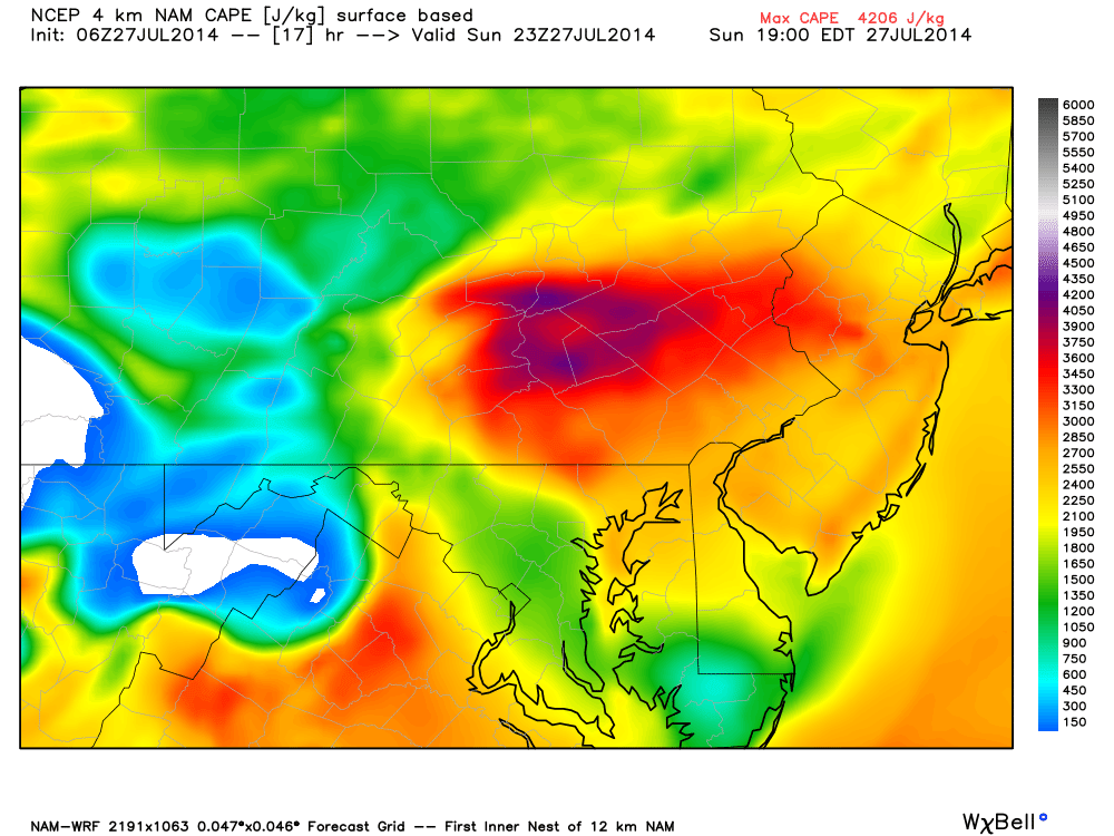
What’s even more impressive is regional mixed layer CAPE (higher up in the atmosphere) exceeding 1000 joules per kilogram. In addition to favorable thunderstorm development associated with instability, there will be decent wind shear associated with a strong upper jet. Winds aloft, just 10,000 feet up) could range from 60-90mph. It would only take moderate disruption to bring some of those winds down to the surface resulting in damaging conditions.
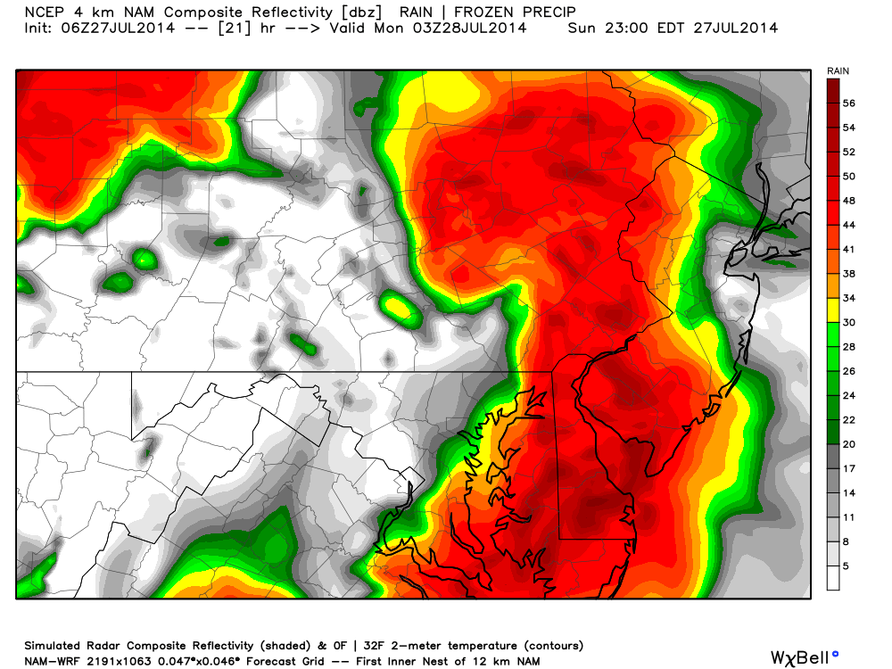
Rainfall will be very heavy during storm time. This is the high-res NAM showing expected precipitation rates at 11PM this evening. Flash flooding is a good possibility given such:
In English: Today should be a mixed bag of sun and clouds with muggy and unsettled conditions. Weaker showers and storms are possible any time but the heavy stuff should come down near or after sunset. Expect heavy downpours of rain, frequent lightning, damaging winds, and a small chance of hail. These unsettled conditions could last into tomorrow. I’ll have a detailed Monday-Friday Outlook posted this evening. Please be safe today! JC
Jonathan Carr (JC) is the founder and sole operator of Weather NJ, New Jersey’s largest independent weather reporting agency. Since 2010, Jonathan has provided weather safety discussion and forecasting services for New Jersey and surrounding areas through the web and social media. Originally branded as Severe NJ Weather (before 2014), Weather NJ is proud to bring you accurate and responsible forecast discussion ahead of high-stakes weather scenarios that impact this great garden state of ours. All Weather. All New Jersey.™ Be safe! JC


LOCAL FORECAST | INTERACTIVE RADAR | LATEST NJ WEATHER ALERTS | WEDDING FORECAST| PRIVACY POLICY
© Copyright 2026 Weather NJ LLC. All Rights Reserved.
Some information that can be found on our website is provided by a private weather station and is not an officially recognized station for weather reporting. Though we always strive to achieve accurate reporting for our own use, it is important that you do NOT depend on the data provided here for any purpose.
