

July 31: Thunderstorms are Building
Discussion: The Bermuda high is currently eroding and slipping to the E. Another area of high pressure is currently over the Great Lakes and will track across the NE US towards the Gulf of Maine (passing by to our N from W to E). The front side anti-cyclonic flow of the high will push a front through NJ tonight. Showers and thunderstorms are possible ahead and along this frontal passage. This creates a stormy window between now and 8PM today.
Precipitable WATer (PWAT) values are ranging from 1.4-1.7 across New Jersey. Most dew point temperatures are in the upper-60s/lower-70s range. This is enough of a hydrospheric setup to warrant more of the flash flooding-type storms cells we’ve become used to this season. Most thunderstorm cell action this afternoon looks isolated-to-scattered and random meaning smaller cells could form anywhere in the state. You might see the energy congeal into more of a widespread linear segment as it finally exits SENJ later in the evening. So scattered random stuff first then organized through SENJ to finish.
Diurnal instability is subject to how much sun can hit the surface. Cumulus clouds are already building and will no doubt transition to cumulonimbus soon. This is still allowing enough sun to destabilize the surface environment (suns out guns out). Wind shear looks rather weak and only closer to the front itself. Leading scattered action will need to leverage some of the convergence coming from the departing Bermuda high’s return flow into the approaching front. With the lacking shear we could still have pulsing storm cells capable of reaching severe criteria but then quickly fizzle out to form adjacent storm cells via downdraft and outflow microfront.
If the new approaching Great Lakes high were to pass over us instead of to our N then all of NJ would experience noticeable relief Thursday into the weekend. But because it will take a northerly track through New England it might cut NJ into two different climates…pleasant for NNJ still muggy for SNJ. That relief should lift out of NNJ for the weekend and then we’re all on the hook for unsettled weather Saturday and Sunday. Highs in the 80s. Dews in the 60s. A mostly sunny day with pop-up showers and thunderstorms possible kind of stuff. I’ll talk more about that tomorrow night in the weekend outlook.
In English: Thunderstorms are possible from now through 8pm this evening. The afternoon (2-5pm) should feature hit-or-miss type storms statewide (not everyone gets hit). Evening hours of the window (5-8pm) should be more of a widespread nature with remaining storm energy focusing and pushing through SNJ/SENJ. Thunderstorms could feature severe-criteria wind gusts, frequent lightning, hail and downpours capable of producing flash flooding. Please be safe! JC
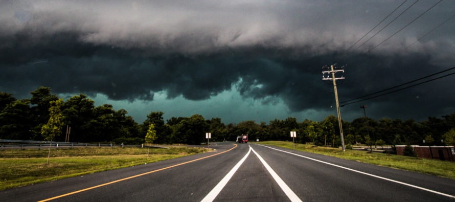
I took the above photograph in Maryland a few years ago when a severe thunderstorm was approaching.
Download the new free Weather NJ mobile app on Apple and/or Android. It’s the easiest way to never miss Weather NJ content. Our premium services go even further above and beyond at the hyper-local level. Looking for industrial-caliber long-range forecasting data that I personally recommend? Check out WeatherTrends360!
Jonathan Carr (JC) is the founder and sole operator of Weather NJ, New Jersey’s largest independent weather reporting agency. Since 2010, Jonathan has provided weather safety discussion and forecasting services for New Jersey and surrounding areas through the web and social media. Originally branded as Severe NJ Weather (before 2014), Weather NJ is proud to bring you accurate and responsible forecast discussion ahead of high-stakes weather scenarios that impact this great garden state of ours. All Weather. All New Jersey.™ Be safe! JC


LOCAL FORECAST | INTERACTIVE RADAR | LATEST NJ WEATHER ALERTS | WEDDING FORECAST| PRIVACY POLICY
© Copyright 2026 Weather NJ LLC. All Rights Reserved.
Some information that can be found on our website is provided by a private weather station and is not an officially recognized station for weather reporting. Though we always strive to achieve accurate reporting for our own use, it is important that you do NOT depend on the data provided here for any purpose.
