

June 1: Watching Weekend Thunderstorms

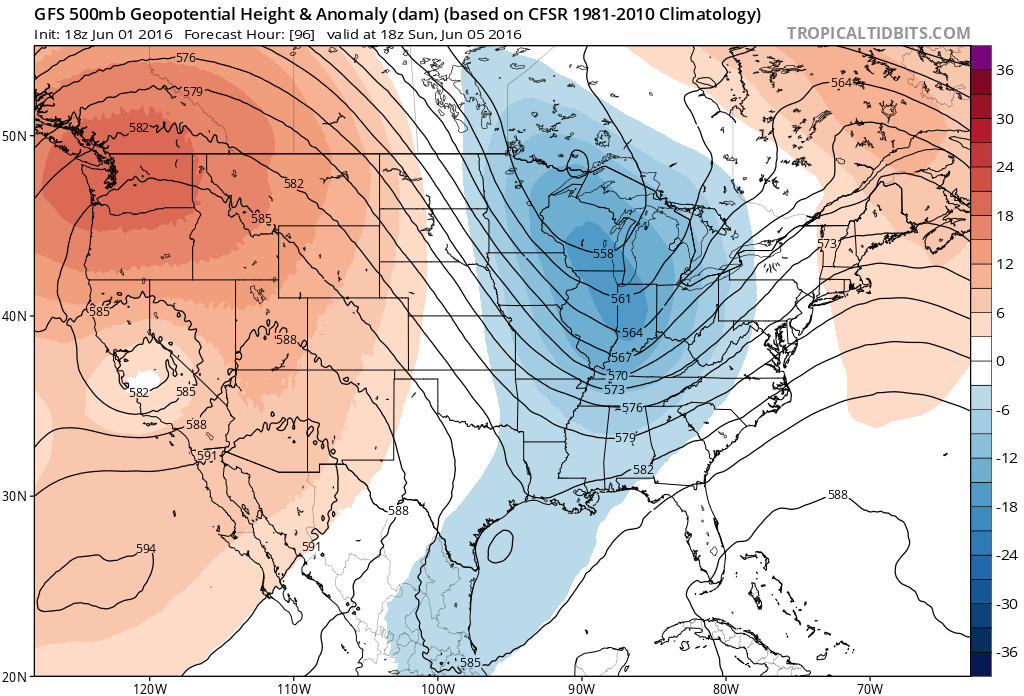
This weekend’s weather is starting to take shape. I’ll post an official weekend outlook tomorrow so this is just a discussion about what I’m seeing on model guidance for Sunday PM hours. The upper-levels have an energetic look as seen here on the latest GFS. What jumps out at me is the strength of the Western US ridge and the phasing energy in the Eastern US:
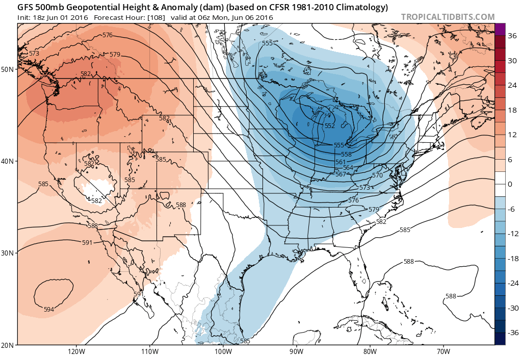
Between 18z and 06Z (2PM Sunday and 2AM Monday), the energy phases and contributes to strengthening a surface low in Canada:
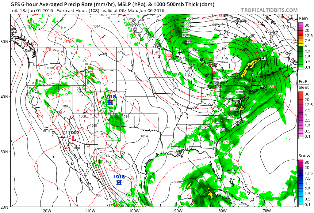
This should enhance the cold frontal passage but also strengthen the warm sector ahead. Therefore, as seen on this New Jersey sounding, instability will be at favorable levels for thunderstorm development:
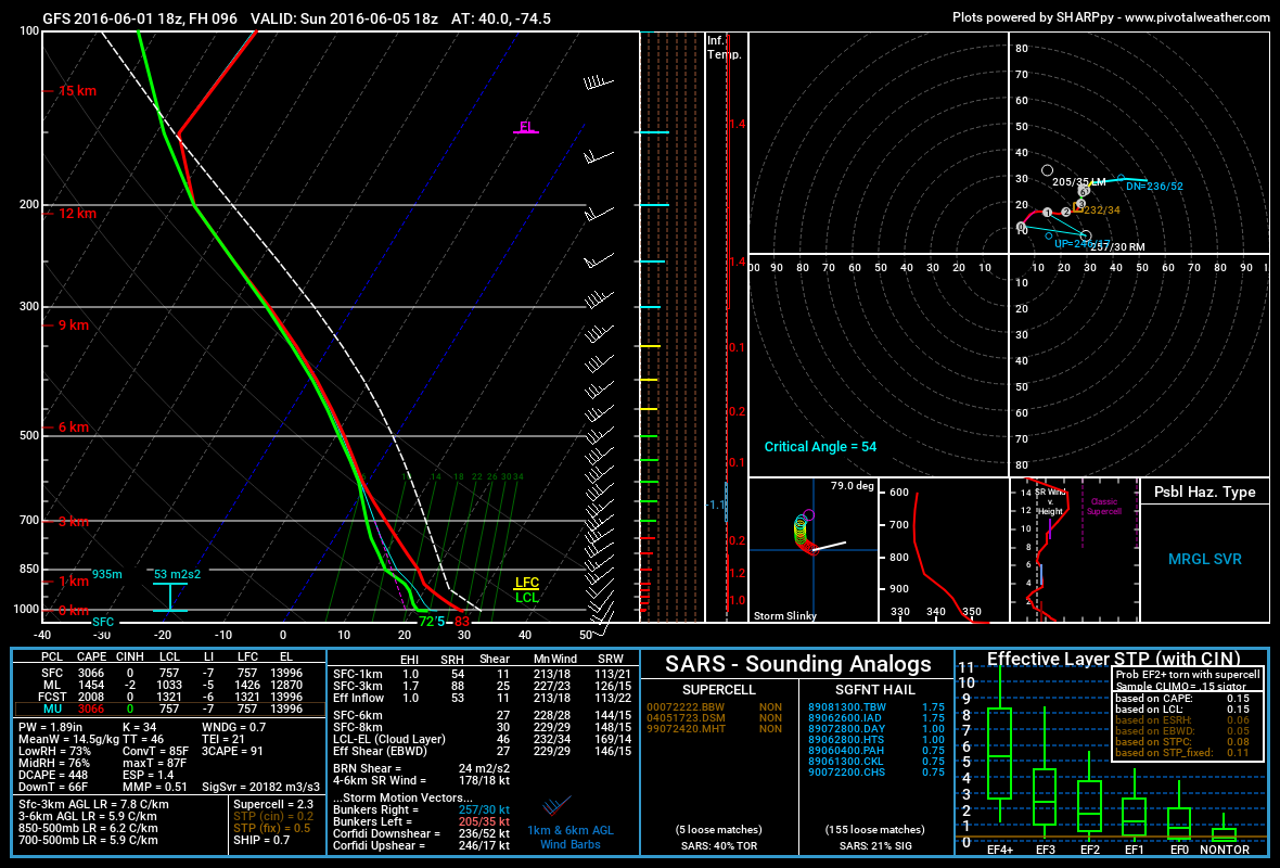
What jumps out at me about the sounding is the MLCAPE reading of close to 1500 j/kg above a SBCAPE reading of 3000 j/kg. Also the difference in temperature between the surface and 500mb is negative 5-7 degrees Celsius depending on your level. From my past experience, this would suggest very towering cumulonimbus clouds with frequent lightning. If the dew point temperatures are going to be in the upper-60s/lower-70s as sounded, then there will be plenty of surface moisture to hoist high into the air.
Surface-500mb bulk shear values are on the weaker side of moderate but we have a 50-60kt 250mb jet which could provide additional lifting. With the instability and lower 500mb heights, it’s not going to take much to form storms. At this point there is no capping inversion at 700mb nor any other convective inhibition factors modeled. Supercell composite values are less than impressive. This is likely due to the linear nature of the storms that should form either along the cold front or along a leeward pre-frontal trough just ahead of it.
About the only inhibiting factor I could possibly see is cloud debris ahead of the main storm line. This could cut off diurnal heating and make for more of a washout/embedded t-storm feel. If there is clearing ahead of the storm line then there’s a saying, “sun’s out guns out.”

In English: Even though rain and possibly some storms are modeled for Friday (can’t let our guard down), Sunday PM hours could feature thunderstorms of severe nature (damaging winds and/or possibly hail). 9 times out of 10, these kind of storms hit EPA and parts of WNJ harder than the ENJ. Sometimes they fizzle before even making it to New Jersey. That’s because they lose energy with loss of sun and/or tread into more stable air due to maritime influence. There is always that one time though. For now, this is just me discussing what I am seeing. I’ll have an official weekend outlook posted tomorrow. Just keep in mind that Sunday afternoon-evening has the potential to be rough thunderstorm-wise should these parameters hold. Saturday looks like the best day of the weekend. Have a great night and be safe! JC
Model images and data by Tropical Tidbits and Pivotal Weather. I took the cover image in Maryland a few years ago.
Jonathan Carr (JC) is the founder and sole operator of Weather NJ, New Jersey’s largest independent weather reporting agency. Since 2010, Jonathan has provided weather safety discussion and forecasting services for New Jersey and surrounding areas through the web and social media. Originally branded as Severe NJ Weather (before 2014), Weather NJ is proud to bring you accurate and responsible forecast discussion ahead of high-stakes weather scenarios that impact this great garden state of ours. All Weather. All New Jersey.™ Be safe! JC


LOCAL FORECAST | INTERACTIVE RADAR | LATEST NJ WEATHER ALERTS | WEDDING FORECAST| PRIVACY POLICY
© Copyright 2026 Weather NJ LLC. All Rights Reserved.
Some information that can be found on our website is provided by a private weather station and is not an officially recognized station for weather reporting. Though we always strive to achieve accurate reporting for our own use, it is important that you do NOT depend on the data provided here for any purpose.
