

June 10: The Heat is On!

Over the next few days we’ll be stuck in the warm sector of a low pressure disturbance passing through the Great Lakes. High pressure centered over Bermuda will spin humidity up its back (West) side which will assist in saturating the warm sector air mass with strong S/SW flow. I suggest you play the song and crank it…
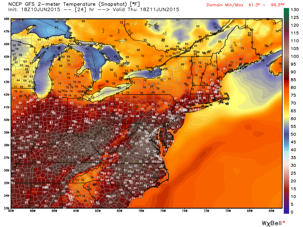
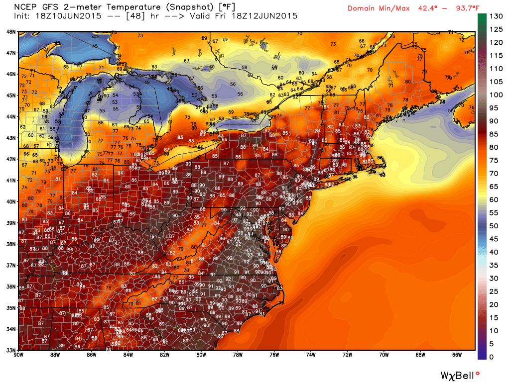
Recent model guidance has ramped up suggested temperatures for tomorrow through Saturday. The next few model images, courtesy of WeatherBell Analytics, represent air temperatures at 2PM on each respective day (Thursday, Friday and Saturday).
Thursday
Friday
Saturday
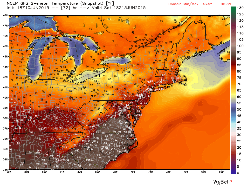
Whenever you have heat and humidity in the warm sector like this, pop-up thunderstorms are possible, especially towards the end of peak diurnal heating (4-7PM). Most of the day should be sunny, hot and humid but storm details will have to be now-casted using same-day data/radar/etc. Also a cold front should push through sometime on Saturday which would mean more of a line segment system of storms followed by cooler and drier air behind for Saturday night. I’ll have the fully-detailed weekend outlook posted tomorrow evening but for now the week finishes hot, stormy and humid with relief Saturday night-Sunday.
In English: Hazy, hot, and humid (Triple-H) tomorrow through Saturday. Storms possible every day. Summer. Be safe! JC
Jonathan Carr (JC) is the founder and sole operator of Weather NJ, New Jersey’s largest independent weather reporting agency. Since 2010, Jonathan has provided weather safety discussion and forecasting services for New Jersey and surrounding areas through the web and social media. Originally branded as Severe NJ Weather (before 2014), Weather NJ is proud to bring you accurate and responsible forecast discussion ahead of high-stakes weather scenarios that impact this great garden state of ours. All Weather. All New Jersey.™ Be safe! JC


LOCAL FORECAST | INTERACTIVE RADAR | LATEST NJ WEATHER ALERTS | WEDDING FORECAST| PRIVACY POLICY
© Copyright 2026 Weather NJ LLC. All Rights Reserved.
Some information that can be found on our website is provided by a private weather station and is not an officially recognized station for weather reporting. Though we always strive to achieve accurate reporting for our own use, it is important that you do NOT depend on the data provided here for any purpose.
