

June 11: Thunderstorms Expected!
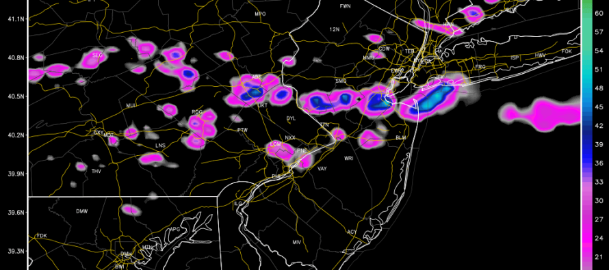
A frontal boundary will drape across extreme NNJ today. Everyone to the south of this boundary is subject to pop-up thunderstorms, especially during afternoon-early evening hours. Conditions in extreme NNJ (north of the boundary – ex: N. Sussex County) should remain mostly pleasant with a much lesser storm chance. For the rest (most) of New Jersey, conditions should be hazy, hot and humid with temperatures topping out in the 90s and dew points flirting with 70—natural thunderstorm fuel to feed instability. Most model guidance suggests a target storm hotspot between I-80 and I-195 between the hours of about 3PM through 9PM. Areas south of I-195 are still suspect for pop-up storms but not as much as that CNJ-NNJ area. Here’s some supporting short-range guidance showing estimated precipitation intensity (generally where the thunderstorms are favored to happen).
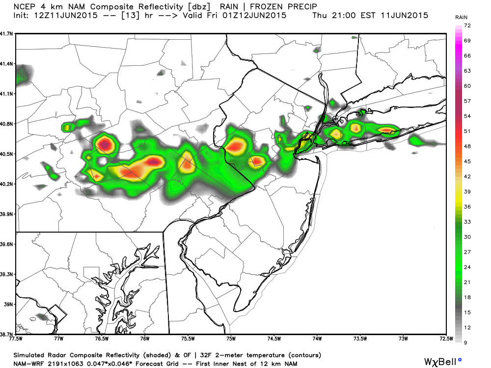
4km NAM: Estimated precipitation intensity between 8-9PM.
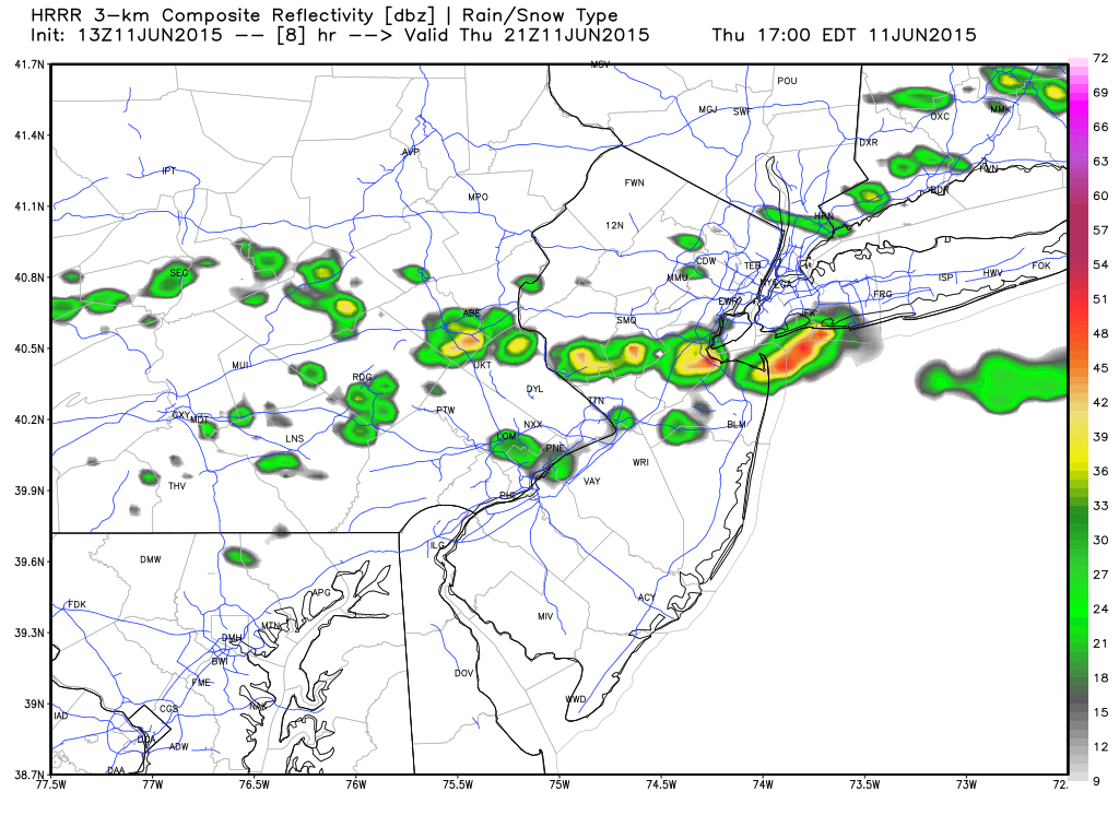
3km HRRR: Estimated precipitation intensity between 4-5PM.
With short range guidance mixed on timing, I would expect thunderstorms any time after 2PM and again, focused on that CNJ-NNJ area. SNJ should remain on standby. Once the sun sets, storms will lose energy and collapse overnight. I’d be surprised if we’re still storming after 10pm. Severe criteria is possible wherever wind gusts exceed 58mph and/or hail reaches a diameter of 1-inch or greater. Trained NWS spotters will trigger localzed Severe Thunderstorm Warnings for such.
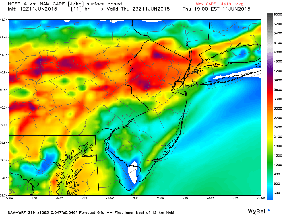
As you can see, late-afternoon/early evening surface instability will be quite high with readings in excess of 4,000j/k of CAPE (joules per kilogram of Convective Available Potential Energy). This traditionally spells frequent lightning and will be mostly due to diurnal surface heating! Notice how CNJ/NNJ is much more destabilized than SNJ?
In English: Thunderstorms and showers are possible between 2PM and 10PM today. Best chance for storms = CNJ and NNJ. Lesser chance (but not zero) for SNJ. While most of the day will be hot and humid, conditions while under a pop-up thunderstorms could deteriorate rapidly with heavy downpours, lightning, wind gusts, and hail if cloud tops can build high enough. Be safe! JC
Jonathan Carr (JC) is the founder and sole operator of Weather NJ, New Jersey’s largest independent weather reporting agency. Since 2010, Jonathan has provided weather safety discussion and forecasting services for New Jersey and surrounding areas through the web and social media. Originally branded as Severe NJ Weather (before 2014), Weather NJ is proud to bring you accurate and responsible forecast discussion ahead of high-stakes weather scenarios that impact this great garden state of ours. All Weather. All New Jersey.™ Be safe! JC


LOCAL FORECAST | INTERACTIVE RADAR | LATEST NJ WEATHER ALERTS | WEDDING FORECAST| PRIVACY POLICY
© Copyright 2026 Weather NJ LLC. All Rights Reserved.
Some information that can be found on our website is provided by a private weather station and is not an officially recognized station for weather reporting. Though we always strive to achieve accurate reporting for our own use, it is important that you do NOT depend on the data provided here for any purpose.
