

June 19: Thunderstorm Schedule
The severe thunderstorm potential has not backed down. Here’s what to expect today…
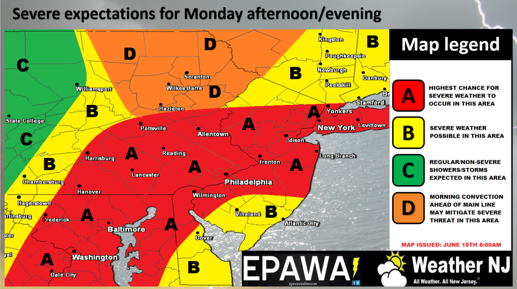
Please click here to view full resolution storm impact map.
Discussion: More than adequate instability and sufficient wind shear parameters coupled with soupy dew points and a cold front trigger represent all of the ingredients for severe thunderstorm potential later today/this evening. Severe Thunderstorm Warnings will be issued locally by the National Weather Service should wind gusts exceed 58mph and/or hail exceeds quarter-size (1-inch) or larger. Tornado Warnings will be issued locally if the National Weather Service feels that enough rotation/vorticiy/atmospheric conditions warrant such or a live observation indicates such. Traditionally/statistically there is a much better chance of straight-line wind damage than tornadic wind damage. The tornado threat possibility is extremely isolated but not off the table. If the cells appear more discrete as they approach then the tornado threat will need to be monitored (lowest chance). If the thunderstorm activity forms into linear segments then straight-line winds are more likely (best chance). We simply need to pay attention to live observations as this system approaches. With any luck, the damaging wind aspect of this will fizzle and most will simply deal with downpours and rumbles. It is best to play it safe and prepare however.
Schedule: There are already some small cells popping in the NWNJ area. These are just expected initial flare-ups in the warm sector ahead of the main event. The main event should move through New Jersey on the following general schedule (give or take an hour):
NWNJ: 3-5PM
WCNJ/NENJ: 4-6PM
SWNJ/ECNJ: 5-7PM
SENJ: 6-8PM
In English: A 1-2 hour period of heavy rain and possibly severe thunderstorms should move through this afternoon/evening (see schedule above for timing). I would at least expect heavy downpours and rumbles. The severe wind/hail potential is statewide but more favored for the NW/interior part of New Jersey. The entire state should have their guard up regardless. Most storm activity should clear the coast by 9-10PM, again SENJ last.
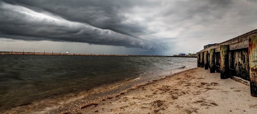
The above photo is another storm shot I took last year from Surf City, NJ. Everyone please be safe! JC
Jonathan Carr (JC) is the founder and sole operator of Weather NJ, New Jersey’s largest independent weather reporting agency. Since 2010, Jonathan has provided weather safety discussion and forecasting services for New Jersey and surrounding areas through the web and social media. Originally branded as Severe NJ Weather (before 2014), Weather NJ is proud to bring you accurate and responsible forecast discussion ahead of high-stakes weather scenarios that impact this great garden state of ours. All Weather. All New Jersey.™ Be safe! JC


LOCAL FORECAST | INTERACTIVE RADAR | LATEST NJ WEATHER ALERTS | WEDDING FORECAST| PRIVACY POLICY
© Copyright 2026 Weather NJ LLC. All Rights Reserved.
Some information that can be found on our website is provided by a private weather station and is not an officially recognized station for weather reporting. Though we always strive to achieve accurate reporting for our own use, it is important that you do NOT depend on the data provided here for any purpose.
