

June 23: Severe Weather Possible!
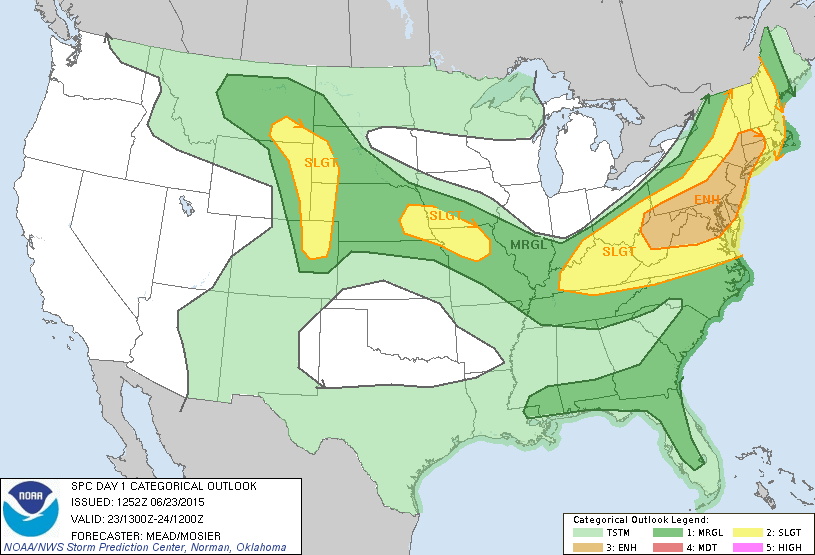
Today could go either way. There are a ton of ingredients on the table for severe thunderstorm potential however there are also inhibiting factors at play. Regardless, a cold front is pushing through from the NW which should push rain and thunderstorms through the entire state between this afternoon and evening. Here’s the NWS SPC convective outlook for today indicating most of New Jersey at an enhanced risk for severe weather:
Why severe criteria is possible:
Instability is modeled to be extremely high during peak diurnal heating this afternoon. I’ve seen several soundings now that spit out 4,000+ j/kg of SBCAPE and 1,700+ j/kg of MLCAPE. The lifted index has been ranging from -6 to -7.3. CAPE and LI are good measurements for instability, more specifically a tell-tale of temperature difference between the surface and aloft. Heat rises so the warmer the surface, the more fuel for storms.
Wind shear is also adequate to produce damaging winds. Both straight line and tornadic winds are possible if the worst case scenario verifies. I’ve seen soundings come in with bulk shear values of 40-50kts. This is the difference in wind direction/speed from surface to aloft. The higher the wind shear values, the higher the chance for damaging winds and rotation.
Dew points will be extremely high as well. They are already into the upper-60s and lower-70s. The higher the dew point temperature, the more noticeable the humidity is. This is also a good measurement of thunderstorm fuel. Ultimately, this surface humidity is what will be hoisted up into the higher and drier altitudes to form towering cumulonimbus clouds. We have plenty of this today.
We have a trigger. The above ingredients are worthless without something to set it off. In this case, the trigger is a cold frontal passage. The cold front is currently near the Great Lakes and will be pushing through our entire region from NW to SE. Rain and storms will surf this cold front just ahead of it. With all of this being said, conditions for severe weather are very favorable today.
Why severe criteria could be limited:
A very powerful storm system hit the Midwest US (Chicago and surrounding area) yesterday. It is currently in it’s fizzle-out stage which is casting cloud debris over our region. such cloud debris could limit diurnal surface instability by not allowing the sun to reach the surface. This is the wildcard for why today could be less severe than expected. Rain and storms should push through regardless but it might be of the classical “strong for NWNJ weak for SENJ/coast” nature. I’ll be keeping a close eye on this today.
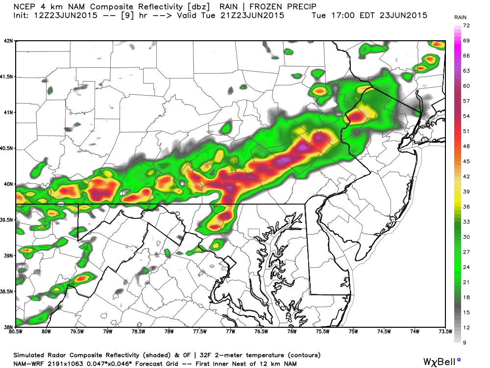
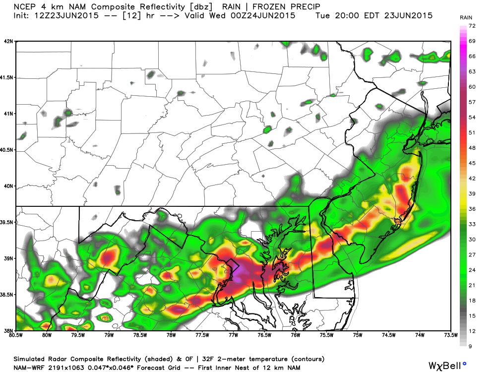
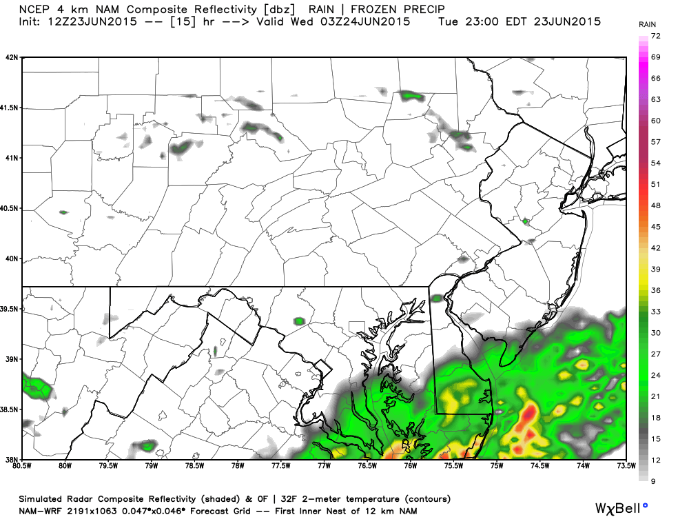
The following 12Z NAM model images, used with permission from WeatherBell Analytics, indicate precipitation intensity which also paints a picture of timing.
Between 4-5PM (just entering NWNJ):
Between 7-8PM (The graduation ceremony killer):
Between 10-11PM (just clearing SENJ out to sea):
In English: Rain and thunderstorms will push through from NW to SE this afternoon-evening after a very hot and humid day. Storm severity will be determined by the amount of sunshine that can reach the surface ahead of the cold front. More sunshine = more severe. Less sunshine = the classic fizzle. I’ll be tracking and will be live on periscope (@myWeatherNJ) if the situation is worthy. Be safe! JC
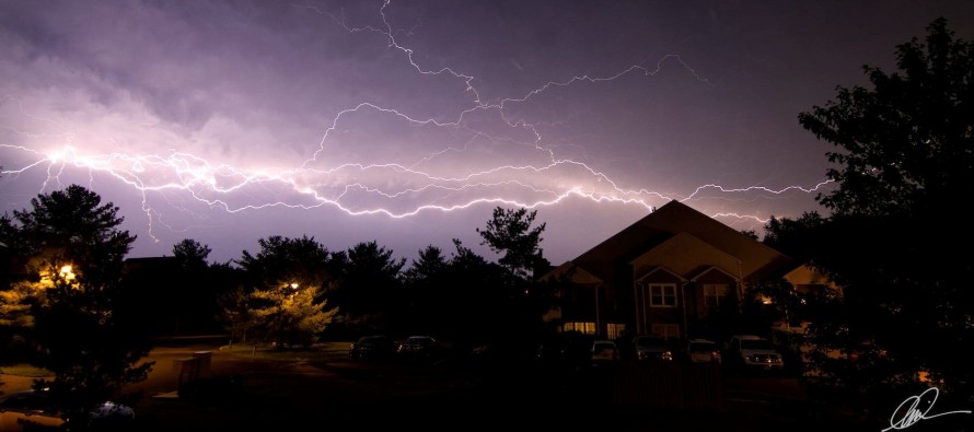
Lightning image by Chris Adolor
Jonathan Carr (JC) is the founder and sole operator of Weather NJ, New Jersey’s largest independent weather reporting agency. Since 2010, Jonathan has provided weather safety discussion and forecasting services for New Jersey and surrounding areas through the web and social media. Originally branded as Severe NJ Weather (before 2014), Weather NJ is proud to bring you accurate and responsible forecast discussion ahead of high-stakes weather scenarios that impact this great garden state of ours. All Weather. All New Jersey.™ Be safe! JC


LOCAL FORECAST | INTERACTIVE RADAR | LATEST NJ WEATHER ALERTS | WEDDING FORECAST| PRIVACY POLICY
© Copyright 2026 Weather NJ LLC. All Rights Reserved.
Some information that can be found on our website is provided by a private weather station and is not an officially recognized station for weather reporting. Though we always strive to achieve accurate reporting for our own use, it is important that you do NOT depend on the data provided here for any purpose.
