

June 3: Thunderstorms Approaching!
Discussion: We’ve had a warm front come through and that’s why today feels warmer and more humid. A cold front is expected to push through overnight tonight but that leaves a very warm and unstable environment today with the warm front still close by to our immediate NE.
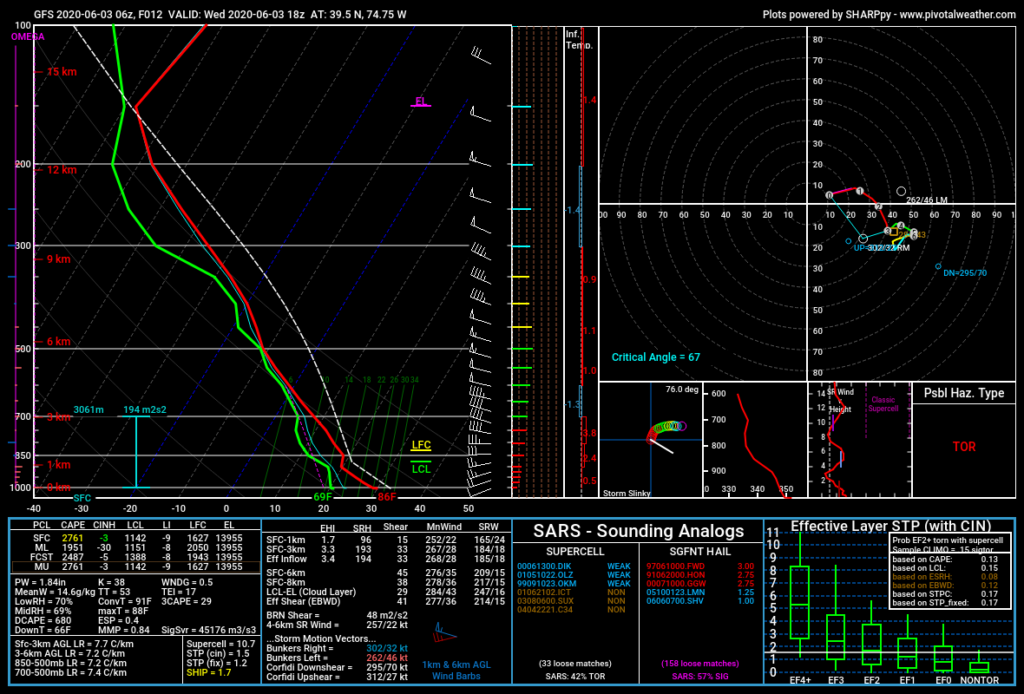
Solar/diurnal instability should build between now and early afternoon allowing sufficient negative buoyancy of air parcels (how easy air can rise). Ever notice a blender filled with hot liquid has a better chance to make a mess than cold liquid? That’s because the warmer the liquid, the easier it is to move. Well, the warmer the lower-level air is (from surface solar heating), the easier it can rise and hoist humid air into the dryer mid-upper levels to form cumulonimbus thunderheads. Marginally sufficient wind shear parameters indicate there’s enough change in wind direction over altitude to support a severe thunderstorm event, especially with supercell potential as indicated by the following Skew-T diagram/sounding for 2pm today (from CNJ/SNJ area):
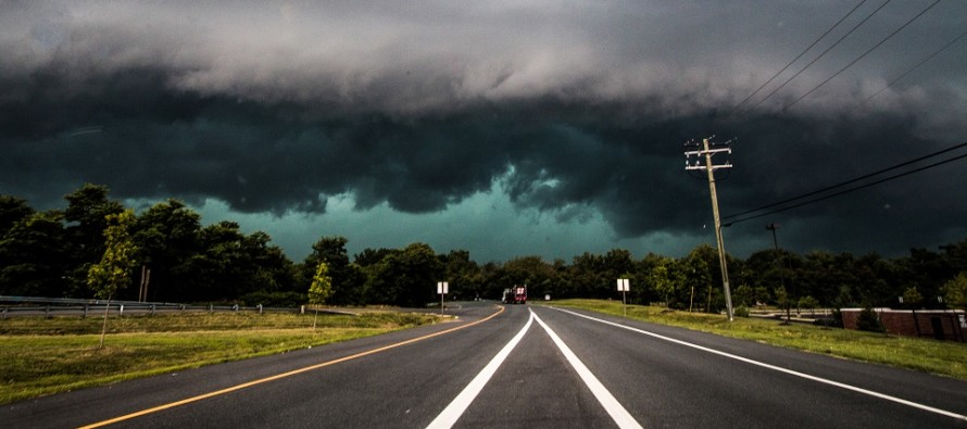
If you look at the central/NW PA radar you can already see the thunderstorm system well-formed and on its way to becoming a Mesoscale Convective System (MCS). This is the kind of system that produces damaging wind gusts and, in most cases, bowing echo segment signatures on radar. You can’t rule out a tornado in this setup, especially on the N and S sides of the massive bow echo I believe will form. However straight line wind damage is the most probable scenario. You will likely have a lot of lightning given the instability well mixed throughout the layers (MLCAPE).
These systems like to ride warm fronts from the W/NW to E/SE like a highway (just like the warm front that is slowly advancing through CNJ/NNJ right now from SW to NE. Therefore, they move very quickly but can pack a lot of punch. My guess is that this MCS will impact NNJ/CNJ primarily early this afternoon but possibly spare at least SWNJ, possibly most of SNJ aside from N coastal area of SNJ. This would then allow SWNJ/SNJ to see more thunderstorm action later this evening/overnight from the cold front.
In English: Expect a warm and humid build today from now until early afternoon. Strong, likely severe, thunderstorms should then pass through NJ from W/NW to E/SE sometime in the noon to 4pm time slot (very conservative window). The actual storm line should not be 4 hours though…likely only an hour or less and will probably scale all of NJ in 2-3 hours. Let’s just say that this afternoon looks stormy. Gusty/damaging winds, heavy downpours and frequent lightning are the most likely symptoms. A small chance of hail and or a tornado are not off the table but less likely than traditional straight line winds. I expect the afternoon thunderstorm system to primarily affect NNJ/CNJ/parts of SENJ. SWNJ and the rest of SNJ, that isn’t affected by this afternoon’s system, have a better chance of seeing storms later tonight/overnight. Everyone please be safe! JC
Download the new free Weather NJ mobile app on Apple and/or Android. It’s the easiest way to never miss Weather NJ content. Our premium services go even further above and beyond at the hyper-local level. Looking for industrial-caliber long-range forecasting data that I personally recommend? Check out WeatherTrends360! Visit the Weather NJ Kaboom Shop for hoodies, tees and infant onesies.
Jonathan Carr (JC) is the founder and sole operator of Weather NJ, New Jersey’s largest independent weather reporting agency. Since 2010, Jonathan has provided weather safety discussion and forecasting services for New Jersey and surrounding areas through the web and social media. Originally branded as Severe NJ Weather (before 2014), Weather NJ is proud to bring you accurate and responsible forecast discussion ahead of high-stakes weather scenarios that impact this great garden state of ours. All Weather. All New Jersey.™ Be safe! JC


LOCAL FORECAST | INTERACTIVE RADAR | LATEST NJ WEATHER ALERTS | WEDDING FORECAST| PRIVACY POLICY
© Copyright 2026 Weather NJ LLC. All Rights Reserved.
Some information that can be found on our website is provided by a private weather station and is not an officially recognized station for weather reporting. Though we always strive to achieve accurate reporting for our own use, it is important that you do NOT depend on the data provided here for any purpose.
