

June 30: Thunderstorms Approaching!

A line of thunderstorms is currently forming in E. PA and will slowly push east—as showers and thunderstorms remain fueled by southerly winds and moisture in the warm sector. Given this traditional setup, western parts of NJ have a much better shot at seeing thunderstorms than eastern/coastal areas of NJ. By the time this slow moving line of storms pushes further into NJ, we’ll lose diurnal surface heating which cuts off the energy supply for storms. At that point, any remaining storms will likely be shear-driven and collapse into multiple gust fronts containing rain showers (what the coast is used to 9 out of 10 times).
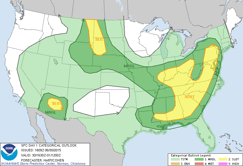
The National Weather Service Storm Prediction Center (NWS SPC) has issued the following convective outlook for today indicating only extreme W. NJ areas at an elevated risk level (SLGT for slight). The rest of NJ is in a lesser-risk category (MRGL for marginal risk). The yellow area has the best probability for damaging winds, hail and even a small chance of a tornado while the green area likely represents the fizzle zone:
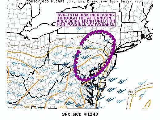
The NWS SPC also just released this mesoscale discussion, indicating an elevated chance for severe thunderstorm watch issuance:
In English: Extreme W. NJ (along the Delaware River) is subject to severe thunderstorms containing hail and possibly damaging winds. The rest of New Jersey is still subject to storms but of a less-intense nature as energy fizzles during coastal approach. Flash flooding is probably the greatest concern for areas that get stuck under training areas of precipitation. As far as timing goes, these storms should impact NJ between late-afternoon and overnight hours, again moving slowly from W to E. Be safe! JC
Jonathan Carr (JC) is the founder and sole operator of Weather NJ, New Jersey’s largest independent weather reporting agency. Since 2010, Jonathan has provided weather safety discussion and forecasting services for New Jersey and surrounding areas through the web and social media. Originally branded as Severe NJ Weather (before 2014), Weather NJ is proud to bring you accurate and responsible forecast discussion ahead of high-stakes weather scenarios that impact this great garden state of ours. All Weather. All New Jersey.™ Be safe! JC


LOCAL FORECAST | INTERACTIVE RADAR | LATEST NJ WEATHER ALERTS | WEDDING FORECAST| PRIVACY POLICY
© Copyright 2026 Weather NJ LLC. All Rights Reserved.
Some information that can be found on our website is provided by a private weather station and is not an officially recognized station for weather reporting. Though we always strive to achieve accurate reporting for our own use, it is important that you do NOT depend on the data provided here for any purpose.
