

June 5: Thunderstorms Approaching!
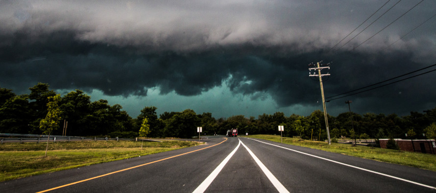
Thunderstorm energy is starting to build to our W/NW as it begins its NJ approach. The warm front is pushing through from S to N. Dew point temperatures are already in the lower-70s in extreme SNJ and this will push N into the rest of NJ between now and afternoon. Not much rainfall along the warm front but that has very little to do with later today. The severity of today’s event will be heavily determined by cloud cover between now and later this afternoon when the line of storms pushes through.
If there is heavy cloud cover, then the sun will be limited in capability to produce instability. This would mean less-intense embedded thunderstorms within a linear segment of rainfall. There would still be a chance for isolated severe criteria being met within the line of rain but damaging wind dynamics would be limited.
If the sky breaks and lets the sun hit the surface between now and afternoon, then instability will build as highly-modeled over the last few days. This would greatly enhance the potential for severe/damaging wind and/or hail conditions once the storm line gets to you.
A lot are asking me if their [insert today’s outdoor event] will be canceled or if they should not go. I cannot answer these questions. I can only tell you my best prediction for what will happen weather-wise. While there will likely be a decent window of clearing/rain-free period from now until the storms, the uknowwhat could really hit the fan as early as late-afternoon for at least parts of WNJ.
My best guess on timing for the main line of storms is between 4PM and 8PM, spanning across NJ from W/NW to E/SE. We’re simply going to have to play the radar for the exact hours but that’s the best I can do.

In English: Expect mostly cloudy skies over the next few hours as the warm front pushes through. Expect humidity to increase as well. Rain showers are possible but should remain isolated in nature. A line of thunderstorms should then push through NJ between 4PM and 8PM (might linger in SENJ for a but longer). By 3PM we should be starting to see its ugly face approaching from the W/NW.
How severe this line of storms becomes will be determined by how much of a clearing occurs ahead of the storms. If today remains mostly cloudy, then storms will be less intense. If the clouds clear and allow sunshine to hit the surface, then the storms will be more severe/damaging. This includes damage from wind in the form of straight-line and/or possibly tornadic as well as hail. Tornadoes and hail are not expected however you can’t rule them out until this all passes. Hopefully, just gusty straight-line winds and frequent lightning is the extent of this. SNJ is favored to see the strongest storms while NNJ is favored to see the least. But the entire state is on the hook for at least rain and a line of thunderstorms.
I will be out chasing today on Long Beach Island. I’m expecting storms there (ENJ coast) around 6-8pm. Areas to the NW will obviously see the line of storms first. I’ll try my best to provide mobile radar updates and maybe some live footage. While I am not telling you to run for cover, it’s not a bad idea to have a plan of safety for when the storms come late-afternoon/early evening. Please be safe! JC
Jonathan Carr (JC) is the founder and sole operator of Weather NJ, New Jersey’s largest independent weather reporting agency. Since 2010, Jonathan has provided weather safety discussion and forecasting services for New Jersey and surrounding areas through the web and social media. Originally branded as Severe NJ Weather (before 2014), Weather NJ is proud to bring you accurate and responsible forecast discussion ahead of high-stakes weather scenarios that impact this great garden state of ours. All Weather. All New Jersey.™ Be safe! JC


LOCAL FORECAST | INTERACTIVE RADAR | LATEST NJ WEATHER ALERTS | WEDDING FORECAST| PRIVACY POLICY
© Copyright 2026 Weather NJ LLC. All Rights Reserved.
Some information that can be found on our website is provided by a private weather station and is not an officially recognized station for weather reporting. Though we always strive to achieve accurate reporting for our own use, it is important that you do NOT depend on the data provided here for any purpose.
