

Light Snow Approaching/Developing
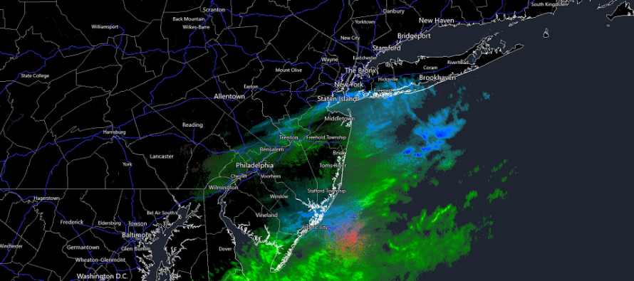
Discussion: The boundary, separating colder temps to the N and milder temps to the S is slowly pushing through NJ and should come to a rest just S/SE of NJ by later tonight. Temps should fall with sundown and the colder air behind the boundary should take most NJ areas down to freezing or just below overnight. Extreme SNJ/SENJ might still hover near or just above freezing overnight. Regardless, a weak wave of energy will follow the boundary and bring more precipitation to NJ between late tonight and early tomorrow morning. What has fallen so far today is not associated with the light snow event set to begin overnight tonight. Today is just some lifting along the advancing boundary before colder temps set in.
As temps gradually drop this evening, we should see precipitation convert from the current slop of snow/ice/rain to all light snow by 2-3am tomorrow morning. The models are still torn as to how much snow could fall between late tonight and early tomorrow morning but nothing is showing a significant snowfall. Therefore the most reasonable expectation is a light snow event between about 2am and noon tomorrow (Thursday). This could mean anything from just flurries and snow showers producing a coating to maybe an inch or two in the absolute maximum overperformance. The middle of the road approach is about ¼ to ¾ of an inch. Given the still-marginal surface environment, the snow will likely struggle to stick to roads or other human-made surfaces, especially if brined. There’s a much better chance of stickage on natural or cold surfaces like grass/trees or parked cars.
Since this is a “southern slider” wave, where the low will track from W to E to the S of NJ, the northern extent of snowfall should cut off somewhere in CNJ with SNJ seeing the most amount of light snow. Marginal temps preventing stickage should be more of an issue along immediate SNJ/SENJ. Areas in SNJ, away from the ocean – closer to the Pine Barrens should have the best chance for stickage. The wave should pull away tomorrow with CNJ/SNJ conditions improving for noon-forward.
Tomorrow night (Wednesday night) through Friday morning then looks clear and colder, but not yet brutally cold. The brutal cold is still expected to arrive with Friday’s Arctic front…a front reinforced by a SE Canadian low and Great Lakes Arctic high. The Arctic front should pass through earlier on Friday, possibly before when peak afternoon temperatures would normally occur. Therefore, Friday could be a situation where the day’s high temperature is achieved during AM hours with temps then falling throughout the day and especially after sundown into the overnight. Brutal cold is then expected from Friday PM through Saturday and into Sunday morning. Sunday we rebound a bit and then see if the Feb 6-8 will produce anything or suffer the fate of most/all other signals this winter.
In English: Precipitation is currently mixed across CNJ/SNJ but will turn to snow by 2-3am overnight tonight. It should then slow lightly from 3am until about noon tomorrow across CNJ/SNJ. This is not NNJ’s event. NNJ will likely be too far N to see light snow and parts of CNJ could see the same. Anything from a coating to an inch is a reasonable expectation with 2 inches reserved for any over-performing bands should they form. Most CNJ/SNJ streets should be ok tomorrow, especially if brined. CNJ/SNJ is more likely to see snow on natural surfaces rather than roads given the marginal temperatures in place. This light wave should clear out of CNJ/SNJ tomorrow by noonish. We’re then calm and colder tomorrow night (Wednesday night) through Friday morning and then super cold Friday PM through Sunday AM. I’ll discuss the Feb 6-8 signal in Thursday’s weekend outlook but like all other signals this year, it’s not looking to good. I’ll start radar analysis later this evening. Have a great rest of your Tuesday and please be safe! JC
Premium Services
KABOOM Club offers inside info forecast discussion, your questions answered, and early storm impact maps (ahead of the public). At 99 cents per month, it’s an extremely feasible way to show support.
My Pocket Meteorologist (MPM), in partnership with EPAWA Weather Consulting, offers professional/commercial interests, whose businesses depend on outdoor weather conditions (snow plowing, landscaping, construction, etc.), with hyper-local text message alerts/forecasts and access to the MPM premium forum—the most comprehensive and technical forecast discussion available for PA and NJ.
Jonathan Carr (JC) is the founder and sole operator of Weather NJ, New Jersey’s largest independent weather reporting agency. Since 2010, Jonathan has provided weather safety discussion and forecasting services for New Jersey and surrounding areas through the web and social media. Originally branded as Severe NJ Weather (before 2014), Weather NJ is proud to bring you accurate and responsible forecast discussion ahead of high-stakes weather scenarios that impact this great garden state of ours. All Weather. All New Jersey.™ Be safe! JC


LOCAL FORECAST | INTERACTIVE RADAR | LATEST NJ WEATHER ALERTS | WEDDING FORECAST| PRIVACY POLICY
© Copyright 2026 Weather NJ LLC. All Rights Reserved.
Some information that can be found on our website is provided by a private weather station and is not an officially recognized station for weather reporting. Though we always strive to achieve accurate reporting for our own use, it is important that you do NOT depend on the data provided here for any purpose.
