

Mar 1: Thunderstorm Update

Pre-frontal rainfall and thunderstorms have already moved through NNJ. This should impact the main event later today…
Disco: We have another potential severe outbreak for the Mid-Atlantic US shaping up. However points N which have seen rainfall and thunderstorms already this morning could be stabilized for the main event along the cold front later today. With that said, here’s out thinking heading in…
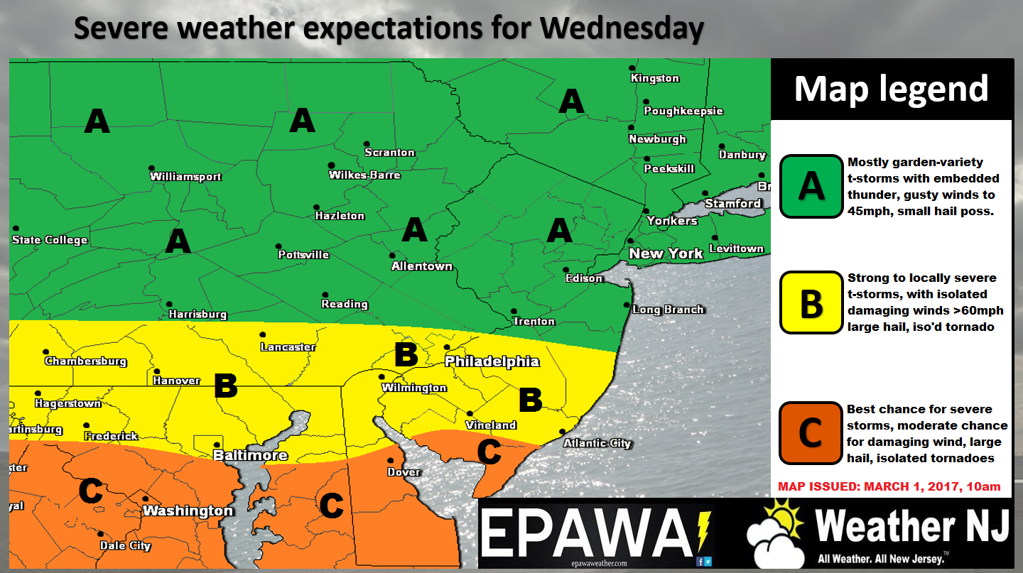
Click here for full resolution storm impact map.
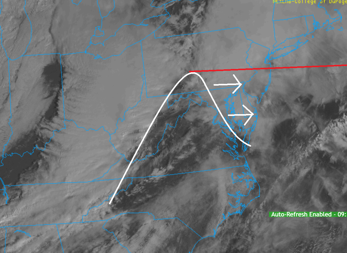
SNJ is favored for stronger storms than NNJ, especially extreme SNJ. The reason for this is diurnal heating duration (hours that the sun can reach the ground and heat it up higher than the air aloft). Since heat rises, this creates the instability needed to enhance the dynamics of the storms aloft. Here’s a visible satellite image illustrating the main envelope of cloud clearing moving E ahead of the cold front and riding storms. This illustrates that southern parts of NJ will likely see more diurnal heating that northern parts of NJ. It’s still cloudy statewide right now but SNJ should see this approaching clearing soon. Since SWNJ will see the clearing first and the longest, they are ground zero Jersey-wise:
In English: NNJ has already seen rainfall and thunderstorms this morning. The rest of the state remains cloudy. In a few hours, skies should begin clearing (moreso for SNJ than NNJ). This should create a muggy feel and set up the best storm chances for SNJ later today (ahead of the cold front). The best overall timing window I can give right now is 2PM to 6PM (a 1 hour period of rain and storms from WNJ to ENJ). I would expect a period of moderate-to-heavy rainfall (possibly small hail), lightning and gusty winds. The National Weather Service will trigger Severe Thunderstorm Warnings if criteria is met. Again, SNJ is favored over NNJ. NNJ could still see some rain, wind and storms but not as strong as extreme SNJ and especially SWNJ. CNJ could go either way so best to prepare for severe critieria and hope for the same fate as NNJ. Everyone have a great Wednesday and please be safe! JC
Jonathan Carr (JC) is the founder and sole operator of Weather NJ, New Jersey’s largest independent weather reporting agency. Since 2010, Jonathan has provided weather safety discussion and forecasting services for New Jersey and surrounding areas through the web and social media. Originally branded as Severe NJ Weather (before 2014), Weather NJ is proud to bring you accurate and responsible forecast discussion ahead of high-stakes weather scenarios that impact this great garden state of ours. All Weather. All New Jersey.™ Be safe! JC


LOCAL FORECAST | INTERACTIVE RADAR | LATEST NJ WEATHER ALERTS | WEDDING FORECAST| PRIVACY POLICY
© Copyright 2026 Weather NJ LLC. All Rights Reserved.
Some information that can be found on our website is provided by a private weather station and is not an officially recognized station for weather reporting. Though we always strive to achieve accurate reporting for our own use, it is important that you do NOT depend on the data provided here for any purpose.
