

Mar 1: Winter Storm Approaching
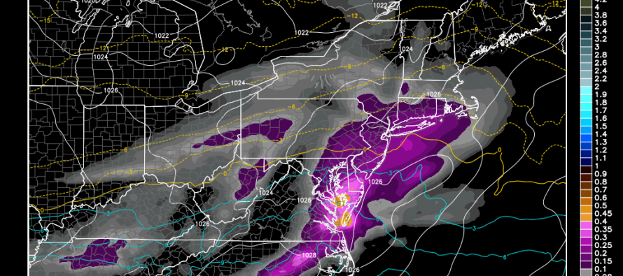
Snow should begin falling between now and noon from west to east. Warm air will try to invade from the south while the surface holds on to colder temperatures. We should be used to these by now. Here are my expected snow accumulations before the changeover:
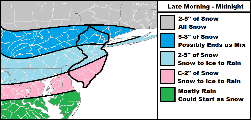
NNJ has the greatest chance at staying all snow. Only southern areas of the darker blue will flirt with a mix towards the end of the system. CNJ has the greatest chance for ice in the form of sleet and freezing rain during the transition. SNJ should see a shorter period of ice and therefore a faster changeover from front end snow to rain. Please take the ice potential seriously, especially in CNJ! This all should end by midnight. Be safe! JC
Jonathan Carr (JC) is the founder and sole operator of Weather NJ, New Jersey’s largest independent weather reporting agency. Since 2010, Jonathan has provided weather safety discussion and forecasting services for New Jersey and surrounding areas through the web and social media. Originally branded as Severe NJ Weather (before 2014), Weather NJ is proud to bring you accurate and responsible forecast discussion ahead of high-stakes weather scenarios that impact this great garden state of ours. All Weather. All New Jersey.™ Be safe! JC


LOCAL FORECAST | INTERACTIVE RADAR | LATEST NJ WEATHER ALERTS | WEDDING FORECAST| PRIVACY POLICY
© Copyright 2026 Weather NJ LLC. All Rights Reserved.
Some information that can be found on our website is provided by a private weather station and is not an officially recognized station for weather reporting. Though we always strive to achieve accurate reporting for our own use, it is important that you do NOT depend on the data provided here for any purpose.
